

A Late Midday Look At Central Alabama’s Weather
RADAR CHECK AT 1:25PM

We have some scattered shower activity out there at this time, with most located in the southern half of the area, but a few are up in the west-central parts. Nothing too heavy, just light to moderate in intensity at this point. The northern most showers are moving to the north-northwest while the rest on radar are moving to the north-northeast.
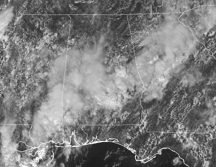
Looking at the latest visible satellite image, much of Central Alabama is covered in clouds at this point, but a good bit of sun is making it to the surface in the extreme northern parts and the northeastern parts of the area.
TEMPERATURES AT 1:25 PM

We are currently running in the mid-70s to the mid-80s across Central Alabama, but you can clearly see that temperatures are much warmer to the north where plenty of sunshine is warming the air near the surface. Birmingham is at 82 degrees, while the warm spot in the area is Talladega at 85 degrees. The usual warm spots in the southern parts of the area are in the mid to upper 70s.
WEATHER FOR THE REST OF THE DAY
We have a boundary moving northward through the area that will be the main focus for showers and a few thunderstorms throughout the remainder of the afternoon and into the night time. Rain will be widespread in coverage in the southern parts until it moves northward during the late afternoon and early evening hours. We’ll have plenty of moisture available, but rainfall will not be extremely heavy. Afternoon highs will be in the lower to mid-80s, with the warmer temperature in the north.
The boundary will continue to push to the north during the night time and overnight hours, and the better rain chances will be in the north/central parts of the area. There may be a few claps of thunder tonight, but nothing strong or severe. Overnight lows will be in the upper 60s to the lower 70s.
CONTINUED SHOWER & STORM CHANCES INTO TUESDAY
Weather will be pretty similar to today… Mainly cloudy skies and extremely muggy, with dewpoint values in the mid-70s. We’ll have a trough moving into the area providing the necessary ingredients for showers and thunderstorms, with better coverage likely during the heating of the day. Better rain chances will be in the western parts of the area, but all of Central Alabama will have a decent chance of rain. Afternoon highs will be in the lower to mid 80s in the north, with mid to upper 80s in the south.
TORNADO REPORTS FROM NATE’S TRIP THROUGH THE AREA
Looks like at this time that there were 4 tornadoes that briefly touched down on Saturday evening with the outer bands of Nate. There 2 in Chilton County… the first was an EF-0 near Pletcher, and the other was an EF-1 north-northeast of Maplesville. The third was an EF-0 in Lowndes County, and the fourth was an EF-1 in Autauga County. Details will be in the Public Information Statement that will be released shortly.
TROPICAL STORM OPHELIA IS WELL OUT IN THE ATLANTIC & WILL STAY A FISH STORM
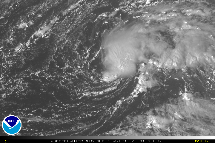
As of the latest update from the NHC, Ophelia is packing winds at 40 MPH sustained and a minimum pressure of 1008mb. Movement is currently to the north-northeast at 5 MPH. A turn toward the northeast is expected later today. A motion toward the east-northeast and east is forecast to occur later tonight,
followed by a turn toward the east-southeast on Tuesday. Ophelia is expected to strengthen to a hurricane within the next 4 days, but will not be a threat to land at all (at this point).
TROPICAL WEATHER CATEGORY ON THE BLOG
Stay up-to-date with the latest updates on all of the tropical systems out in the Atlantic Ocean, Caribbean Sea, or in the Gulf of Mexico with the latest posts in our Tropical Weather category. Click here to see the latest.
GULF COAST WEATHER
Showers will be likely today along the beautiful beaches of Alabama and Northwest Florida, with fine weather returning for midweek and beyond. Highs will be in the middle 80s and lows near 70F. It’s peak season weather in the offseason!
Be sure to keep up to date with the detailed forecasts from Fort Morgan over to Panama City Beach with the AlabamaWx Weather Blog. Click here to see the AlabamaWx Beach Forecast Center page.
The Beach Forecast is partially underwritten by the support of Brett/Robinson Vacation Rentals in Gulf Shores and Orange Beach. Click here to see Brett/Robinson’s Off Season Deals now!
ON THIS DAY IN WEATHER HISTORY
1903 – New York City was deluged with 11.17 inches of rain 24 hours to establish a state record. Severe flooding occurred in the Passaic Valley of New Jersey where more than fifteen inches of rain was reported.
WEATHERBRAINS
Check out the show at www.WeatherBrains.com. You can also subscribe on iTunes. You can watch the show live at live.bigbrainsmedia.com on Monday nights starting at 8:30 PM CDT. You will be able to see the show on the James Spann 24×7 weather channel on cable or directly over the air on the dot 2 feed.
Category: Alabama's Weather, ALL POSTS
About the Author (Author Profile)
Scott Martin is an operational meteorologist, professional graphic artist, musician, husband, and father. Not only is Scott a member of the National Weather Association, but he is also the Central Alabama Chapter of the NWA president. Scott is also the co-founder of Racecast Weather, which provides forecasts for many racing series across the USA. He also supplies forecasts for the BassMaster Elite Series events including the BassMaster Classic.Subscribe
If you enjoyed this article, subscribe to receive more just like it.


