

A Few Clouds And Warm At Midday, Drier Air Is Moving In
LOWER DEWPOINT VALUES ON THE WAY
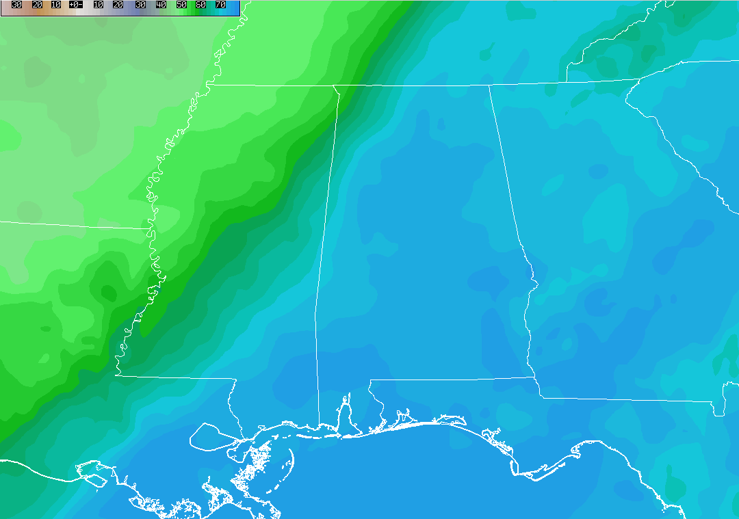
Over Central Alabama at this point, we are still seeing dewpoint value well into the 70s, but the drier air is starting to move into the northwestern corner of the state. The drier air that is located over Arkansas at the moment will make it’s way into the state later this evening, and will make our highs tomorrow feel much more comfortable.
CURRENT CONDITIONS AT 12:15 PM IN CENTRAL ALABAMA
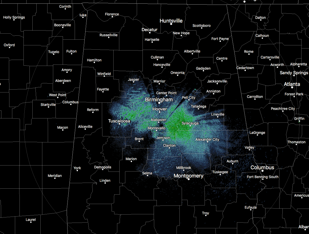
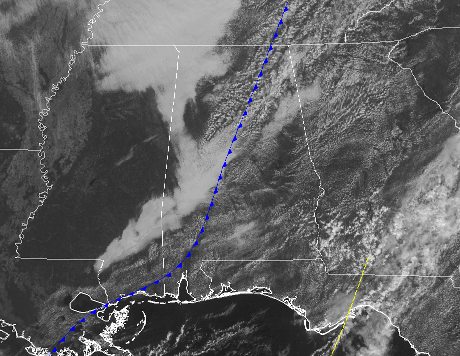
At this point in Central Alabama, we have a mix of sun and clouds overhead across the area. The cold front responsible for bringing us the drier air is now draped over the center of the state. Not seeing any returns on the radar at this point, and it really should be that way throughout the remainder of the afternoon hours. We may have one or two showers pop up with the maximum daytime heating just ahead of the front, but the chances are very low.
For the rest of the day we’ll have decreasing clouds from west to east while a very small chance of an isolated shower is possible out ahead of the cold front as it continues to move through the area. Dewpoints will begin to drop soon after the front passes your location. Afternoon highs will top out in the lower to mid-80s in the northwestern half to the mid-80s to the lower 90s in the southeastern half of the area. Overnight lows will be divided in the same manner, with mid-50s to lower 60s in the northwest, and mid-60s to the lower 70s in the southeast.
CONTINUED WARMTH ON THURSDAY BUT IT WILL BE MORE COMFORTABLE

Not too much to complain about for your Thursday as we’ll have lower dewpoint values ranging from the upper 50s to the lower 60s throughout Central Alabama, making the afternoon highs throughout the 80s feel more comfortable. The only complaint is that we’ll have a few clouds, but those will only block the sun’s rays for a few minutes at a time. Clear skies and cooler temperatures for tomorrow night and into the overnight hours, with lows dropping into the mid-50s to the mid-60s throughout the area.
TROPICAL WEATHER CATEGORY ON THE BLOG
Stay up-to-date with the latest updates on all of the tropical systems out in the Atlantic Ocean, Caribbean Sea, or in the Gulf of Mexico with the latest posts in our Tropical Weather category. Click here to see the latest.
GULF COAST WEATHER
Showers will be likely today along the beautiful beaches of Alabama and Northwest Florida, with fine weather returning for midweek and beyond. Highs will be in the middle 80s and lows near 70F. It’s peak season weather in the offseason!
Be sure to keep up to date with the detailed forecasts from Fort Morgan over to Panama City Beach with the AlabamaWx Weather Blog. Click here to see the AlabamaWx Beach Forecast Center page.
The Beach Forecast is partially underwritten by the support of Brett/Robinson Vacation Rentals in Gulf Shores and Orange Beach. Click here to see Brett/Robinson’s Off Season Deals now!
ON THIS DAY IN WEATHER HISTORY
1954 – A deluge of 6.72 inches of rain in 48 hours flooded the Chicago River, causing ten million dollars damage in the Chicago area.
WEATHERBRAINS
Check out the show at www.WeatherBrains.com. You can also subscribe on iTunes. You can watch the show live at live.bigbrainsmedia.com on Monday nights starting at 8:30 PM CDT. You will be able to see the show on the James Spann 24×7 weather channel on cable or directly over the air on the dot 2 feed.
Category: Alabama's Weather, ALL POSTS
About the Author (Author Profile)
Scott Martin is an operational meteorologist, professional graphic artist, musician, husband, and father. Not only is Scott a member of the National Weather Association, but he is also the Central Alabama Chapter of the NWA president. Scott is also the co-founder of Racecast Weather, which provides forecasts for many racing series across the USA. He also supplies forecasts for the BassMaster Elite Series events including the BassMaster Classic.Subscribe
If you enjoyed this article, subscribe to receive more just like it.


