

A Mid-Afternoon Look At Central Alabama’s Weather
At the 2:00 PM hour in Central Alabama, it is a quite warm and very humid day. Temperatures are currently running throughout the 70s to the lower 80s across the area, and with dewpoints in the upper 60s to 70 degrees in the northern half of the area, it feels like you can wear the air.
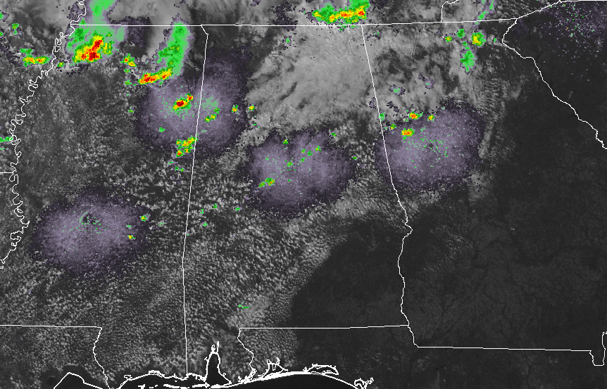
Radar at this time is only showing a few isolated showers in Central Alabama, but back to the west and northwest in Mississippi, several showers and thunderstorms have fired up and are producing copious amounts of lightning, along with heavy rainfall. These are moving to the east-southeast and could potentially move into the western parts of the area by 4-5PM, if they hold together. Good news is that there are no warnings currently in effect, but much of northern Mississippi is defined in a marginal risk for severe weather, while the northwestern corner is in a slight risk for severe storms. No severe weather is expected for any of Alabama.

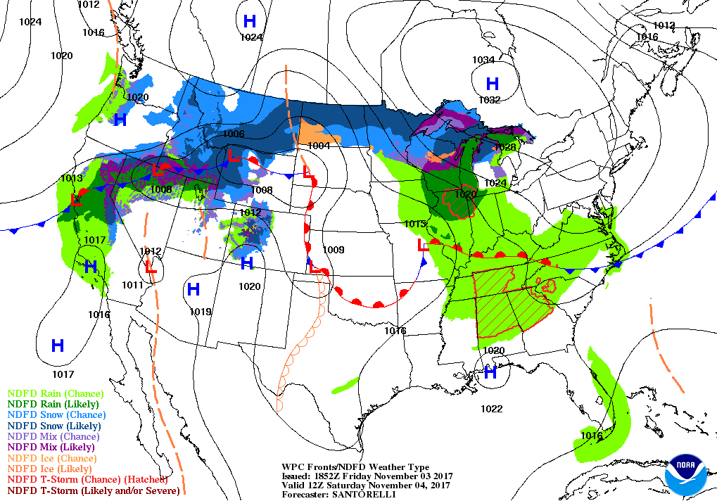
HRRR simulated radar valid at 6PM tonight.
For the rest of today, most everyone in the area will remain dry, but the latest HRRR model run have several showers and storms out there throughout the afternoon and into the evening and late night hours. Afternoon highs will be in the mid-70s to the lower 80s under partly cloudy skies. For the high school football games, carry your umbrella with you when you head out as a shower is possible, with the rain chances in the 20-40% range from south to north. Temperatures at 6PM will be in the lower to mid-70s, and dropping into the mid to upper 60s by the final whistle.
We can expect more showers and storms moving in from the west during the late night through the overnight and early morning hours. No strong or severe storms expected, but thunder could be a little noisy. Overnight lows will be in the lower to mid-60s.
Saturday will feature mostly cloudy skies with scattered showers and storms throughout the morning and afternoon hours, but rain chances will come to an end as we make it into the evening hours. The better chances of rain will be in the northeastern quarter of the area (roughly north of I-20 and east of I-65), but nearly all of Central Alabama will have a small to decent chance. The southwestern corner of the area may stay dry. Afternoon highs will be in the upper 70s to the lower 80s throughout the area.
Category: Alabama's Weather, ALL POSTS
About the Author (Author Profile)
Scott Martin is an operational meteorologist, professional graphic artist, musician, husband, and father. Not only is Scott a member of the National Weather Association, but he is also the Central Alabama Chapter of the NWA president. Scott is also the co-founder of Racecast Weather, which provides forecasts for many racing series across the USA. He also supplies forecasts for the BassMaster Elite Series events including the BassMaster Classic.Subscribe
If you enjoyed this article, subscribe to receive more just like it.


