

Central Alabama’s Weather At Midday
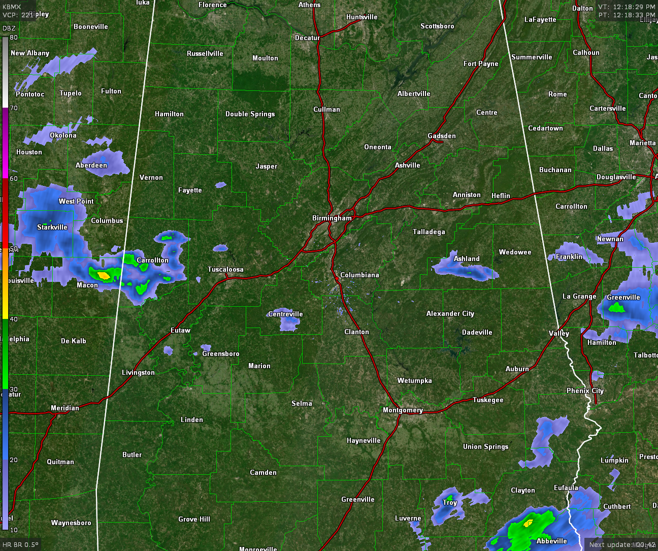
RADAR CHECK AT 12:25 PM: Much of Central Alabama is dry at this point, with rainfall moving into the western parts of the state. A good bit of Pickens County is already receiving rain, and that is starting to move into Greene and Tuscaloosa counties. There are a few scattered showers mainly south of the I-20 & I-20/59 corridors, but these are very small in nature.
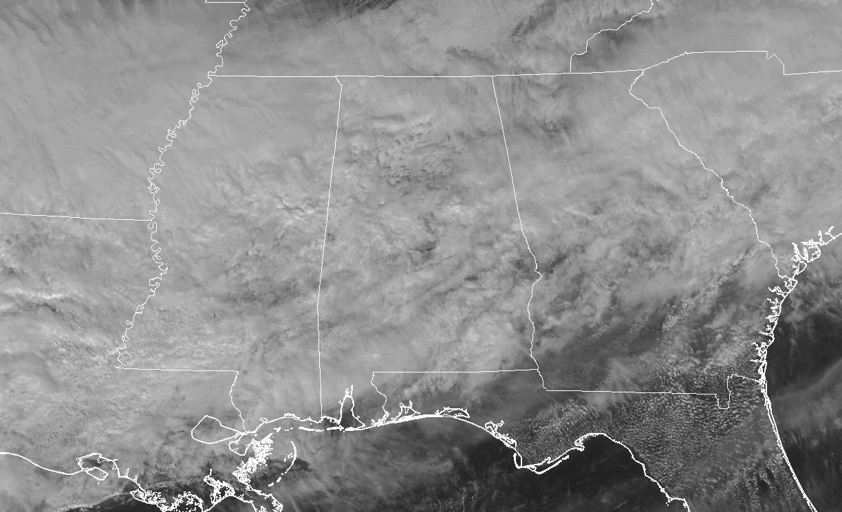
No hope of sunshine out there at this point in Central Alabama, as we are underneath a large blanket of clouds that are covering nearly the entire southeastern United States, with the exception of south Georgia and much of Florida. It’s quite cool out there as well, with Central Alabama’s temperatures running in the upper 40s to the upper 50s in the north. The extreme southern part of the area have much warmer temperatures, with 60s and 70s showing up.
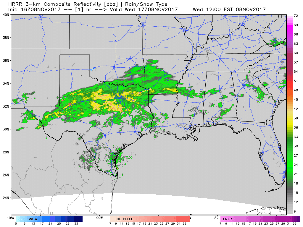
REST OF TODAY: The rest of the afternoon hours will have mostly cloudy to completely overcast skies with a chance of scattered to numerous showers to start with, but becoming more like as the latter part of the day approaches. Most of the rain activity will stay along and north of the I-20 and I-20/59 corridors until later this evening when the activity starts pushing more southward. Much, if not all, of the area will see rainfall after 10PM tonight and through the overnight hours. Afternoon highs will be in the mid-50s to the lower 60s in the north, with mid-60s to the mid-70s to the south. Overnight lows will be in the mid-40s to the mid-50s.
THURSDAY’S WEATHER: Rain should come to an end starting in the extreme western parts of the area by daybreak, and out of the state before we reach the late morning hours or midday. Skies will begin to clear out from the north to the south as the day progresses, but temperatures will stay cool. Afternoon highs will be in the lower to mid-60s throughout the area. Skies will be clear and it will be rather chilly for Thursday night and through the overnight hours. Lows will be in the upper 30s to the mid-40s from north to south throughout the area.
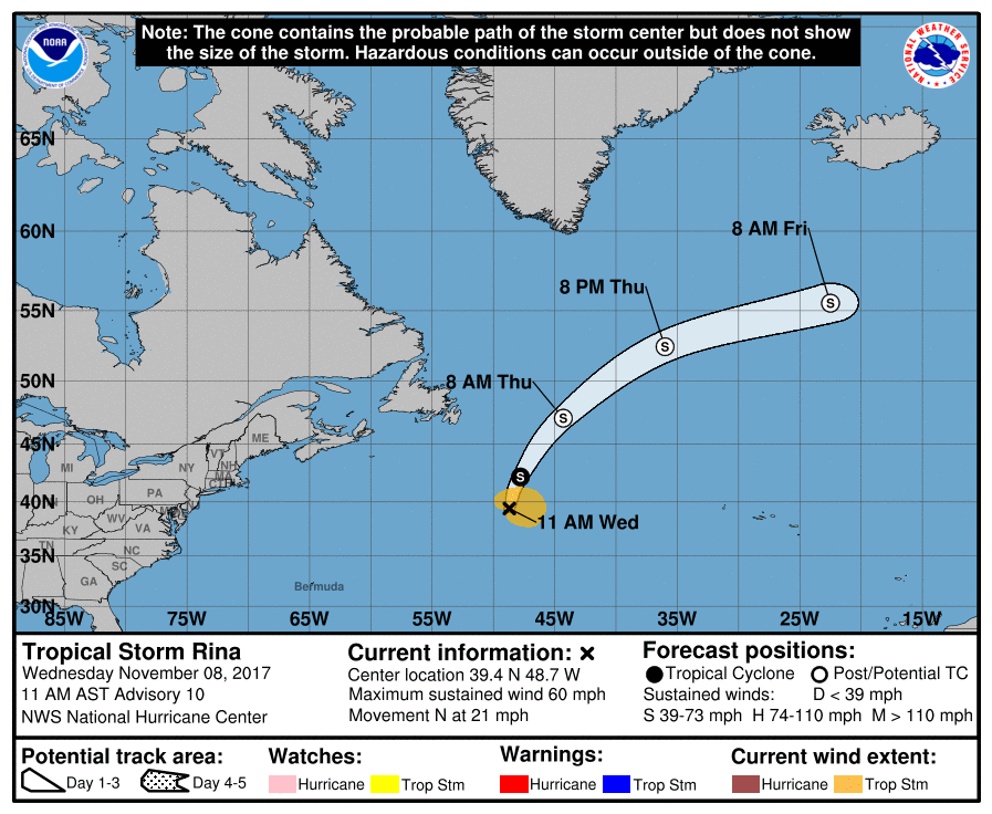
THE TROPICS: Tropical Storm Rina continues to jet to the north-northeast at 21 MPH, away from any landmass. Latest NHC forecast has Rina becoming post-tropical by tomorrow morning while turning more to the east-northeast. All is quiet everywhere else in the Atlantic Basin.
Stay up-to-date with the latest updates on all of the tropical systems out in the Atlantic Ocean, Caribbean Sea, or in the Gulf of Mexico with the latest posts in our Tropical Weather category. Click here to see the latest.
BEACH FORECAST CENTER: Be sure to keep up to date with the detailed forecasts from Fort Morgan over to Panama City Beach with the AlabamaWx Weather Blog. Click here to see the AlabamaWx Beach Forecast Center page. The Beach Forecast is partially underwritten by the support of Brett/Robinson Vacation Rentals in Gulf Shores and Orange Beach. Click here to see Brett/Robinson’s Off Season Deals now!
THIS DAY IN WEATHER HISTORY: 1989 – Afternoon and evening thunderstorms developing along and ahead of a cold front produced severe weather from northern Louisiana into central Georgia. Thunderstorms spawned three tornadoes, and there were sixty-four reports of large hail or damaging winds. A late afternoon thunderstorm in central Georgia spawned a tornado which killed one person and injured eight others at Pineview. Late afternoon thunderstorms in central Mississippi produced baseball size hail around Jackson, and wind gusts to 70 mph Walnut Grove.
WEATHERBRAINS: Check out the show at www.WeatherBrains.com. You can also subscribe on iTunes. You can watch the show live at live.bigbrainsmedia.com on Monday nights starting at 8:30 PM CDT. You will be able to see the show on the James Spann 24×7 weather channel on cable or directly over the air on the dot 2 feed.
Category: Alabama's Weather, ALL POSTS
About the Author (Author Profile)
Scott Martin is an operational meteorologist, professional graphic artist, musician, husband, and father. Not only is Scott a member of the National Weather Association, but he is also the Central Alabama Chapter of the NWA president. Scott is also the co-founder of Racecast Weather, which provides forecasts for many racing series across the USA. He also supplies forecasts for the BassMaster Elite Series events including the BassMaster Classic.Subscribe
If you enjoyed this article, subscribe to receive more just like it.


