

Some Snow Possible Across Central Alabama Friday
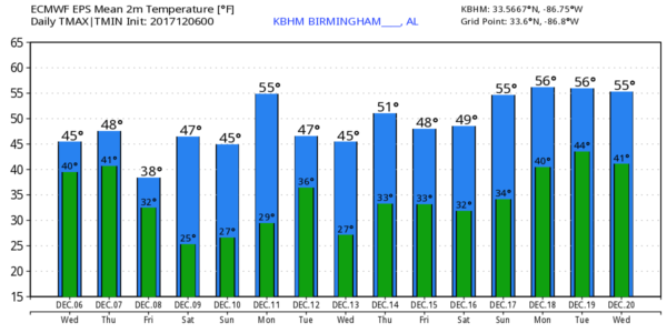
COLD DECEMBER DAY: Temperatures are in the low to mid 40s over much of Alabama this afternoon, but places like Alexander City and Auburn are only in the upper 30s with a very cold rain falling. To the north, however, there is a break in the overcast over parts of the Tennessee Valley where they are enjoying some sunshine.
Tonight will be cloudy and cold, some patchy rain could linger over South Alabama. Most places will be in the 32-35 degree range early tomorrow.
The day tomorrow will be cloudy and cold; some light drizzle is possible, but a decent part of the day will be dry. The high will be in the 45-48 degree range as cold air stays in places.
SNOW FLAKES? A wave will bring precipitation into the southern two-thirds of the state late tomorrow night and into the day Friday. New model data suggests thermal values will be cold enough for some snow across parts of Central Alabama.
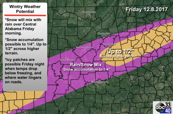
Here are the important points concerning Friday’s situation…
*Accumulation potential will be limited by warm soil temperatures. For now, we will mention accumulation up to 1/4″ across Central Alabama, with amounts to 1/2″ across higher terrain of East Alabama.
*We have adjusted the northern edge of the snow potential up to the I-20 corridor, including Tuscaloosa, Birmingham, and Anniston. The southern edge of the “snow zone” is roughly along U.S. 80… Demopolis to Selma to Montgomery to Opelika. Understand for many communities, the precipitation will begin as a mix of rain and snow. But, it could change to all snow during the day as very cold air filters southward. Most places hold in the 30s all day.
*Not everyone in Central Alabama will see snow.
*Concerning timing, the precipitation will most likely begin during the pre-dawn hours Friday, then tapering off Friday afternoon. The prime window for now is 3:00 a.m. to 3:00 p.m.
*Temperatures Friday morning will be pretty close to freezing, and if we get some evaporational cooling, some places could drop into the 28-32 degree range, meaning there could be some impact for the morning commute.
*As with any snow potential in the south, keep a close eye on the blog for forecast changes, and be prepared for impacts, even if they seem minor now.
THE ALABAMA WEEKEND: The weather will be dry and cold Saturday and Sunday with mostly sunny days and fair nights. Highs in the 40s, lows in the 20-25 degree range. Colder spots see upper teens early Sunday.
NEXT WEEK: The weather looks dry, and a new surge of colder air blows in here Tuesday and Wednesday. Sure looks like temperatures could remain below average around here through Christmas as an upper trough remains anchored over the eastern third of the country. See the Weather Xtreme video for maps, graphics, and more details.
BEACH FORECAST: Click here to see the AlabamaWx Beach Forecast Center page. The Beach Forecast is partially underwritten by the support of Brett/Robinson Vacation Rentals in Gulf Shores and Orange Beach. Click here to see Brett/Robinson’s Hot Deals now!
WEATHER BRAINS: Don’t forget you can listen to our weekly 90 minute netcast anytime on the web, or on iTunes. This is the show all about weather featuring many familiar voices, including our meteorologists here at ABC 33/40.
CONNECT: You can find me on all of the major social networks…
Facebook
Twitter
Google Plus
Instagram
Pinterest
Snapchat: spannwx
Look for the next Weather Xtreme video here by 7:00 a.m. tomorrow…
Category: Alabama's Weather, ALL POSTS, Weather Xtreme Videos
About the Author (Author Profile)
James Spann is one of the most recognized and trusted television meteorologists in the industry. He holds the AMS CCM designation and television seals from the AMS and NWA. He is a past winner of the Broadcast Meteorologist of the Year from both professional organizations.Subscribe
If you enjoyed this article, subscribe to receive more just like it.


