


How’s Our Weather At Noon
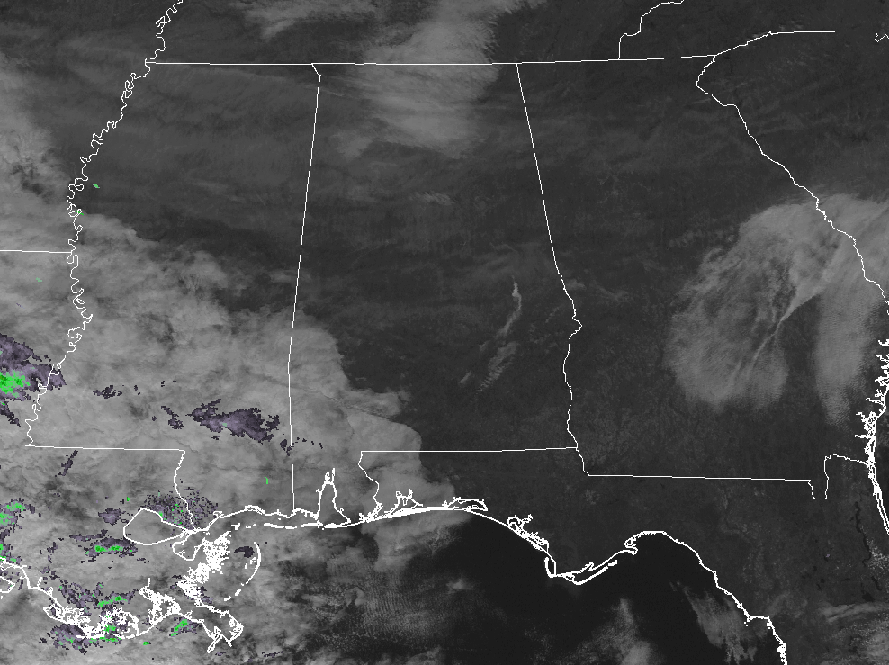
As we have reached the midday hour on this beautiful day after Christmas, skies overhead are mostly clear with some high cirrus clouds floating overhead filtering out some of the sunshine. Temperatures at this time are ranging from the lower 40s in the extreme northern parts of the area to the mid-50s in the south. Birmingham is currently at 48 degrees, while the warm spot is Eufaula at 55 degrees. The coolest spot in the area at this point is Haleyville at 41 degrees.
Weather For The Rest Of Your Tuesday
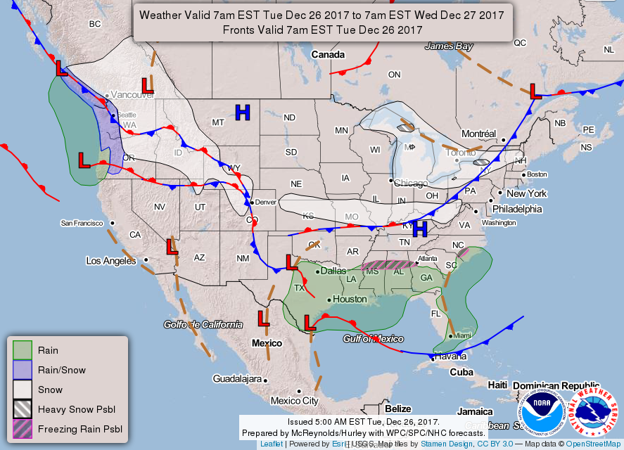
For the remainder of the afternoon hours, skies will start off mostly clear, but more clouds will start to move in ahead of some shower activity back to our southwest. We’ll stay dry until after sunset when showers will start to move in from the southwest. Afternoon highs will be in the mid-40s to the mid-50s.
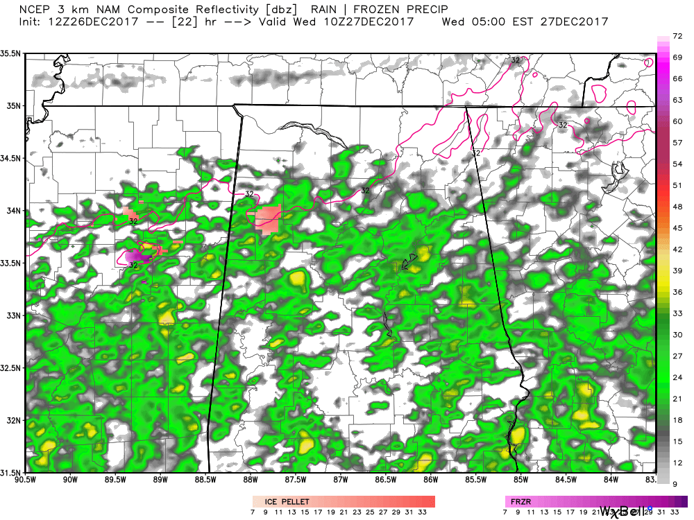
NAM3k Simulated Radar valid at 4AM Wednesday morning.
Looking at the latest model runs for this evening through the overnight hours, we’ll have scattered showers start to move into the southwestern parts of Central Alabama around or just after 5:00 PM and will slowly spread northeastward through the evening and late night hours. By the time we reach midnight, nearly all of Central Alabama will have a decent chance of showers, and as the temperatures drop toward the early morning low, a mix of light freezing rain and sleet will develop across Lamar, Fayette and Marion Counies and develop eastward across northern Tuscaloosa, Walker, northern Jefferson, Culman, Blount and northern St. Clair Counties through 7-8 a.m. While widespread travel problems are not expected, icy spots could develop on bridges and overpasses. Conditions will be potentially dangerous in spots through 9 a.m. Check road and weather conditions carefully before heading out late tonight or early tomorrow morning.
Rain Moves Out By Wednesday Afternoon & Remain Cold
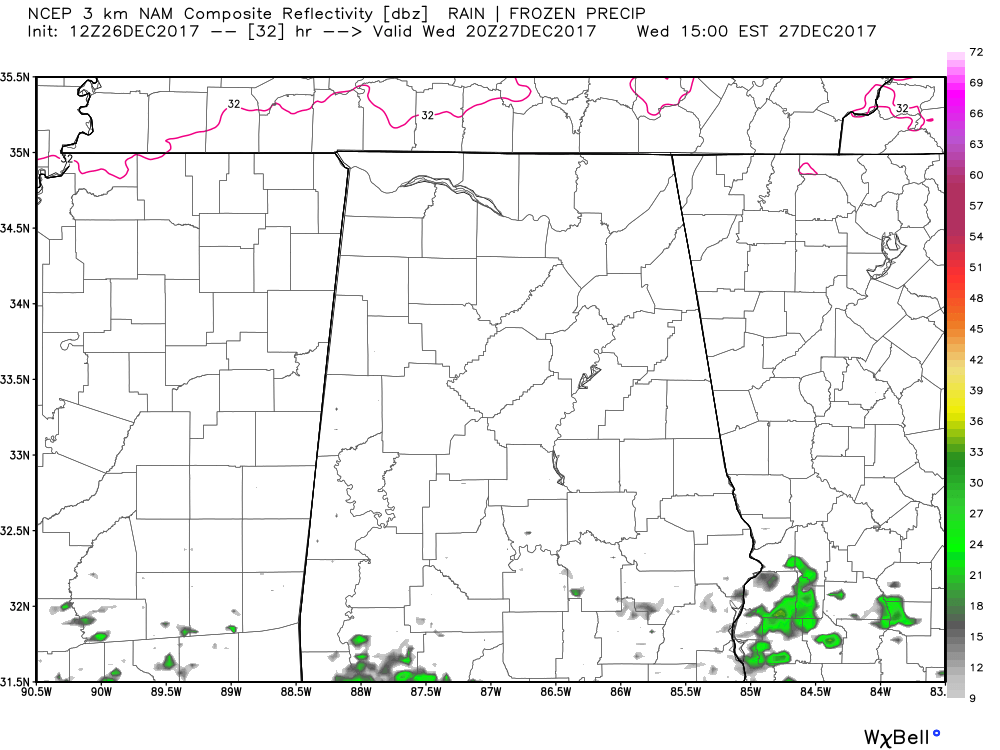
NAM3k Simulated Radar valid at 2PM Wednesday afternoon.
Showers and a few embedded sleet pellets will persist through the early morning hours until everyone gets above freezing by around the 9:00 AM hour. After that, showers will start to move out of Central Alabama, being south of I-20 by 11:00 AM, and just about completely out of the area by 4:00 PM. A few scattered showers will be possible in the extreme southern portions of the area after that time, before more scattered showers move back in from the south during the late night and overnight hours. Those showers could possibly make it back as far north as the I-20 corridor by daybreak on Thursday, but I believe much of the activity will stay south of a line from Tuscaloosa to Alabaster to Sylacauga. Afternoon highs will be in the 40s throughout the area, with lows in the mid-20s to the upper 30s.
This Day In Weather History
1776 – George Washington crossed the ice-clogged Delaware River. He marched on Trenton in the midst of snow and sleet thus surprising and capturing many of the British garrisons.
The Beach Forecast
Click here to see the AlabamaWx Beach Forecast Center page. The Beach Forecast is partially underwritten by the support of Brett/Robinson Vacation Rentals in Gulf Shores and Orange Beach. Click here to see Brett/Robinson’s Off-Season Deals now!
WeatherBrains
Check out the show at www.WeatherBrains.com. You can also subscribe on iTunes. You can watch the show live at live.bigbrainsmedia.com. You will be able to see the show on the James Spann 24×7 weather channel on cable or directly over the air on the dot 2 feed.
E-Forecast
Get the Seven-Day Forecast delivered directly to your inbox by email twice daily. It is the most detailed weather forecast available in Central Alabama. Subscribe here. It’s free!
Advertise With Us
Don’t miss out! We can customize a creative, flexible and affordable package that will suit your organization’s needs. Contact Bill Murray at (205) 687-0782.


