

An 8 O’Clock Look at the Alabama Weather Situation
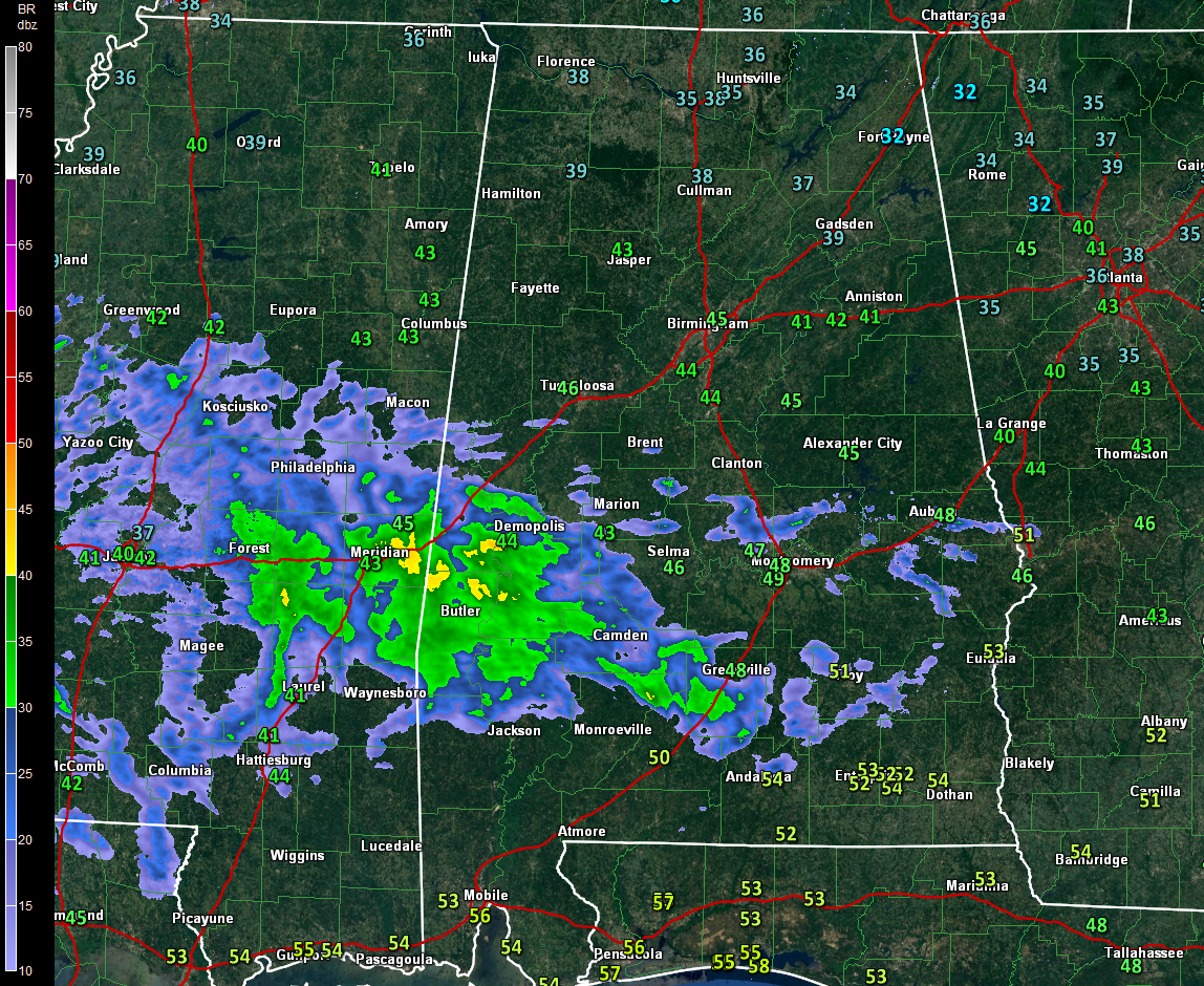
Light rain is tracking across the southern third of Alabama tonight, generally south of a line from Eutaw to Clanton to Auburn.
To the west, rain is lifting northeastward now across much of Louisiana and the southern third of Mississippi. This precipitation will be lifting into West Central Alabama over the next couple of hours. The precipitation is being produced by a weak surface low south of the Louisiana coast.
Temperatures across North Alabama are in the middle and upper 30s. Across Central Alabama are in the middle and upper 40s. Dewpoints have jumped 7-10 degrees over the past several hours and are now in the upper 20s to lower 30s across the I-20 Corridor. This means that temperatures in the I-20 Corridor will have a hard time falling below freezing along and south of I-20 and the precipitation should fall mainly as rain mixed with a little sleet.
North of I-20, from Lamar, Fayette and Walker Counties across northern Tuscaloosa, northern Jefferson, northern St. Clair, Cullman, Blount, Etowah, Cherokee, Calhoun and Cleburne Counties, temperatures will fall into the lower 30s and a mix of light freezing rain and sleet will fall starting after midnight. There could be a few icy spots on roads, especially bridges and overpasses in these counties.
In northern parts of the Birmingham Metro, temperatures should fall to at or below freezing, causing for some slick spots there.
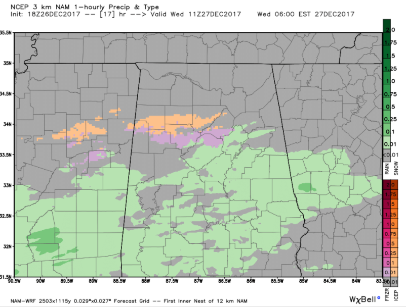
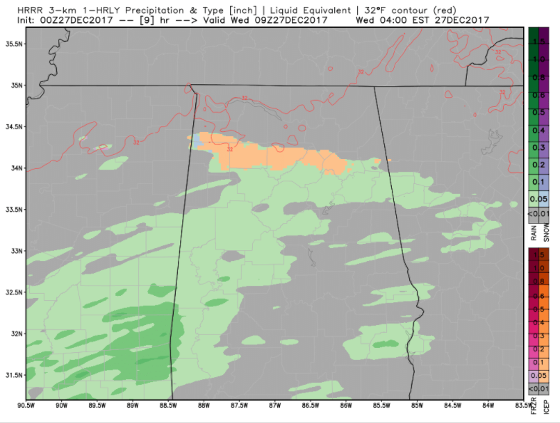
The NAM-3k is what our forecast is based upon. The HRRR is slightly warmer than the NAM-3k and keeps the wintry mix a little further north, over Marion, Winston, Cullman, northern Blount and Etowah Counties. So there is still some uncertainty in this forecast. We will be watching is throughout the night and will have frequent updates and the very latest reports.
Here is the NAM-3k at 5 a.m. showing light freezing rain in pink and sleet in orange.
Here is the HRRR showing more sleet than freezing rain and keeping the wintry precip a little further north.
If you have to travel late tonight or tomorrow morning in areas along and north of I-20, check the latest road and weather conditions before leaving. Wake up early before heading out to work in the rest of the Birmingham and Tuscaloosa areas. Temperatures should remain above freezing in Tuscaloosa, but outlying parts of Tuscaloosa County could see colder temperatures and a few problems. Postpone your travel until later in the morning if conditions start deteriorating.
The precipitation chances will quickly diminish the further north that you go, with most of the precipitation staying south of US-278. There could be a few snowflakes along the northern edge of the precipitation shield, especially over Northeast Alabama’s DeKalb County.
Temperatures should warm above freezing by 10-11 a.m.. in all areas allowing for any ice to melt.
Category: Alabama's Weather, ALL POSTS
About the Author (Author Profile)
Bill Murray is the President of The Weather Factory. He is the site's official weather historian and a weekend forecaster. He also anchors the site's severe weather coverage. Bill Murray is the proud holder of National Weather Association Digital Seal #0001 @wxhistorianSubscribe
If you enjoyed this article, subscribe to receive more just like it.


