

A Late Night Look At New Year’s Eve & New Year’s Day
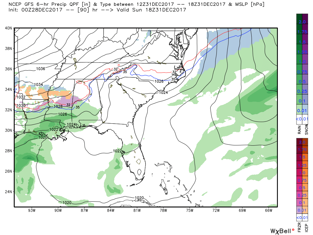
GFS valid at 12PM Sunday Afternoon.
The latest run of the GFS (00z) is showing a much drier solution at this point with the main body of moisture moving through the southern half of Central Alabama and staying south of the I-20 corridor. There is a risk for some wintry mix (snow, sleet, freezing rain, as it first moves into the state on Sunday afternoon, but that quickly dissipates as it moves into South Alabama during the evening hours. The dreaded 540 line stays well north of the moisture, so accumulations look very unlikely.
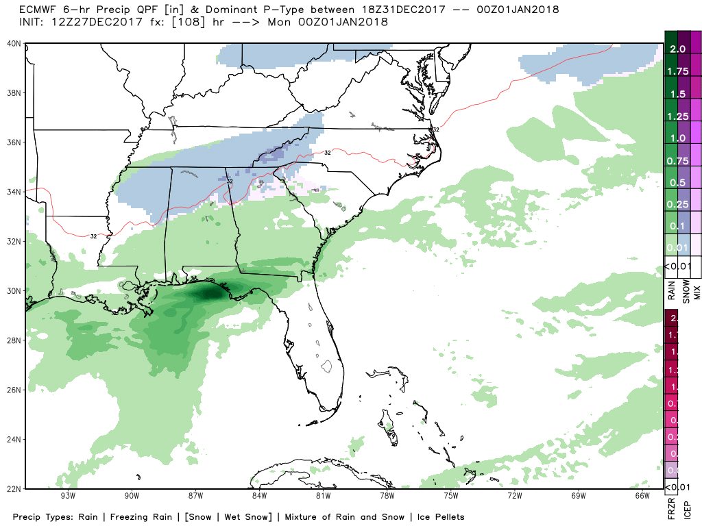
European valid at 6PM Sunday Evening.
The European apparently has flip-flopped from what it has been printing out for the last few days. Both models agree with Saturday being a relatively nice but chilly day, but moisture moves in just after midnight on Sunday morning and spreads across Central Alabama during the pre-dawn and into the early morning hours. A wintry mix will start moving into the northwestern parts of the state by daybreak and will progress to the southeast as the colder air moves in with the mix. That will eventually turn into all light snow showers as it continues to move across the northern half of Central Alabama. Most of the precipitation will be out of the area by the drop of the ball at midnight to bring in 2018, but a few flurries will be possible. With temperatures dropping below freezing quickly with the mix and snowfall, light accumulations in the northern half of Central Alabama can be expected to range from a dusting to 1/4 inch.
So the best bet at this point will be to go in the middle with these two models and say showers will be possible starting on Sunday afternoon through the start of 2018 at midnight and moving out very soon after that. A few icy spots are possible as temperatures will be quickly dropping well below freezing below the front, especially on bridges and elevated surfaces. As far as accumulating snowfall, those in the northern half of the state could see a dusting to just a tad more as you go farther north. Highs on Sunday will be in the mid-30s to the upper 40s from north to south, but holding in the mid-30s to the lower 40s for Monday’s highs. Temperatures will be really dropping on Monday evening and lows will bottom out in the mid-teens to the lower 20s.
For the trip to New Orleans for the Sugar Bowl, Alabama fans will put up with some showers and maybe a few sleet pellets on Sunday, but travel on Monday should be just fine. As far as a trip to Atlanta for the Peach Bowl, there is a good chance that your travel may be completely dry, but I couldn’t rule out a stray shower or two on Sunday afternoon and night. That could be mixed with a few flurries or sleet pellets into the late night hours on Sunday, but Monday’s travel should be just fine. Just might have to watch for a few leftover slick spots on bridges, but not expecting a big problem at this point.
Category: ALL POSTS, Winter Weather
About the Author (Author Profile)
Scott Martin is an operational meteorologist, professional graphic artist, musician, husband, and father. Not only is Scott a member of the National Weather Association, but he is also the Central Alabama Chapter of the NWA president. Scott is also the co-founder of Racecast Weather, which provides forecasts for many racing series across the USA. He also supplies forecasts for the BassMaster Elite Series events including the BassMaster Classic.Subscribe
If you enjoyed this article, subscribe to receive more just like it.


