

Sunny, but Cold Saturday Afternoon
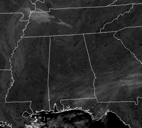
It remains a mainly sunny Saturday afternoon, with only some upper-level cirrus clouds providing a bit of filtered sunshine in some locations.
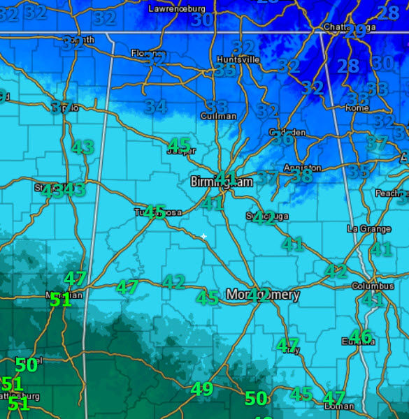
Temperatures early this afternoon are in the upper 30s and lower 40s, and high temperatures this afternoon will be in the lower to mid 40s across much of North/Central Alabama, while some upper 30s will hold on in eastern and northern portions of the state.
These are still well below average for this time of year, but certainly an improvement over the temps of the last week. We are dry and we are going to be staying dry well into tomorrow. For tonight, it is going to be another very cold night with lower 20s for most locations, and yes, a few upper teens will show up in those notorious colder spots. However, this should be the last bitterly cold night for a while as our weekend warming trend begins and last into the week ahead.
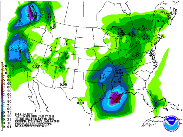
RAIN ON THE WAY: On Sunday, moisture levels increase and the sky becomes mostly cloudy. It will be warmer day, but still chilly with highs in the upper 40s to lower 50s for most of us. Most of the day looks to be dry, but there could be a stray shower late tomorrow afternoon over extreme West and Northwest Alabama, but most of the rain will arrive Sunday night, mainly after midnight, and will last through the day Monday.
WINTER WEATHER MISCHIEF?: During the pre-dawn hours Monday, most of Alabama will be fine, just expect a cold rain with temperatures well above freezing with upper 30s for most locations. For areas in extreme Northeast Alabama, where we typically see those colder temperature pockets, we still need to mention the chance of period of freezing rain or sleet between midnight Sunday night and 6:00 a.m. Monday. Counties with the best chance of seeing some freezing rain are Jackson, Marshall, DeKalb, and Cherokee. Some bridge icing is possible, but not especially likely, and any impact won’t last long as warm air advection kicks in and a soaking rain falls during the day Monday.
MESSY MONDAY: Monday will be a cloudy, raw, cool and wet day for Alabama, as a soaking rain is expected. Rain amounts Monday should be in the one-half to one inch range across the state, with heavier amounts to the west; some thunder is possible, but there is no risk of severe weather. We should reach the low 50s Monday afternoon.
CFP NATIONAL CHAMPIONSHIP: For fans headed to Atlanta for Monday’s national championship game, there is a window Monday morning when some freezing rain is possible across North Georgia, with potential for a little bridge icing, but this should be a temporary issue, and temperatures should be above freezing in Atlanta by late morning. Rain is likely through Monday night, so take some rain gear if you plan on walking to Mercedes Benz Stadium. The high in Atlanta Monday will be in the upper 40s.
Category: Alabama's Weather, ALL POSTS
About the Author (Author Profile)
Macon, Georgia Television Chief Meteorologist, Birmingham native, and long time Contributor on AlabamaWX. Stormchaser. I did not choose Weather, it chose Me. College Football Fanatic. @Ryan_StinnetSubscribe
If you enjoyed this article, subscribe to receive more just like it.


