Cold, Cold, Snow? More Cold, Then Warmer for Next Weekend
We are getting off to a chilly start on this early January Saturday morning. Alabama went back into the deep freeze yesterday morning behind a cold front. A cloudy, blustery day replete with snow flurries, sleet and light rain gave way to slowly clearing skies overnight and cold readings in the lower 20s to upper 20s. A few of the normally colder spots will check in with readings in the teens I am certain.
Today will be another cold and raw day, but with gradually increasing sunshine. We hope. Sometimes, these winter clouds have a way of hanging tougher than we expect. But let’s call for gradual clearing today. Highs will be limited to the 30s north of I-20, with only lower 40s across South Central Alabama. Wind chill values will be in the teens all day with a fresh northerly breeze of around 10 mph making it feel quite uncomfortable.
Readings tonight will be 4-5 degrees colder than those of last night, with readings as cold as 18F in Hamilton and Gadsden, 19-20F in Birmingham, Anniston and Tuscaloosa and lower 20s all the way to Troy. So be ready for a hard freeze overnight. Wind chill readings will be in the single digits as well, so take precautions if you will be exposed to the cold. Remember pets and vulnerable friends, family and neighbors.
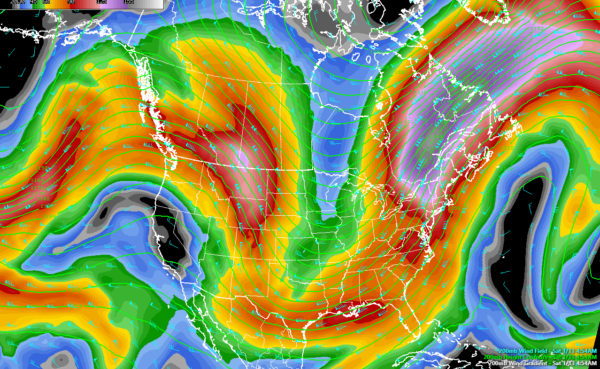
By tomorrow, that deep trough will still be anchored on the eastern half of the country, keeping Alabama in a cold advection situation. Highs will not be much warmer tomorrow than today, running 39-43F across the middle of Alabama. Sunday night lows will still be cold, in the lower and middle 20s, with an emphasis on lower.
MONDAY MODERATION:
It will feel like a tropical heat wave by Monday afternoon as the mercury climbs back into the upper 40s and lower 50s, but this is still some 5 degrees or so below normal for this time of year.
WILL THE SCHOOLS BE CLOSED?!?!?!
I can already hear the refrain now. A fast-moving cold front will cut quickly through Central Alabama Tuesday morning, serving to drop temperatures again during the day. And since they will be starting out in the upper 20s and lower 30s, and only managing to make it into the lower and middle 30s before the front arrives, it’s back in the freezer again for us. The big question is, how much post-frontal precipitation can the front squeeze out? The models are in fairly good agreement now that around 0.10 inches of liquid equivalent could fall in the form of light snow during the day Tuesday. This could translate into around one inch of snow in the Tennessee Valley and a dusting to one inch as far south as just south of I-20. Will this be enough to cause problems? The answer is: quite possibly. While it isn’t going to be a big snow event, it certainly bears watching. The kiddos could get an extra day out of school after the Dr. King holiday on Monday. Stay tuned.
BACK IN THE DEEP FREEZE
By Wednesday morning, most locations across the northern half of Alabama will be well down into the teens, with some single digits readings as well. Wednesday afternoon highs will not get above freezing for areas north of I-20. Wednesday night lows will be in the teens.
THURSDAY THAW
Temperatures start to make a rebound on Thursday, topping out in the lower to mid-40s. Friday will be little warmer as we will have small ridging with the flow coming from the west-southwest. But increasing clouds could hold readings back a bit, so 40s may be common. The GFS is showing rain moving in late on Friday and moving out early on Saturday, while the European is keeping the state dry.
NEXT SYSTEM
The European model has our next chance of rain coming on late Sunday night (1/21) and into Monday (1/22), while the GFS somewhat agrees with that solution with the timing of the rain coming in on Sunday morning and lasting through Sunday night. The temperatures appear to stay in the 50s for highs throughout next weekend and through Tuesday (1/23), with lows in the 30s and 40s… More typical for this time of the year.
WEATHERBRAINS
Great show Monday night as we will be joined by Mark Taylor from WeatherBell and the guys from Surfline. They make forecasts for surfers all over the world. We will also be talking about Kevin’s great victory over The Facebook.
Brian will be back with the video for Sunday. I will see you again next weekend as he will be on travel again. Til next time, keep an eye to the sky!
Category: Alabama's Weather, ALL POSTS


