

Clouds Hang Around; Not Much Rain Today
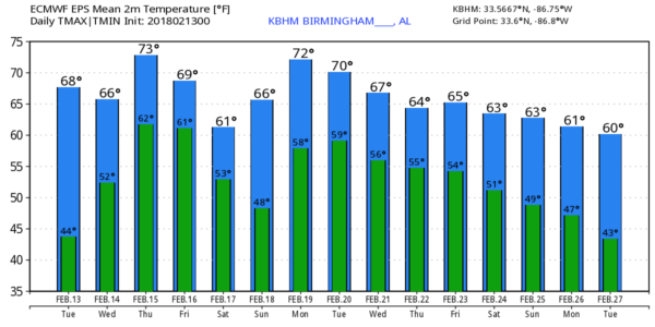
THIS MORNING: Temperatures have changed little across Alabama over the past 18 hours. We have mostly 40s over the northern half of the state, but Dothan reports 61 degrees just before daybreak. They are south of a stalled surface front, representing the leading edge of shallow, cold air that covered North and Central Alabama yesterday. The front will dissipate today, and temperatures won’t be as cold. We will reach the 50s by afternoon, and some places will see low 60s, mainly along and south of I-20. Down in South Alabama, highs will be close to 70 this afternoon.
Clouds will linger today, but we don’t expect anything more than isolated showers. The chance of any one spot seeing a shower is only about one in eight.
TOMORROW THROUGH FRIDAY: A broad southwest flow aloft will persist across the Deep South, meaning very little sun on these three days.
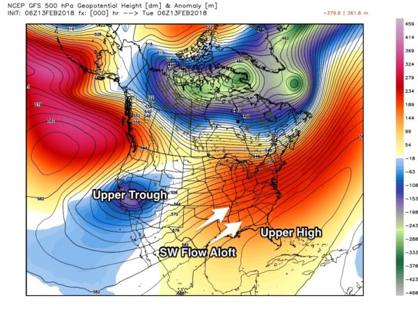
And, we will need to mention a chance of showers each day as well. Highest coverage of showers will be over the northern half of Alabama, especially along and north of I-20. The southern counties of the state will be impacted by an upper ridge over the Gulf of Mexico, meaning few, if any showers there. Highs will be well up in the 60s, and some spots could see low 70s by Thursday and Friday afternoon.
THE ALABAMA WEEKEND: A cold front will slip through here late Friday night and Saturday, stalling out somewhere across Central Alabama. This means clouds will linger through the weekend, and once again we will deal with showers both days. Saturday should be cooler with a high in the 50s, but we rise into the low 60s Sunday. Best coverage of rain over the weekend will be over the northern half of the state, and there will be some breaks in the rain. And, no flooding issues like last weekend. Just occasional showers. And, little rain for the southern quarter of Alabama.
NEXT WEEK AND BEYOND: The upper pattern will persist. Trough in the western U.S… ridge over the Bahamas and the Florida Peninsula. And, for us, a southwest flow aloft… meaning most days next week will feature a cloudy sky with some risk of showers. The weather will be mild with highs well up in the 60s; we could see low 70s on a day or two. The bottom line is that we won’t see much sun around here for the next 10 days with occasional showers, especially for the northern half of the state. No severe storms, no flooding, and probably not much thunder and lightning.
BEACH FORECAST: Click here to see the AlabamaWx Beach Forecast Center page.
WEATHER BRAINS: Don’t forget you can listen to our weekly 90 minute netcast anytime on the web, or on iTunes. This is the show all about weather featuring many familiar voices, including our meteorologists here at ABC 33/40.
CONNECT: You can find me on all of the major social networks…
Facebook
Twitter
Google Plus
Instagram
Pinterest
Snapchat: spannwx
I will do a weather program this morning at Emma Sansom Middle School in Gadsden… then I will be speaking at the Anniston Rotary Club. Look for the next Weather Xtreme video here by 4:00 this afternoon. Enjoy the day!
Category: Alabama's Weather, ALL POSTS, Weather Xtreme Videos
About the Author (Author Profile)
James Spann is one of the most recognized and trusted television meteorologists in the industry. He holds the AMS CCM designation and television seals from the AMS and NWA. He is a past winner of the Broadcast Meteorologist of the Year from both professional organizations.Subscribe
If you enjoyed this article, subscribe to receive more just like it.


