

Great Weather At Midday, Rain Returns Tonight
Chamber Of Commerce Weather At Midday Across Central Alabama
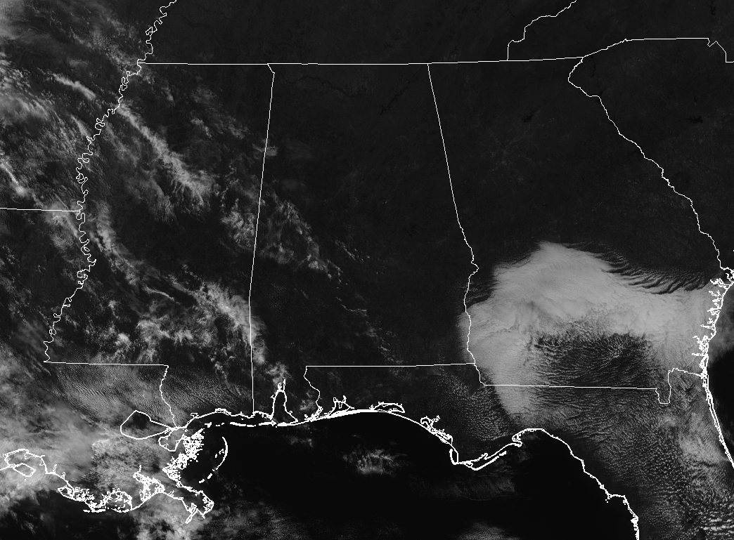
Central Alabama is looking fine and dandy at 12:05 PM with mostly clear to sunny skies and temperatures currently in the mid-60s to the lower 70s throughout the area. Birmingham was sitting at 64 degrees with light winds out of the southeast around 5-8 MPH. The warm spot was Troy at 70 degrees, while Cullman was the cool spot at 62 degrees. Better enjoy this weather while you can, because rain invades later tonight.
Great For The Remainder Of The Day, Showers & Storms Move In Late
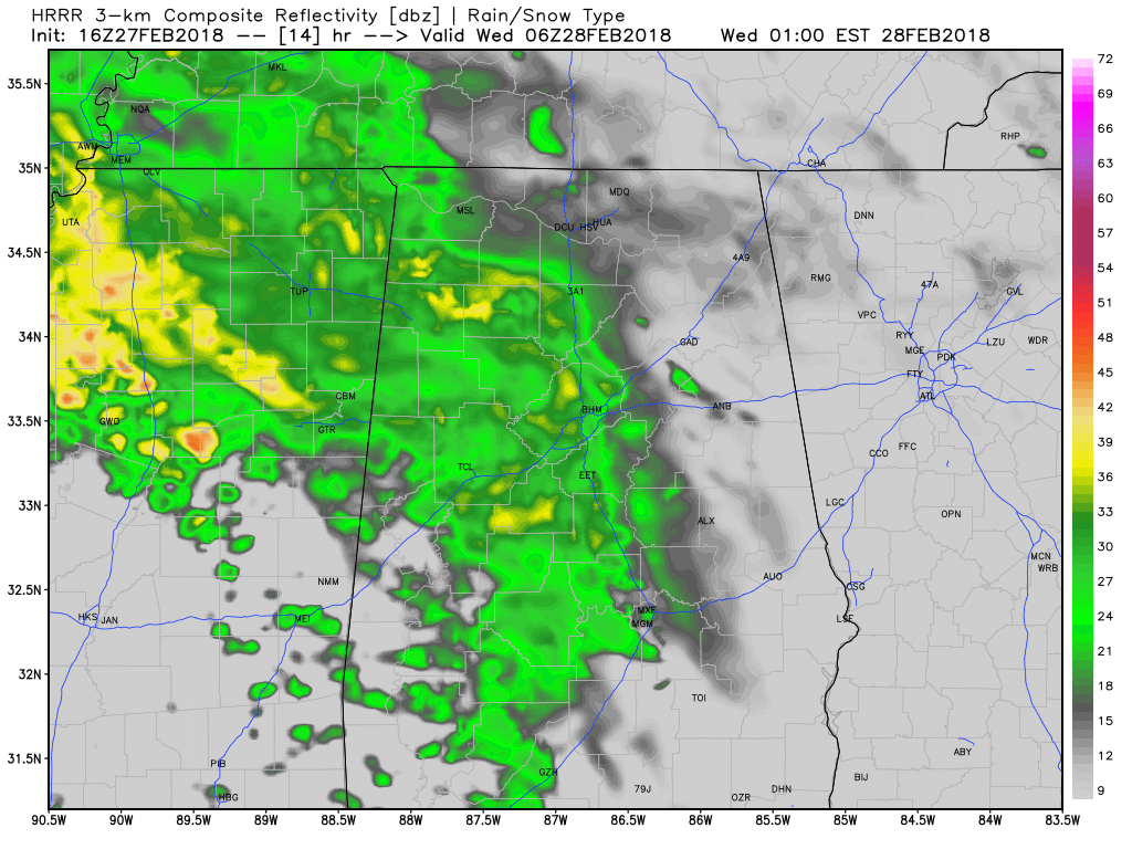
HRRR Simulated Radar solution valid at 12AM Wednesday.
For the rest of the afternoon and early evening hours, you couldn’t ask for a better day across Central Alabama. We’ll have mostly sunny to sunny skies to start, but clouds will eventually start moving in during the late afternoon and into the evening hours. Afternoon highs will be in the upper 60s to the lower 70s. Showers and a few embedded thunderstorms will start to move into the western portions of Central Alabama around the 7PM-9PM timeframe tonight and eventually spread across nearly all of the area by 1AM-3AM. No severe weather expected tonight, but the rain at times could be moderate to heavy. Overnight lows will be in the 50s.
Wednesday’s Weather Will Feature Scattered Showers & Storms
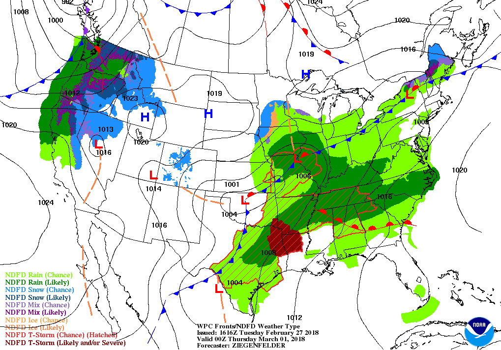
It will be a mostly cloudy and a quite wet day to start with, as scattered to numerous showers and thunderstorms will move across the area during the pre-dawn through the morning rush hours. Those will affect nearly all of North and Central Alabama to start, but as the morning progresses, the coverage will be mainly over the northern parts of Central Alabama and into North Alabama. After the morning, we’ll have a risk of scattered showers and storms throughout the remainder of the afternoon and into the evening and late night hours. As of this point, none of Alabama will be in a defined severe storm risk by the Storm Prediction Center, but we’ll keep an eye on it as severe weather will be possible just to our west. Wednesday’s highs will be in the upper 60s to the upper 70s throughout Central Alabama, with lows in the 60s.
Flood Watch Goes Into Effect Wednesday Morning
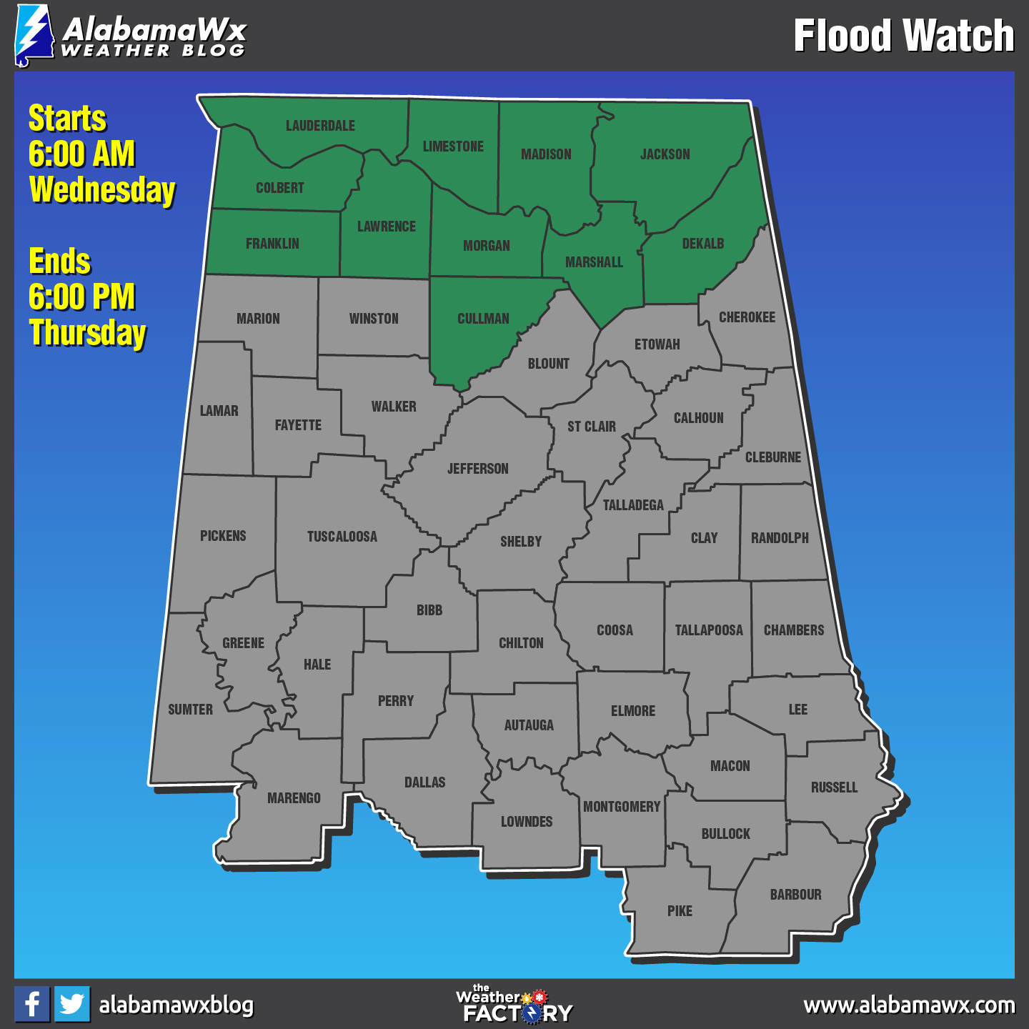
The National Weather Service in Huntsville has issued a Flood Watch for the North Alabama counties of Colbert, Cullman, De Kalb, Franklin AL, Jackson, Lauderdale, Lawrence, Limestone, Madison, Marshall, and Morgan from Wednesday morning through Thursday afternoon. Multiple waves of moderate to heavy rainfall will impact the area late tonight through Thursday afternoon as a warm front moves north through the area followed by a cold front on Thursday. 2 to 3.5 inches of rainfall is possible with locally higher amounts likely, especially where thunderstorms occur. With area rivers and streams already running high combined with the saturated soils, it will not take much rain for areal and river flooding of low lying areas and some roadways to occur. Do not drive through water that is covering a road.
A Flood Watch means there is a potential for flooding based on current forecasts. You should monitor later forecasts and be alert for possible Flood Warnings. Those living in areas prone to flooding should be prepared to take action should flooding develop.
Beach Forecast Center
Is it warm or cold at the beach today? Will it rain in two days? Get the latest forecast for the beaches from Fort Morgan to Panama City on our Beach Forecast Center page. There, you can select the forecast of the region that you are interested in.
WeatherBrains
This week, the panel entertained the Director of the GOES-R and JPSS satellite programs, Greg Mandt. Don’t forget you can listen to our weekly 90 minute netcast anytime on the web at WeatherBrains.com or on iTunes. This is the show all about weather featuring many familiar voices, including the meteorologists at ABC 33/40.
E-Forecast
Get the AlabamaWx Weather Blog’s Seven-Day Forecast delivered directly to your inbox by email twice daily. It is the most detailed weather forecast available in Central Alabama. Subscribe here… It’s free!
Advertise With Us
Don’t miss out! We can customize a creative, flexible and affordable package that will suit your organization’s needs. Contact Bill Murray at (205) 687-0782.
On This Day In Weather History
1717 – What was perhaps the greatest snow in New England history commenced on this date. During a ten-day period, a series of four snowstorms dumped three feet of snow upon Boston, and the city was snowbound for two weeks. Up to six feet of snow was reported farther to the north, and drifts covered many one-story homes.
Category: Alabama's Weather, ALL POSTS
About the Author (Author Profile)
Scott Martin is an operational meteorologist, professional graphic artist, musician, husband, and father. Not only is Scott a member of the National Weather Association, but he is also the Central Alabama Chapter of the NWA president. Scott is also the co-founder of Racecast Weather, which provides forecasts for many racing series across the USA. He also supplies forecasts for the BassMaster Elite Series events including the BassMaster Classic.Subscribe
If you enjoyed this article, subscribe to receive more just like it.


