

Another Very Nice Day
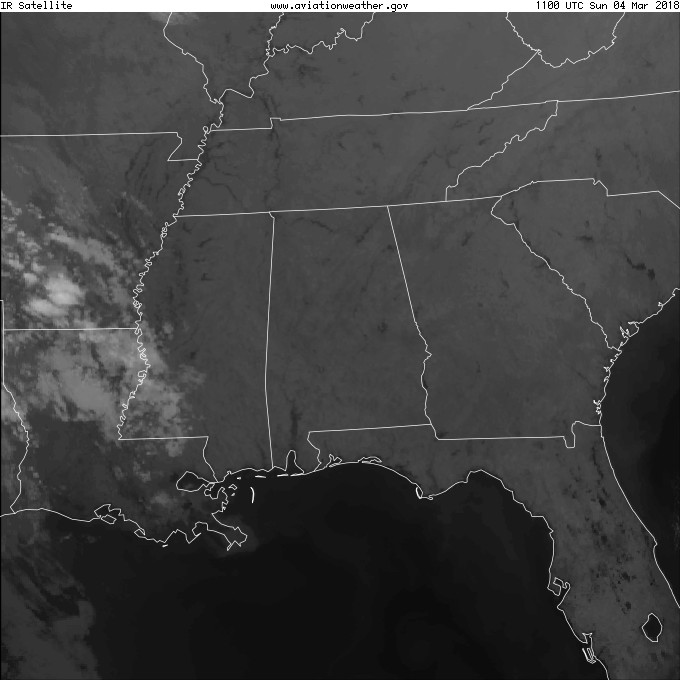
Starting the day out with clear sky across much of the Southeast US, but unlike yesterday, a few clouds are visible across the Lower Mississippi River Valley where moisture levels were on the increase ahead of the next system that will bring rain to Central Alabama on Monday and early Tuesday. We will probably see some high cirrus clouds today, but those clouds will only filter the sun somewhat highs still expected to approach the 70-degree mark.
The surface high helping to bring us a spectacular weekend will gradually move eastward while a strong upper trough with a closed low in eastern South Dakota will carve out a fairly deep trough over the eastern US. A surface low located in eastern South Dakota Monday will trail a cold front along the Mississippi River into East Texas on Monday at midday. With moisture levels coming up tonight and Monday, we will see a warm front move northward allowing the potential for some patchy rain and a few showers. The main rain event should hold off until Monday evening into early Tuesday morning. While instability will gradually decrease as the front moves east, there could be enough instability for us to hear some thunder. But as SPC indicates, there is only a marginal risk of severe storms on Day 2 over the Lower Mississippi River Valley with only thunderstorms forecast for Day 3. Highs Monday will be held in the 60s due to patchy rain and clouds. The high forecast for Tuesday is somewhat tricky due to the timing of the front. Temperatures will likely be falling through the 50s during the afternoon for much of Central Alabama.
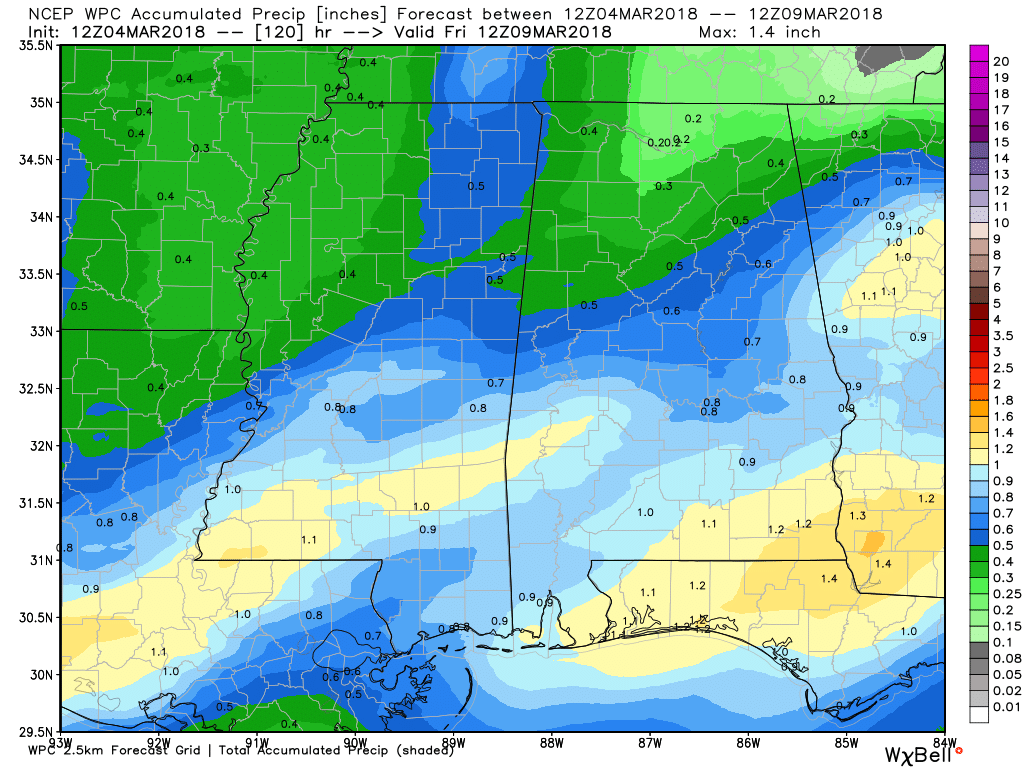
Rainfall amounts will vary with the slightly higher amounts across the southern half of the state where amounts are expected to be between three-quarters and about one inch. The northern third of the state will see amounts of one-quarter to one half inch.
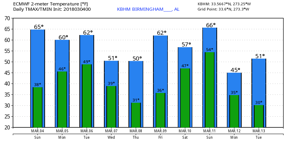
The trough digs into the eastern US on Wednesday and Thursday turning our weather sharply colder. I expect highs both days to be in the lower and middle 50s. The GFS MOS guidance has backed off a few degrees on the morning lows Wednesday, Thursday, and Friday with the latest values still in the middle and lower 30s. We’ll need to keep a close eye on future model runs for the potential for some widespread frost since the 850 millibar temperatures along with 1000 to 500 millibar thicknesses will be so low.
By Friday afternoon, we begin to enter a warming trend as the broad trough moves into the Atlantic and we come under weak ridging. Highs Friday and Saturday should be back into the 60s. But several weak disturbances in the nearly zonal flow on Saturday will bring the chances of rain back into the forecast for the weekend. And while it is just across the line into voodoo country, another one of these short waves is forecast to carve out another trough across the eastern US with a very deep upper low forecast to dive into North Georgia. This will even bring the potential for some winter weather for northern sections of the Southeast US. But remember, we’re into voodoo country, but certainly some interesting possibilities.
Further out, we stay fairly chilly into March 13th. Broad ridging brings back some warmer weather from the 14th through the 17th when there is another potential for a trough along the eastern seaboard. The screaming message is that the pattern is likely to remain active with some forecast challenges to deal with.
Beach Forecast: Click here to see the AlabamaWx Beach Forecast Center page.
WeatherBrains: Don’t forget you can listen to our weekly 90 minute netcast anytime on the web, or on iTunes. This is the show all about weather featuring many familiar voices, including our meteorologists here at ABC 33/40.
James Spann will have the next edition of the Weather Xtreme Video here on Monday morning. Enjoy another nice day in Central Alabama. Godspeed.
-Brian-
.
Category: Alabama's Weather, ALL POSTS, Weather Xtreme Videos
About the Author (Author Profile)
Brian Peters is one of the television meteorologists at ABC3340 in Birmingham and a retired NWS Warning Coordination Meteorologist. He handles the weekend Weather Xtreme Videos and forecast discussion and is the Webmaster for the popular WeatherBrains podcast.Subscribe
If you enjoyed this article, subscribe to receive more just like it.


