

Showers, Clouds, Breezes, and Colder Temperatures, Sun, Milder Temperatures; It’s March!
Check your watches. The correct Central DAYLIGHT Time is 9:30 a.m. Of course, your time will vary, based on what time you read this post. But we sprung forward an hour overnight. Get ready for a longer period of light this evening that is a preview of summertime.
NOT A PREVIEW IN THE TEMPERATURE DEPARTMENT: We go back in the cooler over the next four days a strong high pressure over the middle of the country builds down through the Midwest and into the Southeast. HIghs will be in the 50s and lows in the 30s starting tonight and through Thursday morning. In fact, we will be below freezing across much of the area Wednesday and Thursday mornings.
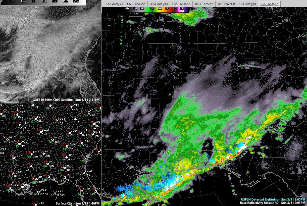
STRONG STORMS PUSHING INTO SOUTH ALABAMA: On the radar this morning, showers and storms have pushed into South Alabama with the heaviest rain now southeast of I-85 and I-85 over that part of the state.
SEVERE WEATHER POSSIBLE TODAY: As the storms sag into the Gulf Coast region today, there is a slight risk of severe weather over southeastern Louisiana, with a marginal risk eastward along the coast into the Florida Big Bend area.
STRONG HIGH: The strong high pressure is up to 1031 millibars this morning over eastern Montana and it will build even further as it moves down into the Plains states. Winds are gusting to over 40 mph over North Texas this morning, including 45 mph at Dallas and 47 mph at Meacham in Fort Worth.
SHOWERS/CLOUDS THROUGH THIS EVENING: Clouds will hang tough through this evening as the broad area of low-pressure slides eastward across Alabama. By morning, the surface low will be near Chattanooga, with the second low near New Orleans. Meanwhile, a strong upper-level disturbance will swing into the Southeast and cut off into an upper-level low. As it does, some wraparound moisture will make clouds hang tough until early Monday.
SNOW SHOWERS: There will even be a few snow showers over the Tennessee Valley late tonight and early Monday as the low, with its attendant cold temperatures aloft, sets up shop nearby. No accumulations are expected and there should be no impact.
RAW DAY MONDAY: The clearing will be slow at best Monday. It will be a raw day, with highs in the 50s and strong northwesterly winds of 10-20 mph with gusts of 20-30 mph.
MIDWEEK COOLDOWN: Highs Tuesday and Wednesday will be in the 50s. Lows Tuesday and Wednesday morning will be below freezing in most locations.
END OF WEEK MODERATION: Highs on Thursday will be back in the 60s as high pressure slides east and allows southerly winds to return. We will be back in the 70s Friday and Saturday.
RAIN RETURNS OVER THE WEEKEND: Rain will move back into the picture Saturday and Sunday as the high sets up shop off the Southeast coast of the United States.
Category: Alabama's Weather, ALL POSTS
About the Author (Author Profile)
Bill Murray is the President of The Weather Factory. He is the site's official weather historian and a weekend forecaster. He also anchors the site's severe weather coverage. Bill Murray is the proud holder of National Weather Association Digital Seal #0001 @wxhistorianSubscribe
If you enjoyed this article, subscribe to receive more just like it.


