

Unsettled Weather Through Thursday
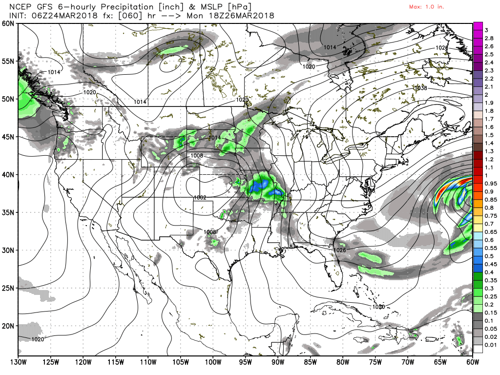
Starting the weekend out on a mostly cloudy note across the Southeast US with very light, spotty showers across mainly the northern third of Alabama. Temperatures qualify as mild with readings mainly in the 50s, but it was a little cooler in East Central Alabama where values were in the 40s. The surface map featured a surface low near Kansas City with a warm front trailing into East Tennessee. Aloft, Alabama was between a fairly deep trough over the East Coast and a ridge axis just west of the Mississippi River Valley. The upper flow was from the northwest, so these showers today will be moving from northwest to the southeast.
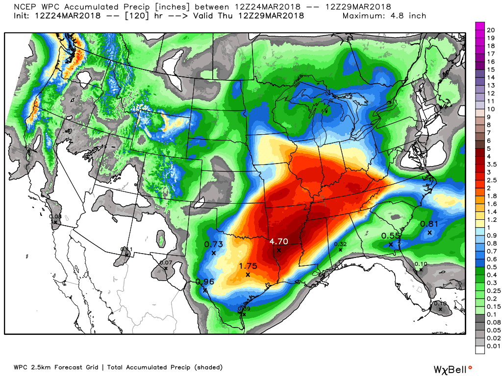
Rainfall over the next five days through Thursday morning should present with a strong gradient from Southeast Alabama where rainfall values will be around a third of an inch to values near 3 inches in Northwest Alabama. Part of the reason for the large amounts over the Lower Mississippi River Valley is the upper flow that will maintain a tap into Pacific moisture for much of the week ahead.
SPC maintains a severe weather threat mainly to our west for Days 3, 4, and 5. Instability and shear values rise ahead of a slow moving cold front on Thursday, so we’ll have to keep an eye on the potential for severe storms that day. This current projection would signal the threat to be the greatest to our south.
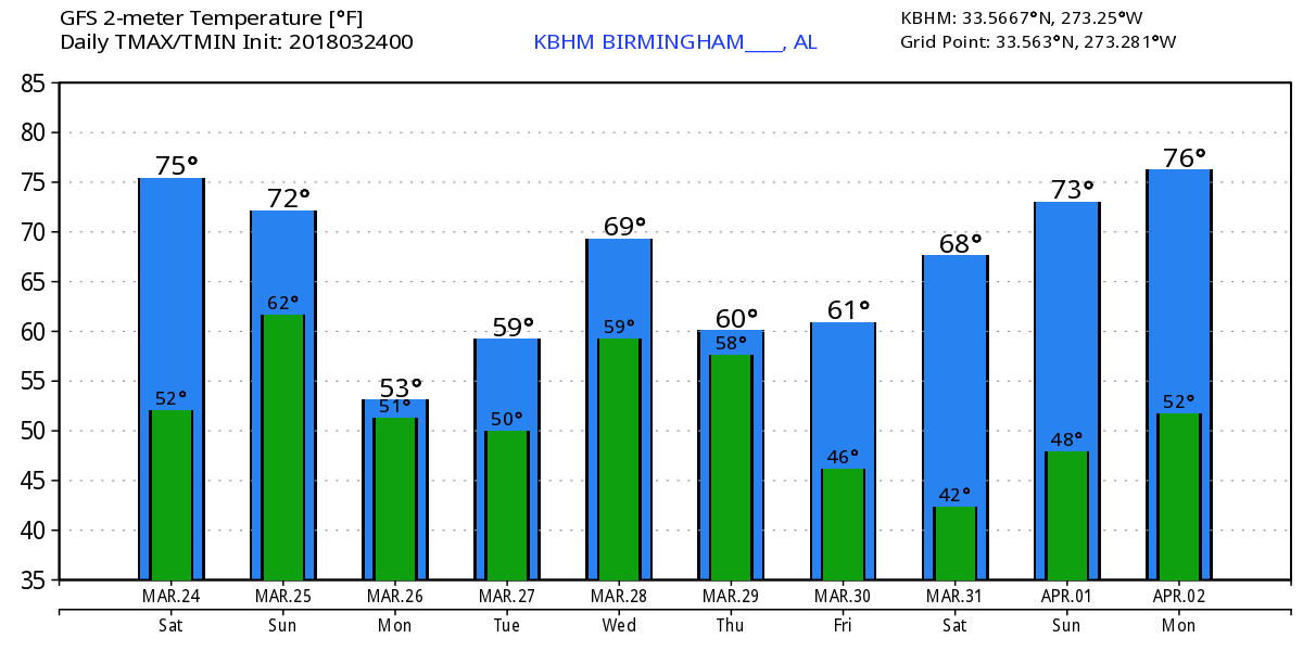
Today and Sunday will see similar days with chances for showers and warm temperatures with highs reaching into the lower half of the 70s. Aloft we have a ridge with weak disturbances traveling through the flow to enhance showers off and on while a deep trough slowly lumbers through the Southwest US. Late Sunday and into Monday we’re likely to see a nice cold air damming situation, also known as the wedge, set up with the big high centered over the New England states. This wedge is the reason for dropping the highs for Monday into the 50s. Monday could easily be one of those dreary days with an overcast sky, fog and drizzle, and rather chilly temperatures. The high should be in the upper 50s providing the wedge does set up across all of North and Central Alabama.
The deep trough over the Southwest US begins to come eject northeastward on Wednesday as it moves steadily eastward into the Mid-Atlantic States by Saturday. This sets up the Southeast US for the potential round of severe storms on Thursday. As noted above, this is one to keep our eyes on, but it could certainly lead to severe weather for the Gulf Coast region due to the position of the surface low over Southeast Mississippi. SPC notes in their discussion no specific outlook area for Day 5 due to the uncertainties in the quality of the thermodynamic profiles. Temperatures for much of the middle of the week after Monday should climb back into the 70s. After the surface low and the cold front move by on Thursday, we should see temperatures again in the 60s for highs and in the 40s for lows. Next weekend promises to be dry and sunny with temperatures pretty close to seasonal averages for the latter part of March and very early April.
Looking into voodoo country, the screaming message from the GFS is the relative lack of any strong systems. The flow becomes nearly zonal around April 2nd with a strong upper trough moving across the Great Lakes area around the 4th of April. That is followed by another shift to nearly zonal flow around April 6th.
Beach Forecast: Click here to see the AlabamaWx Beach Forecast Center page.
WeatherBrains: Don’t forget you can listen to our weekly 90 minute netcast anytime on the web, or on iTunes. This is the show all about weather featuring many familiar voices, including our meteorologists here at ABC 33/40.
Thanks so much for tuning into the Weather Xtreme Video. I expect to post the next edition here first thing on Sunday morning. Check back often for additional updates on the Alabama weather scene. Have a great day and Godspeed.
-Brian-
.
Category: Alabama's Weather, ALL POSTS, Weather Xtreme Videos
About the Author (Author Profile)
Brian Peters is one of the television meteorologists at ABC3340 in Birmingham and a retired NWS Warning Coordination Meteorologist. He handles the weekend Weather Xtreme Videos and forecast discussion and is the Webmaster for the popular WeatherBrains podcast.Subscribe
If you enjoyed this article, subscribe to receive more just like it.


