

Severe Thunderstorm Warning Continues for Parts of Lauderdale, Colbert and Franklin Counties Until 9:30 p.m. CDT
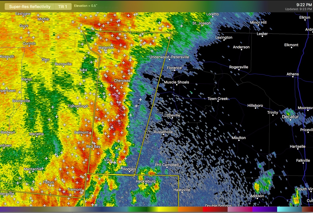
…A SEVERE THUNDERSTORM WARNING REMAINS IN EFFECT UNTIL 930 PM CDT
FOR WESTERN LAUDERDALE…WESTERN COLBERT AND WESTERN FRANKLIN
COUNTIES…
At 914 PM CDT, severe thunderstorms were located along a line
extending from near Walnut Grove to near Tremont, moving east at 50
mph.
HAZARD…60 mph wind gusts and penny size hail.
SOURCE…Radar indicated.
IMPACT…Expect damage to roofs, siding, and trees.
Locations impacted include…
Red Bay, J P Coleman State Park, Cherokee, Belgreen,
Underwood-Petersville, Vina, Hodges, Waterloo, Malone and Posey Loop.
PRECAUTIONARY/PREPAREDNESS ACTIONS…
Remain alert for a possible tornado! Tornadoes can develop quickly
from severe thunderstorms. If you spot a tornado go at once into the
basement or small central room in a sturdy structure.
Category: Alabama's Weather, ALL POSTS
About the Author (Author Profile)
Bill Murray is the President of The Weather Factory. He is the site's official weather historian and a weekend forecaster. He also anchors the site's severe weather coverage. Bill Murray is the proud holder of National Weather Association Digital Seal #0001 @wxhistorianSubscribe
If you enjoyed this article, subscribe to receive more just like it.


