

Quick Update At 3:45 PM: More Counties Removed From The Tornado Watch
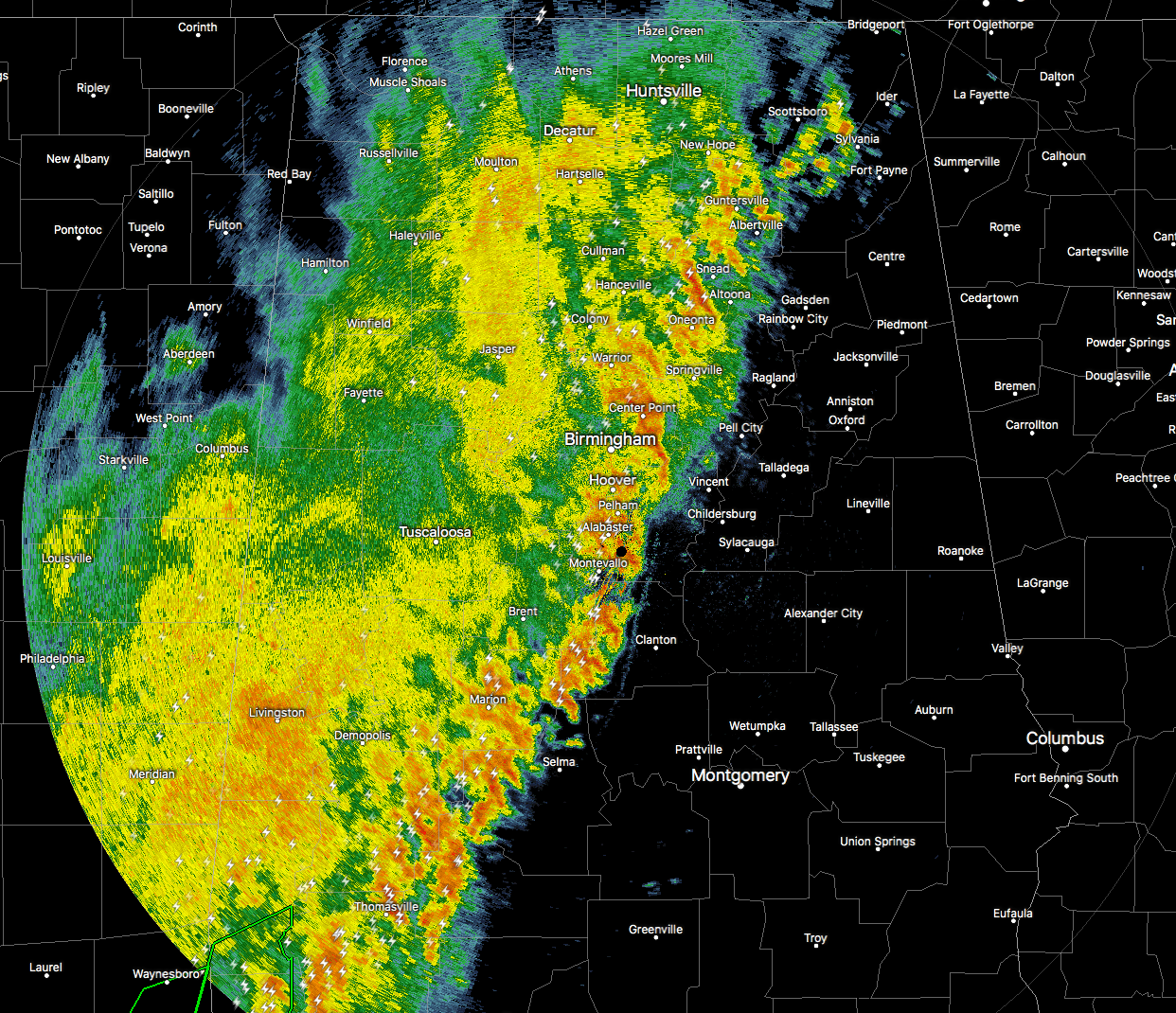
The line of storms now stretches from Bridgeport in the upper northeast corner of Jackson County, down to the southwest through Altoona and Leeds, to the south through Thorsby and Orrville in southern Dallas County. No severe storms are in progress across the North/Central Alabama area, but heavy rainfall and a good amount of lightning is occurring along and just behind the leading edge of the squall line.
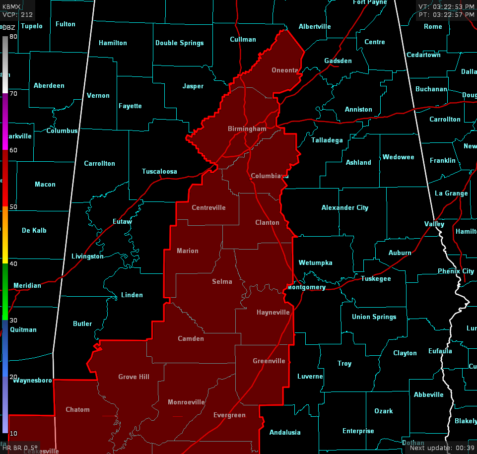
NWS Birmingham continues to remove counties from the Tornado Watch that is in effect for parts of Central Alabama until 7:00 PM. Counties remaining in the watch are Autauga, Bibb, Blount, Chilton, Dallas, Jefferson, Lowndes, Perry, and Shelby. Hale, Marengo, Tuscaloosa, and Walker were the latest counties removed from the watch at 3:00 PM.
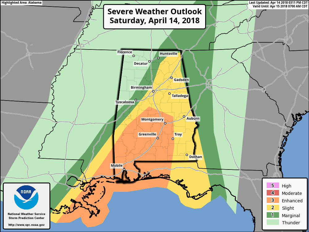
As the line continues to slowly move eastward, the treat for severe weather continues to shrink. An Enhanced Risk continues for the south-central and parts of the southwest Central Alabama, while a Slight Risk continues for the eastern half of Central Alabama and much of the eastern half of North Alabama.
Threats for the enhanced risk areas include a few tornadoes (some of which could be strong) and damaging winds up to 70 MPH. Threats for the slight risk areas are damaging winds up to 60 MPH and a brief tornado or two. For the marginal risk areas, the threat is much smaller than the slight risk area, but not zero.
Once the leading stronger storms on the front of the line passes your location, your severe weather threat will have ended. We still have the risk for excessive rainfall, so Flash Flood Warnings may be issued.
The main window for strong to severe storms throughout the area will be from now until around 12:00 AM Sunday. For the western parts of the area (Hamilton, Tuscaloosa, Demopolis), the threat of severe storms is over. For the central parts of the area (Birmingham, Clanton, Selma), the window will be from now until 6:00 PM. For the east-central parts of the area (Montgomery, Alexander City, Anniston), the window will be from 5:00 PM to 9:00 PM. For the eastern parts of the area (Auburn, Troy, Eufaula), the window will be from 7:00 PM until 12:00 AM.
Continue to check back on AlabamaWx.com for any breaking updates on the ongoing weather situation.
Category: Alabama's Weather, ALL POSTS
About the Author (Author Profile)
Scott Martin is an operational meteorologist, professional graphic artist, musician, husband, and father. Not only is Scott a member of the National Weather Association, but he is also the Central Alabama Chapter of the NWA president. Scott is also the co-founder of Racecast Weather, which provides forecasts for many racing series across the USA. He also supplies forecasts for the BassMaster Elite Series events including the BassMaster Classic.Subscribe
If you enjoyed this article, subscribe to receive more just like it.


