

Strong Storms Approaching Tuscaloosa
Strong storms are approaching Tuscaloosa right now.
the NWS Birmingham has issued a significant weather advisory for them.

They are not severe at this time, but they have plenty of lightning, brief heavy rain, and gusty winds.
Be in a substantial structure as these storms approach.
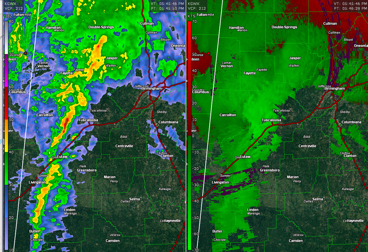
…SIGNIFICANT WEATHER ADVISORY FOR TUSCALOOSA COUNTY UNTIL 645 PM CDT…
At 548 PM CDT, Doppler radar was tracking strong thunderstorms along a line extending from 6 miles northwest of Lake Lurleen State Park to near Union. Movement was northeast at 30 mph. Winds in excess of 40 mph will be possible with these storms.
Locations impacted include…Tuscaloosa, Northport, Holt, Brookwood, Coaling, Coker, Samantha, McFarland Mall, Lake Lurleen State Park, Tuscaloosa Amphitheater, Tuscaloosa Regional Airport, Lake Wildwood, Binion Creek Landing, Shelton State Community College, Bryant Denny Stadium, University Mall, Deerlick Creek Campgrounds, Bankhead Lock And Dam, Whitson and Lake Tuscaloosa.
Category: ALL POSTS
About the Author (Author Profile)
Subscribe
If you enjoyed this article, subscribe to receive more just like it.


