

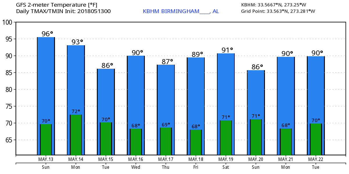
Hot, Dry before Becoming Unsettled Tuesday
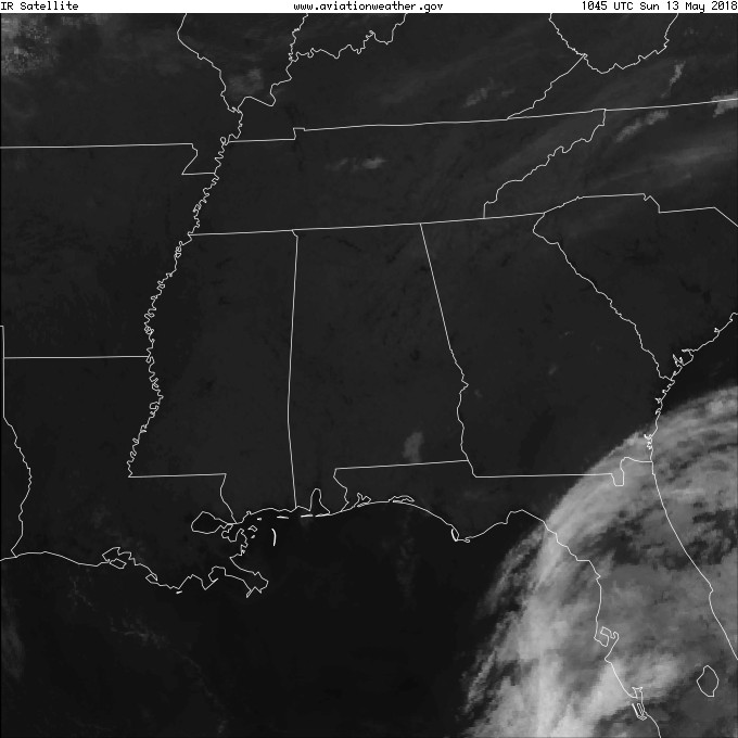
Our view from space this morning continued to show clear skies across nearly all of the Southeast US with the exception of the Florida Peninsula. That’s where an upper level low was developing that is expected to drift slowly north over the next several days and bring unsettled weather to a large portion of the Southeast US from Tuesday through the weekend. For this morning we start out the day clear with morning lows coming in close to 60 degrees. With lots of sun again today, Mother’s Day will be another warm one as highs climb close to or slightly above 90 degrees.
Monday that upper low drifts into the Northeast Gulf of Mexico. Central Alabama should remain dry and continued hot with highs once again near or slightly above the 90-degree mark.
Tuesday the weak but closed upper low drifts a little further west reaching a spot just off the Florida Handle south of Destin. This should bring showers into Central Alabama with the best time for them to occur coincident with afternoon heating. The additional clouds and rain should help to hold down our highs with values in the lower and middle 80s.
Severe weather for Days 1 and 2 should remain well north of Alabama along a stalled frontal boundary draped from Kansas to the Mid-Atlantic states.
This is where the pattern seems to get stuck. The closed upper low is still identifiable on Wednesday just south of Mobile, but it opens up into a fairly narrow trough on Thursday and phases with a slow moving trough coming across the Central US. The open trough hangs around the Alabama-Mississippi area through next weekend maintaining an unsettled pattern that means daily showers. I do not expect this slow moving trough to produce all day rains, but showers will be fairly plentiful each day with the most likely times for rain from late morning through late afternoon as shower development is aided by diurnal heating. Showers will diminish as the sun goes down, but with the presence of the trough in the Southeast US, we will see some showers even into the overnight hours. Closed and showers will help to hold highs in the 80s with lows in the 60s.
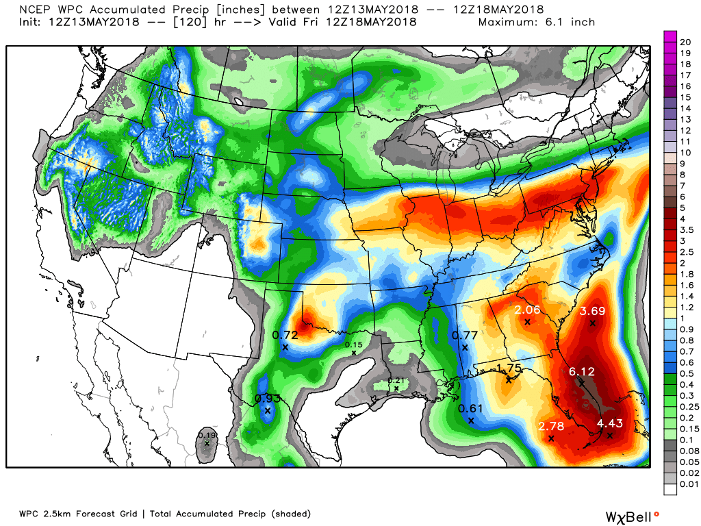
Rainfall with this slow moving system will be plentiful especially over the Florida Peninsula. Rainfall through next Friday morning will range from around three-quarters of an inch along the Alabama-Mississippi line to amounts close to 2 inches along the Alabama-Georgia line. This is more of a west to east gradient compared to the northwest to southeast gradient we saw yesterday. The good news is that this weak system is not expected to bring any severe weather to the area.
Looking out into voodoo country, and we find something quite interesting to watch and speculate about. You may recall the GFS projecting a rather strong looking tropical system that moved across the Florida Straits and northeastward along the US East Coast in the run yesterday. Well, the GFS has made it even more interesting on the latest run by developing a low over the western Caribbean and moving it north across the eastern Gulf into Southeast Alabama – all before the hurricane season actually kicks off on June 1st. The European model only goes out 10 days, but at the 10 day point, the Euro is also showing an area of unsettled weather in the western Caribbean. So this one is definitely a prime candidate for “keeping an eye on.” Understand I’m not forecasting a tropical storm or hurricane for the eastern Gulf at this point – this is very likely model madness as we see the GFS generate such storms fairly often. But the first name in the 2018 list will be Alberto.
Regions Tradition: The Regions Tradition will be May 16-20 at the beautiful Greystone Golf & Country Club! Make plans to attend one of the majors of the PGA Champions Tour! You can see legendary golfers Bernhard Langer, John Daly, Vijay Singh, and more tee it off with Nick Saban, Gus Malzahn, Bo Jackson, and other celebrities in the NCR Pro-AM. Juniors 18 & under are admitted free with a ticketed adult, and five-day grounds tickets are $80. Single day grounds tickets are $20. GET YOUR TICKETS HERE!!!
Beach Forecast: Click here to see the AlabamaWx Beach Forecast Center page.
WeatherBrains: Don’t forget you can listen to our weekly 90 minute netcast anytime on the web, or on iTunes. This is the show all about weather featuring many familiar voices, including our meteorologists here at ABC 33/40.
Mother’s Day weekend is always a busy one for me with the annual Buck Creek Festival. The weather for this outdoor festival was absolutely gorgeous, the music lineup was superb, and the crowds were great. Always nice to have people stop by to say hello. James Spann will be back bright and early Monday morning with the next edition of the Weather Xtreme Video. Happy Mother’s Day. Godspeed.
-Brian-
.
Category: Alabama's Weather, ALL POSTS, Weather Xtreme Videos
About the Author (Author Profile)
Brian Peters is one of the television meteorologists at ABC3340 in Birmingham and a retired NWS Warning Coordination Meteorologist. He handles the weekend Weather Xtreme Videos and forecast discussion and is the Webmaster for the popular WeatherBrains podcast.Subscribe
If you enjoyed this article, subscribe to receive more just like it.


