

Storms With Heavy Rain Building Southward
Storms have intensified tonight across areas south and east of Birmingham.
They have lots of lightning and heavy rain. Gusty winds are being experienced across much of the area as numerous outflow boundaries are criss-crossing the region.
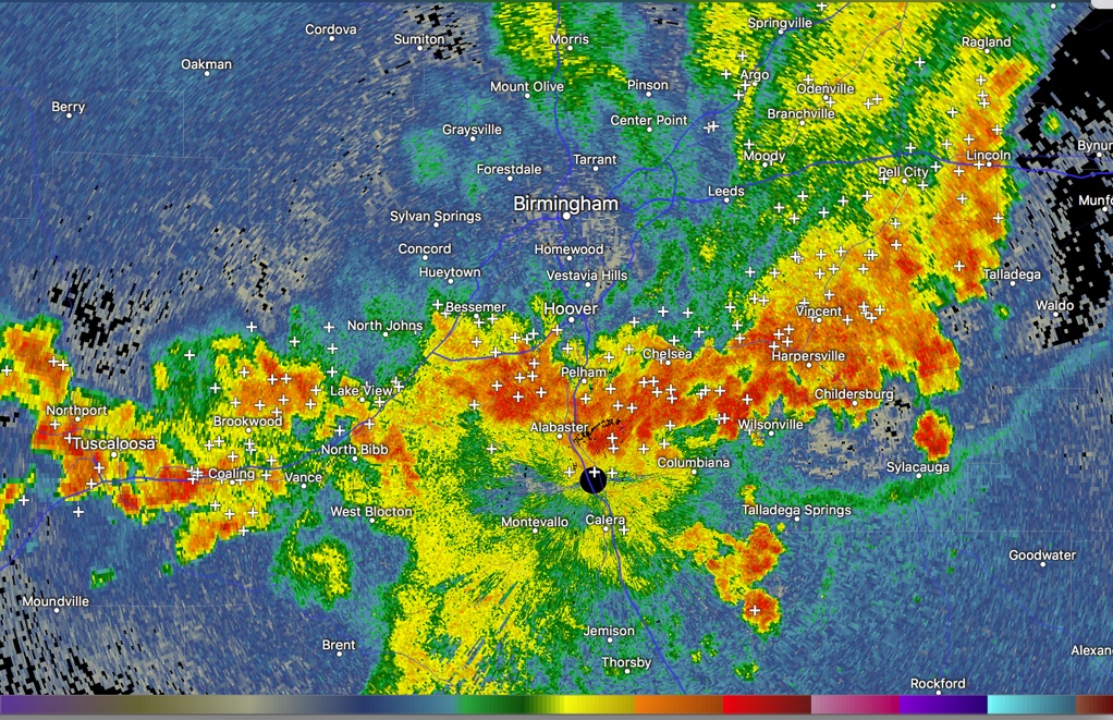
Rainfall amounts are approaching one inch per hour in some of the heavier storms. Flooding of poor drainage areas is likely. Be careful if you are driving.
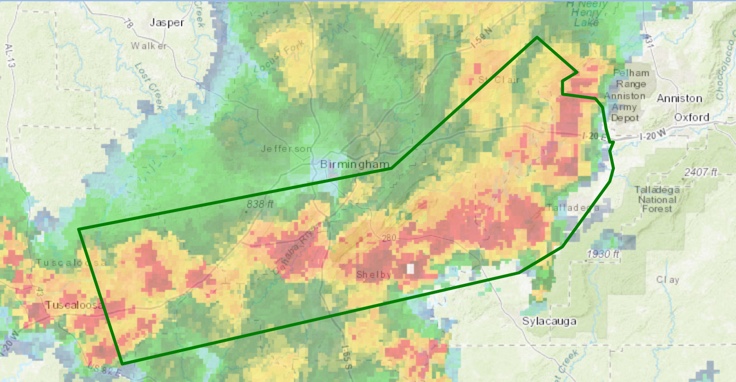
The National Weather Service in Birmingham has issued a
* Flood Advisory for Minor Flooding in Poor Drainage Areas for…
Central Talladega County in east central Alabama…
Southeastern Tuscaloosa County in west central Alabama…
Shelby County in central Alabama…
Northern Bibb County in central Alabama…
Southern Jefferson County in central Alabama…
Southern St. Clair County in central Alabama…
* Until 1145 PM CDT.
* At 947 PM CDT, Doppler radar indicated heavy rain due to
thunderstorms. This will cause minor flooding. Overflowing poor
drainage areas will result in minor flooding in the advisory area.
Rain totals may reach 2 to 3 inches in some areas in a short
period of time.
* Some locations that will experience flooding include…
Southwestern Birmingham, Hoover, Vestavia Hills, Alabaster,
Bessemer, Homewood, Pelham, Mountain Brook, Helena, Hueytown,
Talladega, Pell City, Leeds, Moody, Fairfield, Chelsea,
Childersburg, Odenville, Wilsonville and Lincoln.
Category: Alabama's Weather, ALL POSTS
About the Author (Author Profile)
Bill Murray is the President of The Weather Factory. He is the site's official weather historian and a weekend forecaster. He also anchors the site's severe weather coverage. Bill Murray is the proud holder of National Weather Association Digital Seal #0001 @wxhistorianSubscribe
If you enjoyed this article, subscribe to receive more just like it.


