

Strong Storms Across Central Alabama; Franklin County Severe Storm Moving into Mississippi
Storms continue across parts of Central, as well as Northwest Alabama tonight.
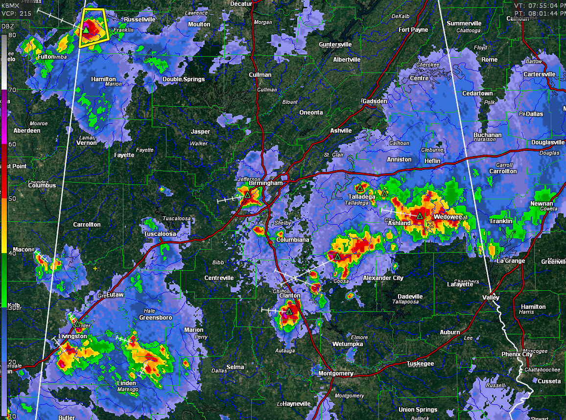
A severe thunderstorm warning is in effect for parts of Frankin County until 815 p.m. A very intense storm is near Red Bar about to cross the border into Mississippi Tishomingo County. Hail and damaging winds are a threat along with the lightning and torrential rains.
Numerous heavy thunderstorms are in a band across Central Alabama from Sumter and Marengo Counties over to Chilton, Coosa, Clay, and Randolph Counties. The heaviest storms are from Ashland to Wedowee.
The storm south of Clanton in Chilton County will be weakening as it has collapsed and is gusting out now.
Storms in the Birmingham area are producing loud thunder, heavy rain and perhaps some small hail. They are crossing I-59/20 in western sections of the Metro.
Watch outflow boundaries from the storms in Clay County that are pushing into Shelby and St. Clair Counties. They will probably intensify the storms over Shelby County.
All of the storms have frequent lightning, heavy rain and gusty winds.
Category: Alabama's Weather, ALL POSTS
About the Author (Author Profile)
Bill Murray is the President of The Weather Factory. He is the site's official weather historian and a weekend forecaster. He also anchors the site's severe weather coverage. Bill Murray is the proud holder of National Weather Association Digital Seal #0001 @wxhistorianSubscribe
If you enjoyed this article, subscribe to receive more just like it.


