

Notes On Alberto
“Subtropical Storm Alberto” has formed near Cozumel, Mexico this morning. Sustained winds are near 40 mph.
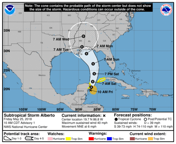
*This is not a classic tropical storm now; it is broad with multiple low-level circulations.
*The center should be near the coast Monday; it is NOT expected to reach hurricane strength.
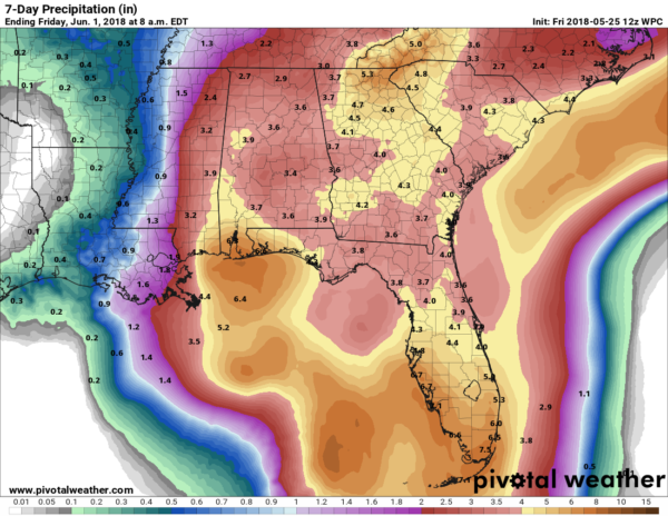
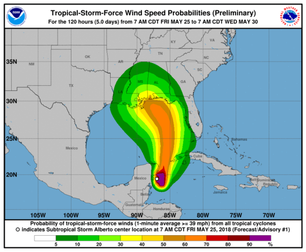
*The main threat for the coast will be rain/flooding (east of the landfall point), and rip currents. Rain amounts could exceed 6 inches in spots on the Gulf Coast Sunday and Monday with flooding likely.
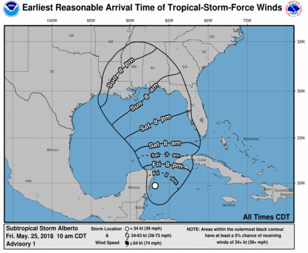
*There will be no direct impact on the Gulf Coast today or tomorrow (other than rough surf); the sky will be partly sunny with the usual chance of scattered storms. Rain and wind will begin to increase Sunday afternoon.
*The rip current danger will be high all weekend long; red flags are already flying. Stay out of the Gulf… the risk is NOT worth it.
*Winds could gust in the 40/45 mph category at times Sunday night and Monday from Dauphin Island and Gulf Shores west to Destin and Panama City Beach.
*A few isolated tornadoes will be possible along and east of the circulation center late Sunday into Monday.
*Weather conditions will improve greatly on the coast Tuesday and on through the rest of the week as the tropical system dissipates inland.
*There is always going to be some uncertainty involving tropical systems as they tend to have a mind of their own sometimes, so keep an eye out for forecast changes.
Look for a new discussion and Weather Xtreme video later today…
Category: Alabama's Weather, ALL POSTS, Tropical
About the Author (Author Profile)
James Spann is one of the most recognized and trusted television meteorologists in the industry. He holds the AMS CCM designation and television seals from the AMS and NWA. He is a past winner of the Broadcast Meteorologist of the Year from both professional organizations.Subscribe
If you enjoyed this article, subscribe to receive more just like it.


