

Sunday Morning Notes On Alberto
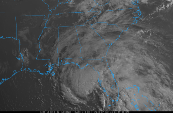
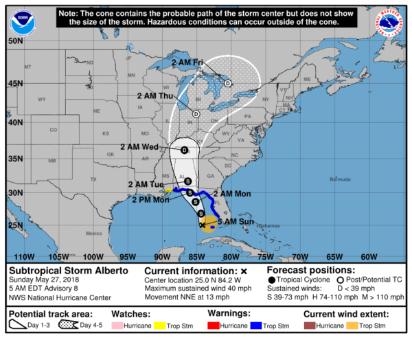
FORECAST TRACK SHIFTING EASTWARD: The track continues to adjust eastward, meaning some changes in the impact on Alabama and the Gulf Coast. Subtropical Storm Alberto still has sustained winds near 40 mph… gradual strengthening is forecast until the system reaches the Gulf Coast tomorrow. Landfall is now expected near Panama City Beach around midday tomorrow based on faster forecast forward motion.
GULF COAST KEY POINTS
*With the landfall now projected near Panama City Beach, that puts the Alabama Gulf Coast, and Pensacola on the better, drier side of the system with an offshore slow. No storm surge issues, and rain amounts of 1-2 inches. Mobile County would wind up with under one inch. This also means no serious flooding is expected there, and no tornado threat. Most of the rain directly associated with Alberto will come tonight and tomorrow (but there will be scattered storms today), but with the circulation center passing well to the east there will be some good breaks in the rain on the Alabama coast. Bottom line is that the eastward adjustment in the track is excellent news for the Alabama coast and Pensacola.

*The main threat of flooding will come from Destin and Panama City Beach eastward to Port St. Joe, where rain amounts could reach the 6-10 inch range in a few places. Again, most of the rain directly from Alberto will come tonight and tomorrow, although a few passing storms are likely today.
*Very dangerous rip currents will continue along the Central Gulf Coast. Red flags are flying, stay OUT of the Gulf!!
*Winds could gust to 40/50 mph around Destin, Panama City Beach, Port St. Joe, and Indian Pass lat tonight and tomorrow as Alberto comes ashore.

*A few isolated, short lived tornadoes are possible today across Central and South Florida (especially south of I-4), and tomorrow roughly from Panama City Beach eastward to Jacksonville.
*Weather will improve greatly along the Gulf Coast tomorrow night, and the rest of the week will feature routine weather with a good supply of sunshine daily and just the standard chance of scattered thunderstorms.
NORTH/CENTRAL ALABAMA KEY POINTS
*The weather today won’t be much different that recent days. Warm, humid, scattered showers and storms in random places this afternoon and tonight.
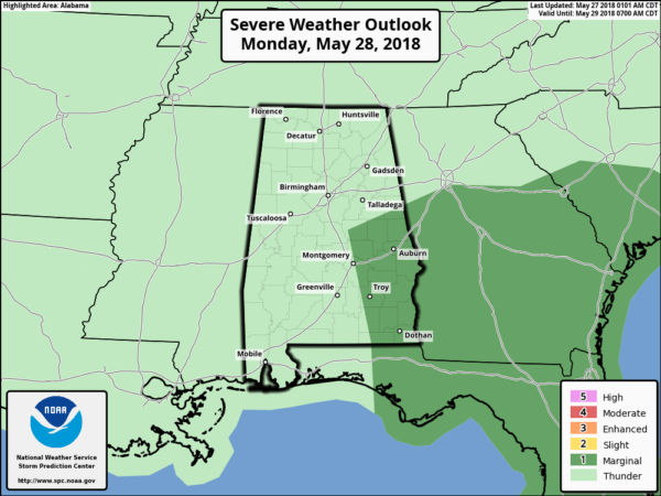
*The rain shield associated with Alberto will impact mainly Central and East Alabama late tomorrow, tomorrow night, and Tuesday. Rain amounts of 4-6 inches are possible across Southeast Alabama, otherwise 2-4″ inch totals are expected east of I-65. West Alabama will see 1-2 inches. Highest risk of inland flooding will be over the southeast counties of Alabama.
*A few isolated, short lived tornados are possible across Southeast Alabama tomorrow; SPC has defined a “marginal risk” there.
*The weather trends drier Wednesday through Friday, but we will still have the chance of scattered, random showers and storms as a moist airmass will linger across the state.
Continue to keep an eye on the blog for forecast changes today!
Category: Alabama's Weather, ALL POSTS, Tropical
About the Author (Author Profile)
James Spann is one of the most recognized and trusted television meteorologists in the industry. He holds the AMS CCM designation and television seals from the AMS and NWA. He is a past winner of the Broadcast Meteorologist of the Year from both professional organizations.Subscribe
If you enjoyed this article, subscribe to receive more just like it.


