

Sunday Evening Notes On Alberto
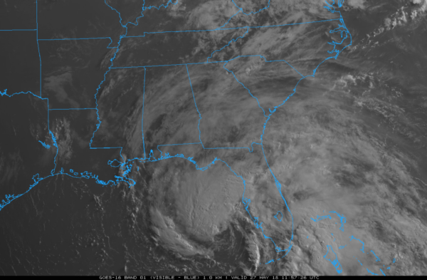
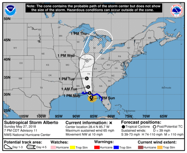
ALBERTO APPROACHING THE GULF COAST: This evening the center of Subtropical Storm Alberto is about 90 miles south/southwest of Apalachicola, Florida… sustained winds have increased to 65 mph. Little additional strengthening is expected before Alberto reaches the Gulf Coast tomorrow morning. In fact, it could weaken a bit overnight due to dry air getting into the circulation.
Steady weakening is expected after landfall, and Alberto is forecast to become a tropical depression tomorrow night or Tuesday.
The center of Alberto should move inland between Destin and Panama City Beach tomorrow morning as a tropical storm. Then, it moves slowly northward through Central Alabama as it weakens tomorrow night and Tuesday.
KEY MESSAGES FOR THE GULF COAST: Remember, the primary impact will be along and EAST of the landfall point. This means Pensacola and the Alabama coast will be on the west, “good” offshore side of the system. Rain amount of 1-2 inches are expected from Pensacola west to Dauphin Island, and little, if any flooding issues are expected. No tornado threat.
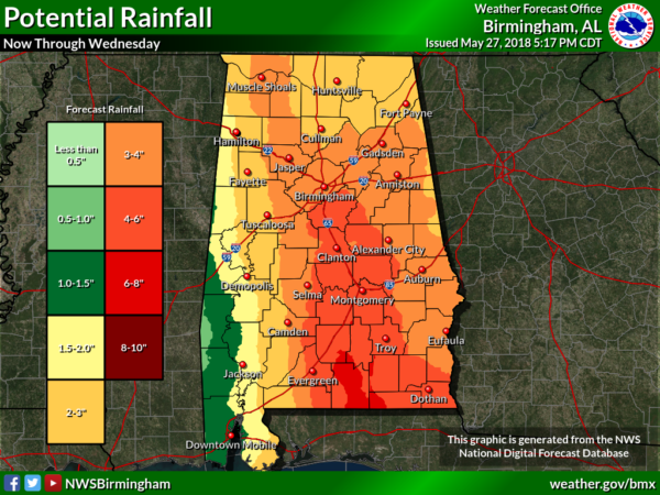
*From Destin east to Panama City Beach and Port St Joe/Apalachicola, rain amounts in places could exceed 6 inches with flooding very possible over the next 24 hours.

*A few isolated, short lived tornadoes are possible tomorrow from Destin and Panama City Beach eastward to Jacksonville.
*Winds from Alberto could gust to 40/50 mph at times around Destin, Panama City Beach, and Port St. Joe/Apalachicola tomorrow; this could bring down a few trees and bring scattered power outages. But no serious structural damage is expected.
*Storm surge from Crystal River to Navarre Florida is expected to be in the 2 to 4 ft range. The deepest water will occur along the immediate coast. Surge-related flooding depends on the relative timing of the surge and the tidal cycle, and can vary greatly over short distances.
*A high danger of rip currents will continue all along the Central Gulf coast through tomorrow. There has been at least one drowning so far, and multiple people rescued this weekend. STAY OUT OF THE GULF WATERS.
*The weather will greatly improve on the Gulf Coast tomorrow evening, and the weather Tuesday through the weekend looks very routine with partly sunny days and the usual risk of scattered storms.
KEY MESSAGES FOR INLAND PARTS OF ALABAMA: The prime rain shield from Alberto will move through the state tomorrow afternoon, tomorrow night, and into Tuesday.
*Heaviest rain will be over Central and East Alabama, along and east of the track of the circulation center. Amount could exceed 5 inches over Southeast Alabama; amounts of 3-6″ are possible as far north as Birmingham, Anniston, and Gadsden. Amounts will be lighter over the western side of the state.
A flash flood watch is in effect for the southern quarter of Alabama, and it could be extended north and east tomorrow.
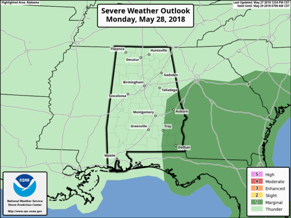
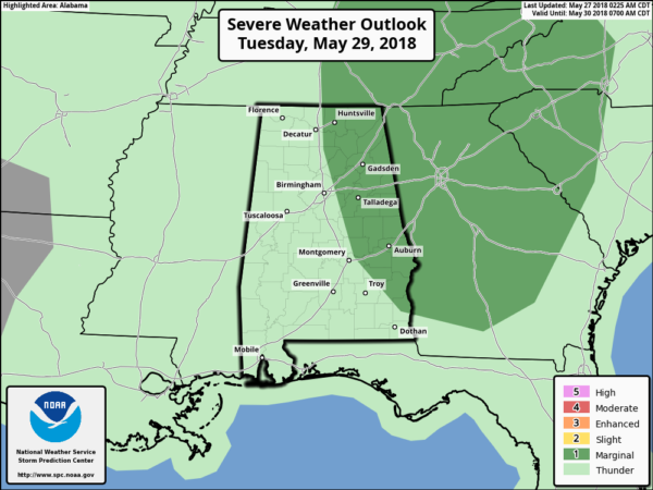
*A few short lived, isolated tornadoes will be possible over the eastern third of the state tomorrow into Tuesday; SPC has a “marginal risk” defined…
*It will be breezy tomorrow afternoon through Tuesday morning, but gradient winds over North/Central Alabama should remain below 30 mph. No widespread power outages are expected.
*Showers and storms become fewer in number across Alabama Wednesday through Friday with a mix of sun and clouds each day. Highs will be in the 80s.
Keep an eye on the blog for potential forecast changes overnight and tomorrow…
Category: Alabama's Weather, ALL POSTS, Tropical
About the Author (Author Profile)
James Spann is one of the most recognized and trusted television meteorologists in the industry. He holds the AMS CCM designation and television seals from the AMS and NWA. He is a past winner of the Broadcast Meteorologist of the Year from both professional organizations.Subscribe
If you enjoyed this article, subscribe to receive more just like it.


