

A Few Notes on Alberto at 10 a.m.
Subtropical storm Alberto is moving northward now toward the coast.
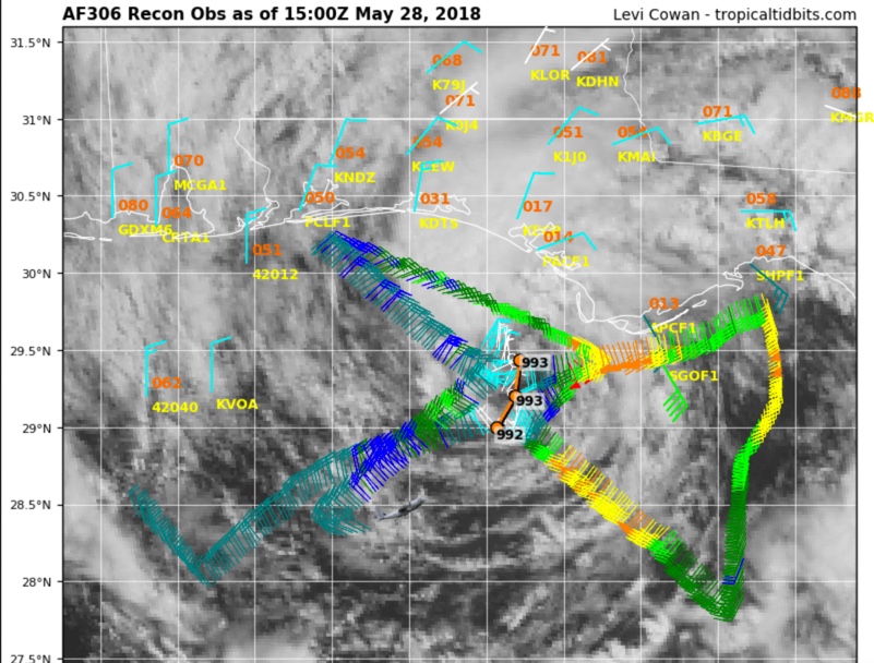
The Air Force plane just found the center and the dropsonde measured 993 millibars when it splashed into the ocean. Since it was not the exact center, the central pressure was estimated at 992 mb.
Maximum flight level winds on the inbound leg through the northeastern quadrant were 56 knots, which translates to about 58 mph. There have been multiple reliable SFRM readings of surface winds around 50 mph.
Winds on the advisory were dropped back slightly to 60 mph.
The center of Alberto is about 45 miles south-southwest of Panama City, Florida. The center seems to be wobbling toward the coast in a cycloidal fashion, appearing to do small loop de loops as it moves generally northward at 8 mph. On this track, the center will cross the coast just west of Panama City between 3 and 4 p.m.
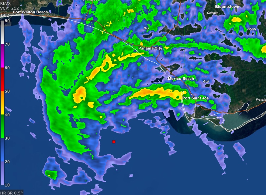
Radar shows a convective band moving through Panama City right now with another approaching Mexico Beach from Port. St. Joe. The bands are accompanied by heavy rain and gusty winds.
The ocean is angry and chaotic now with crashing waves and blowing spray. Tides are running 1.4 feet above normal at Panama City, but are falling now with the falling astronomical tide. The tide is rising at Apalachicola despite the fact that the astronomical tide is dropping. Apalachicola is now nearly 3 feet above normal. Southeasterly winds are pushing water up against the coast there.
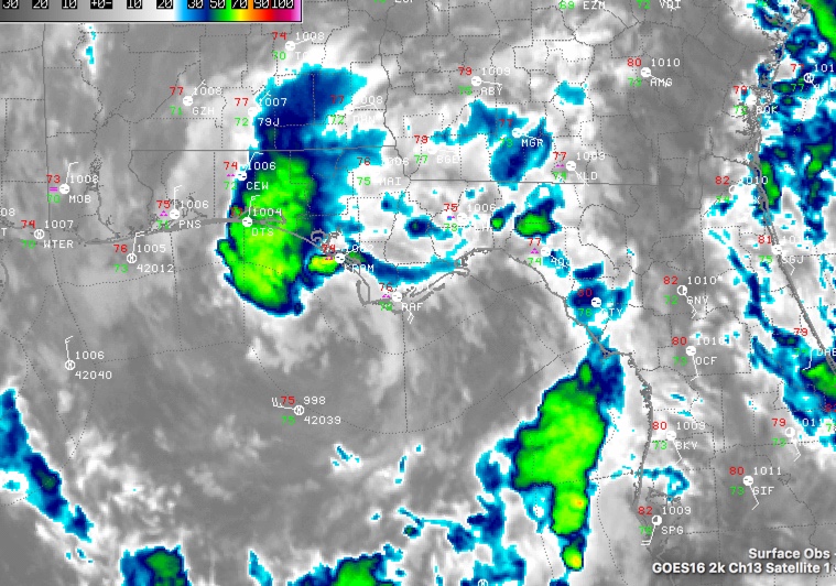
The satellite continues to show convection only in the northwestern quadrant, although some convection was forming near shore around Panama City.
Category: ALL POSTS
About the Author (Author Profile)
Bill Murray is the President of The Weather Factory. He is the site's official weather historian and a weekend forecaster. He also anchors the site's severe weather coverage. Bill Murray is the proud holder of National Weather Association Digital Seal #0001 @wxhistorianSubscribe
If you enjoyed this article, subscribe to receive more just like it.


