

A Quick Check At 5:05 PM: Some Strong Storms Out There
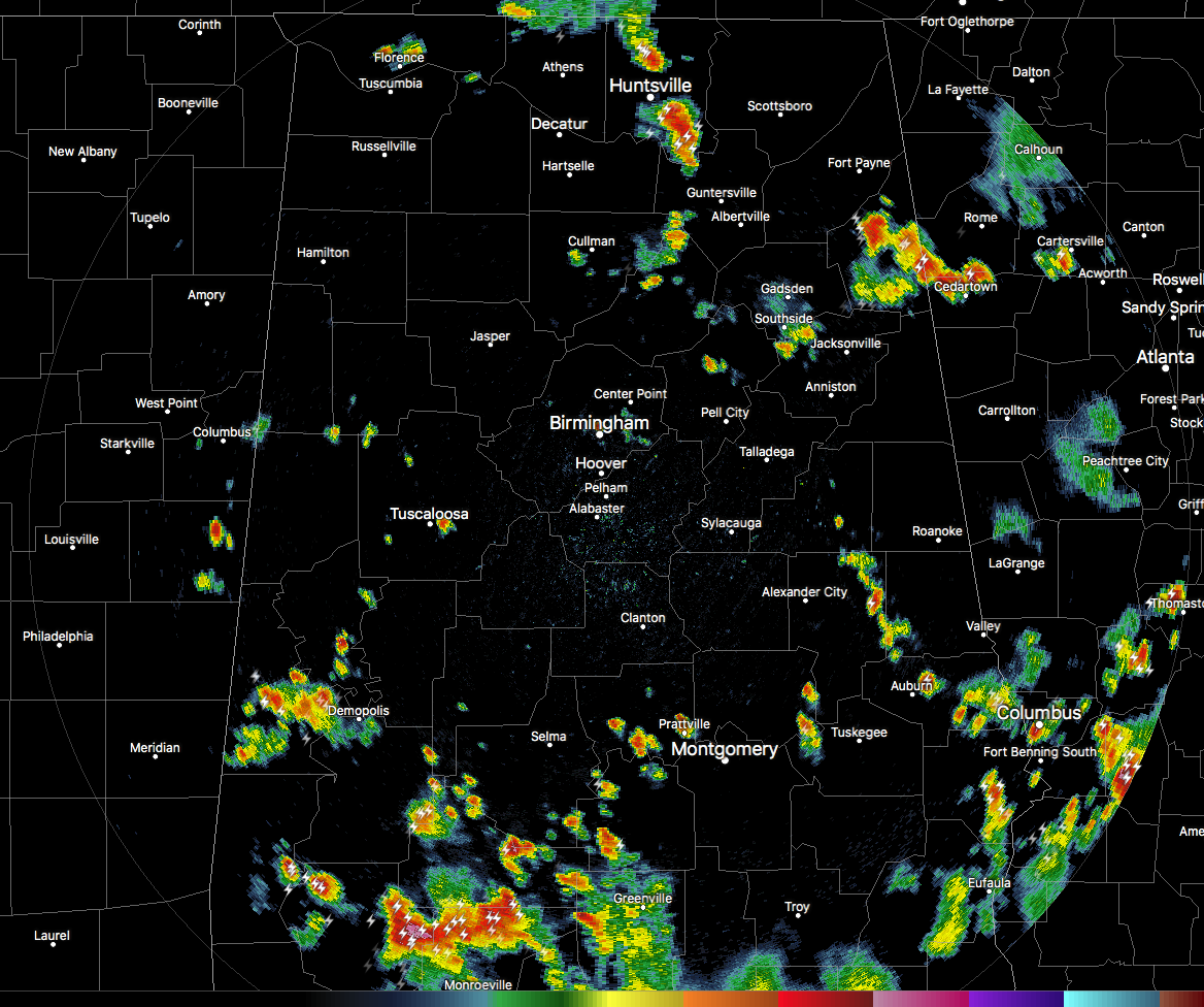
Showers and storms are continuing to pop up and dissipate this afternoon across portions of North and Central Alabama, with the larger storms located in the northeastern parts of the area. A couple of these storms have significant weather advisories on them for gusty downdraft winds.
The strongest storm on radar looks to be over portions of Madison and into the northern parts of Marshall County. This storm has a possibility of winds up to 50 MPH and nickel size hail as it moves eastward at 10 MPH. Heavy rain and dangerous cloud-to-ground lightning is occurring with this storm.
The other stronger storm is located over Cherokee County that may have winds up to 40 MPH, along with heavy rain and dangerous cloud-to-ground lightning. We may have to watch for ponding and possible localized flash flooding in poor drainage areas as it is nearly stationary. Radar estimates of up to 2.50 inches have fallen just southwest of Centre and south of Leesburg.
There are more showers and storms developing as I type, especially one over the Birmingham metropolitan area over the airport and into downtown. So far, no lightning detected, but the storm is starting to expand outward. We’ll watch it to see if it gets stronger or if it starts to rain itself out.
Category: Alabama's Weather, ALL POSTS
About the Author (Author Profile)
Scott Martin is an operational meteorologist, professional graphic artist, musician, husband, and father. Not only is Scott a member of the National Weather Association, but he is also the Central Alabama Chapter of the NWA president. Scott is also the co-founder of Racecast Weather, which provides forecasts for many racing series across the USA. He also supplies forecasts for the BassMaster Elite Series events including the BassMaster Classic.Subscribe
If you enjoyed this article, subscribe to receive more just like it.


