

Outflow Boundaries Causing More Storms To Fire Up In The Southern Parts Of The Area
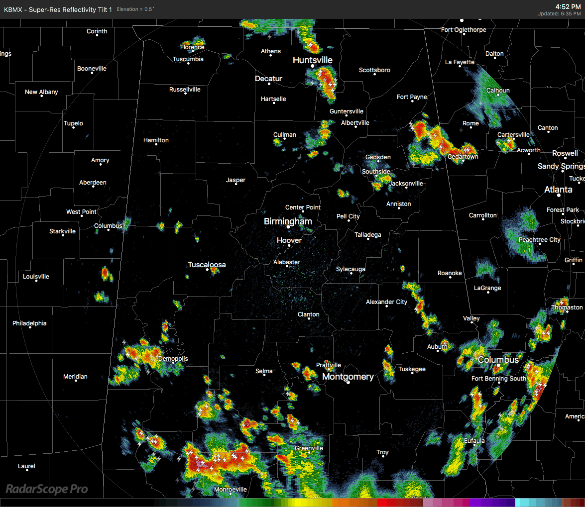
An outflow boundary from earlier storms is quickly racing northward from the southern parts of the area through Bibb, Chilton, and Coosa counties is being the catalyst for more storms firing up just behind it. Just watch the above animation as more storms forms and grow quickly just after the boundary races through the southern parts of Chilton and the central parts of Perry counties.
This trend should continue to happen as the boundary moves northward into air that has not been previously rain-cooled.
Storms in the northern half of Central Alabama and up into North Alabama are moving slowly to the east at this point, but we do notice that the activity in the northern parts of the state is beginning to settle down as most of the activity has weakened from just a couple of hours ago.
All of these storms will continue through sunset and into the late evening hours before finally starting to slowly weaken and die off. A few of these could last into the late night and into the overnight hours. A few of these could be strong with gusty winds, heavy downpours, some small hail, and dangerous cloud-to-ground lightning.
I’ll have updates throughout the evening and any warnings or advisories will be posted on the blog as soon as they are issued.
Category: Alabama's Weather, ALL POSTS
About the Author (Author Profile)
Scott Martin is an operational meteorologist, professional graphic artist, musician, husband, and father. Not only is Scott a member of the National Weather Association, but he is also the Central Alabama Chapter of the NWA president. Scott is also the co-founder of Racecast Weather, which provides forecasts for many racing series across the USA. He also supplies forecasts for the BassMaster Elite Series events including the BassMaster Classic.Subscribe
If you enjoyed this article, subscribe to receive more just like it.


