

A Quick Update On Our Weather Situation At 6:00 PM
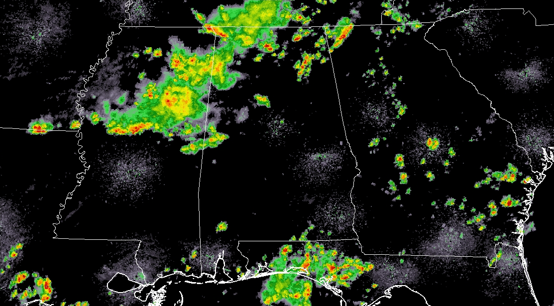
The good news is that the showers and storms that have moved through Central Alabama today have not been as strong as the ones we have seen over the past few days. An MCS moved through much of Mississippi and the extreme western parts of Alabama throughout the day keeping much of the energy with it. That has kept convection held down over much of the area, but we do see that instability values are running at or just over 2500 J/kg over portions of Elmore, Tallapoosa, Macon, and Lee counties.
At this point, the better chances of showers and storms will be south of a line from Pickensville to Birmingham to Piedmont, but a few are still possible north of that. As with the last several nights, much of the shower and storm activity will begin to diminish after the sun sets and we lose the heating of the day. The latest HRRR run is showing that a few showers and storms may linger around well into the overnight hours over the south-central parts of Central Alabama, especially over portions of Autauga, Elmore, Lowndes, and Montgomery counties.
The risk of any storms becoming strong are low at this point, but we’ll keep an eye open throughout the evening.
Category: ALL POSTS
About the Author (Author Profile)
Scott Martin is an operational meteorologist, professional graphic artist, musician, husband, and father. Not only is Scott a member of the National Weather Association, but he is also the Central Alabama Chapter of the NWA president. Scott is also the co-founder of Racecast Weather, which provides forecasts for many racing series across the USA. He also supplies forecasts for the BassMaster Elite Series events including the BassMaster Classic.Subscribe
If you enjoyed this article, subscribe to receive more just like it.


