

Storms Pushing West Over the I-20 Corridor
UPDATE 538 PM
A severe thunderstorm warning has been issued for parts of Etowah and St, Clair Counties.
In the Birmingham Metro, pea size hail is falling in Pinson and Trussville.
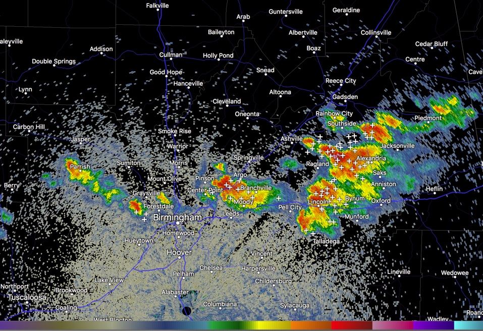
Strong storms have formed along I-20 east of Birmingham and are pushing west in the lower mid-level flow on the north side of an upper low over South Alabama.
The storms are gaining enough shear from differences in wind direction with height to stay a little organized and so they may hold together into the Birmingham Metro. Already, storms are into the Pinson, Clay, Center Point area of northeastern Jefferson County.
They are being fueled by strong heating that has caused high instability, with CAPE values pushing 4,000 joules/kg east of Birmingham.
They are not expected to be severe, but one becoming briefly severe is not out of the question with the potential for damaging winds. In any case, be alert for the lightning, heavy rain and gusty winds to 30 mph as they push westward at 20 mph.
Scott Martin drove through them in Trussville and reported that the temperature fell from 93t 72 on his car thermometer. He estimated wind gusts at only 15 mph or so.
Category: Alabama's Weather, ALL POSTS
About the Author (Author Profile)
Bill Murray is the President of The Weather Factory. He is the site's official weather historian and a weekend forecaster. He also anchors the site's severe weather coverage. Bill Murray is the proud holder of National Weather Association Digital Seal #0001 @wxhistorianSubscribe
If you enjoyed this article, subscribe to receive more just like it.


