

Strong Storms Approaching Extreme Northwest Alabama
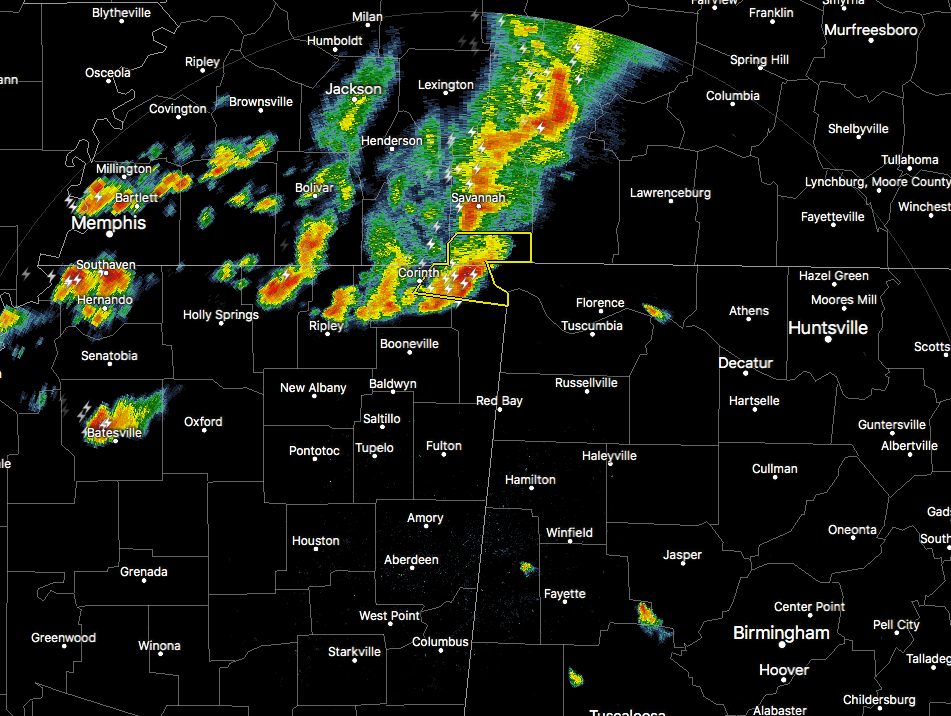
A batch of strong to severe thunderstorms are starting to enter the northwest corner of Lauderdale County in northwest Alabama, with the lead storm having a severe thunderstorm warning issued on it until 7:30 PM for damaging wind gusts up to 70 MPH. This lead storm is moving east at 55 MPH. We’ll have to see if NWS Huntsville continues with a severe thunderstorm warning or decides to go with a significant weather advisory. Either way, this storm is capable of producing strong wind gusts, heavy rainfall, and dangerous cloud-to-ground lightning.
As I type this, they went with a Severe Thunderstorm Warning for parts of Colbert and Lauderdale counties until 7:45 PM.
The good news is that these storms should begin a weakening trend as they continue to move farther into the state due to the cooling of the boundary layer. I wouldn’t be surprised if strong storms continue on until around 9:00 PM before losing enough daytime heating and instability to weaken.
We’ll keep you posted.
Category: Alabama's Weather, ALL POSTS
About the Author (Author Profile)
Scott Martin is an operational meteorologist, professional graphic artist, musician, husband, and father. Not only is Scott a member of the National Weather Association, but he is also the Central Alabama Chapter of the NWA president. Scott is also the co-founder of Racecast Weather, which provides forecasts for many racing series across the USA. He also supplies forecasts for the BassMaster Elite Series events including the BassMaster Classic.Subscribe
If you enjoyed this article, subscribe to receive more just like it.


