

A Severe Thunderstorm Is Approaching The Birmingham Metropolitan Area
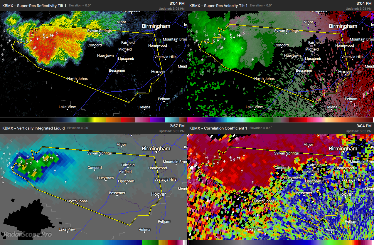
A strong thunderstorm capable of producing winds in excess of 60 MPH was currently located over Oak Grove and is heading to the east at 40 MPH. This storm has had a history of showing rotation back when it was over the northern parts of Tuscaloosa County, so we will need to watch for any strengthening and rotation starting back up.
This storm is also dumping copious amounts of rain and producing plenty of cloud-to-ground lightning. There is plenty of instability out there, so this storm will continue at this strength or could possibly grow stronger as it continues to move eastward.
Locations in the path of this storm include Southwestern Birmingham, Hoover, Vestavia Hills, Bessemer, Homewood, Hueytown, Fairfield, Pleasant Grove, Midfield, Brighton, Lipscomb, Sylvan Springs, North Johns, Birmingham Fairgounds, Bull City, Ensley, Bluff Park, Legion Field, Splash Adventure and Concord.
Category: ALL POSTS
About the Author (Author Profile)
Scott Martin is an operational meteorologist, professional graphic artist, musician, husband, and father. Not only is Scott a member of the National Weather Association, but he is also the Central Alabama Chapter of the NWA president. Scott is also the co-founder of Racecast Weather, which provides forecasts for many racing series across the USA. He also supplies forecasts for the BassMaster Elite Series events including the BassMaster Classic.Subscribe
If you enjoyed this article, subscribe to receive more just like it.


