

Storms Intensifying Over Northwest Alabama
Thunderstorms are intensifying tonight across Northwest Alabama.
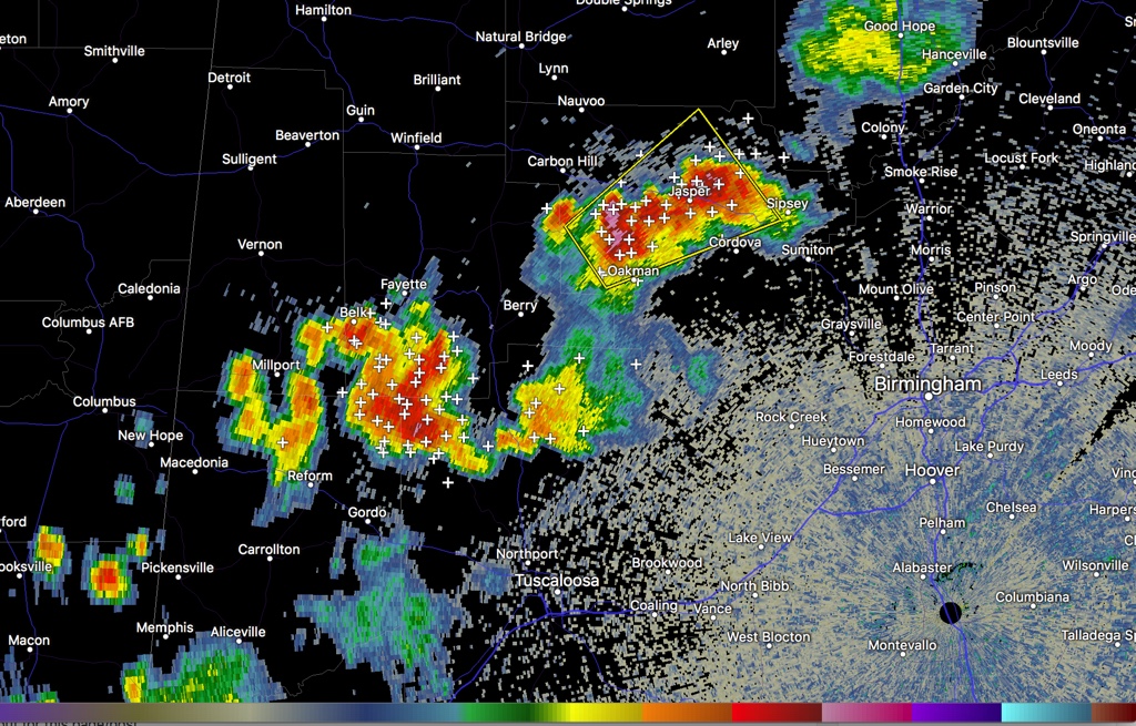
A new severe thunderstorm warning is in effect for parts of Walker County tonight. The storm near Oakman has really formed a strong core and is capable of damaging winds over 60 mph. It will impact the city of Jasper directly within the next 10 minutes. It shows signs of large hail as well.
The storms extend from the Jasper/Parrish area to south of Berry and Fayette to northwest of Reform in Pickens County.
The storms are moving northeast at 25-30 mph. They will affect parts of Walker, Fayette, northern Tuscaloosa, southern Lamar and Pickens Counties moving into Cullman and Blount Counties over the next hour.
Hail to over one inch is also possible along with torrential rains and dangerous cloud to ground lightning. There is tremendous lightning with these storms.
Be in a safe place as these storms approach.
There has been damage tonight in Winston County in the Grayson and Moreland Cemetary area according to Brad Travis of WAFF Huntsville. Trees down, tin off of barns, debris everywhere. From storm that went through about 9 p.m.
The storms have formed underneath an upper-level wind max over Northwest Alabama. They will weaken over the next couple of hours as the line drifts southeast.
Category: Alabama's Weather, ALL POSTS
About the Author (Author Profile)
Bill Murray is the President of The Weather Factory. He is the site's official weather historian and a weekend forecaster. He also anchors the site's severe weather coverage. Bill Murray is the proud holder of National Weather Association Digital Seal #0001 @wxhistorianSubscribe
If you enjoyed this article, subscribe to receive more just like it.


