

Strong Storms Continue Across North Central Alabama With Torrential Rain, Lightning, Gusty Winds and Some Hail
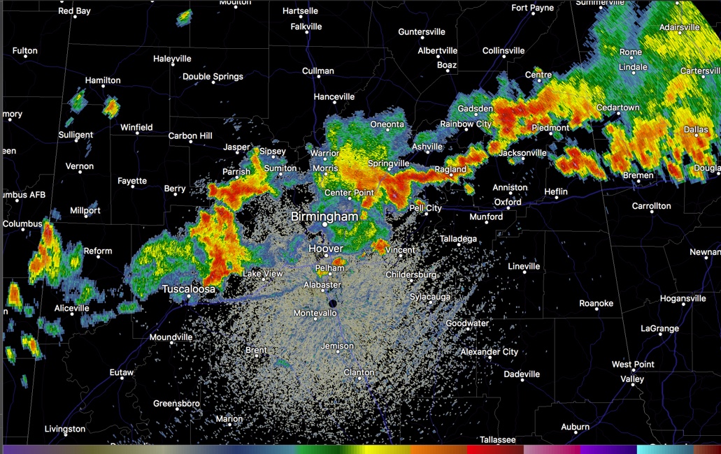
Strong storms continue generally along and north of I-59 this afternoon across North Central Alabama.
The strongest storms at 4 p.m. are across northeastern Jefferson, Blount, St. Clair, Etowah, Calhoun and Cleburne Counties.
The storms over northeastern Jefferson and St. Clair Counties are strongest in the Odenville/Argo areas, with heavy rain back into the Clay and Pinson areas. Strong winds are indicated passing south of Ashville in St. Clair County.
In northern Tuscaloosa County, very strong storms are passing north of Holt and Brookwood. These storms will march eastward into western Jefferson County and could affect the southern half of Jefferson County eventually, including areas from the western section through downtown and the airport southward to Hoover.
New storms over southern Walker County, will be moving into northern Jefferson County around Graysville and Adamsville.
Lots of ominous clouds accompanying the strong storms, but no threat of any tornadoes. There are gusty winds to 40 mph and some of the strongest storms could briefly become severe producing damaging winds of 60 mph or greater. Watch out especially for the lightning and be careful if driving because of the heavy rains.
Trees are down in some areas, including Gadsden and Etowah County.
Category: Alabama's Weather, ALL POSTS
About the Author (Author Profile)
Bill Murray is the President of The Weather Factory. He is the site's official weather historian and a weekend forecaster. He also anchors the site's severe weather coverage. Bill Murray is the proud holder of National Weather Association Digital Seal #0001 @wxhistorianSubscribe
If you enjoyed this article, subscribe to receive more just like it.


