

Getting Hot At Midday; Few Showers & Storms Already Popping Up
CONDITIONS ACROSS CENTRAL ALABAMA AT 11:45 AM
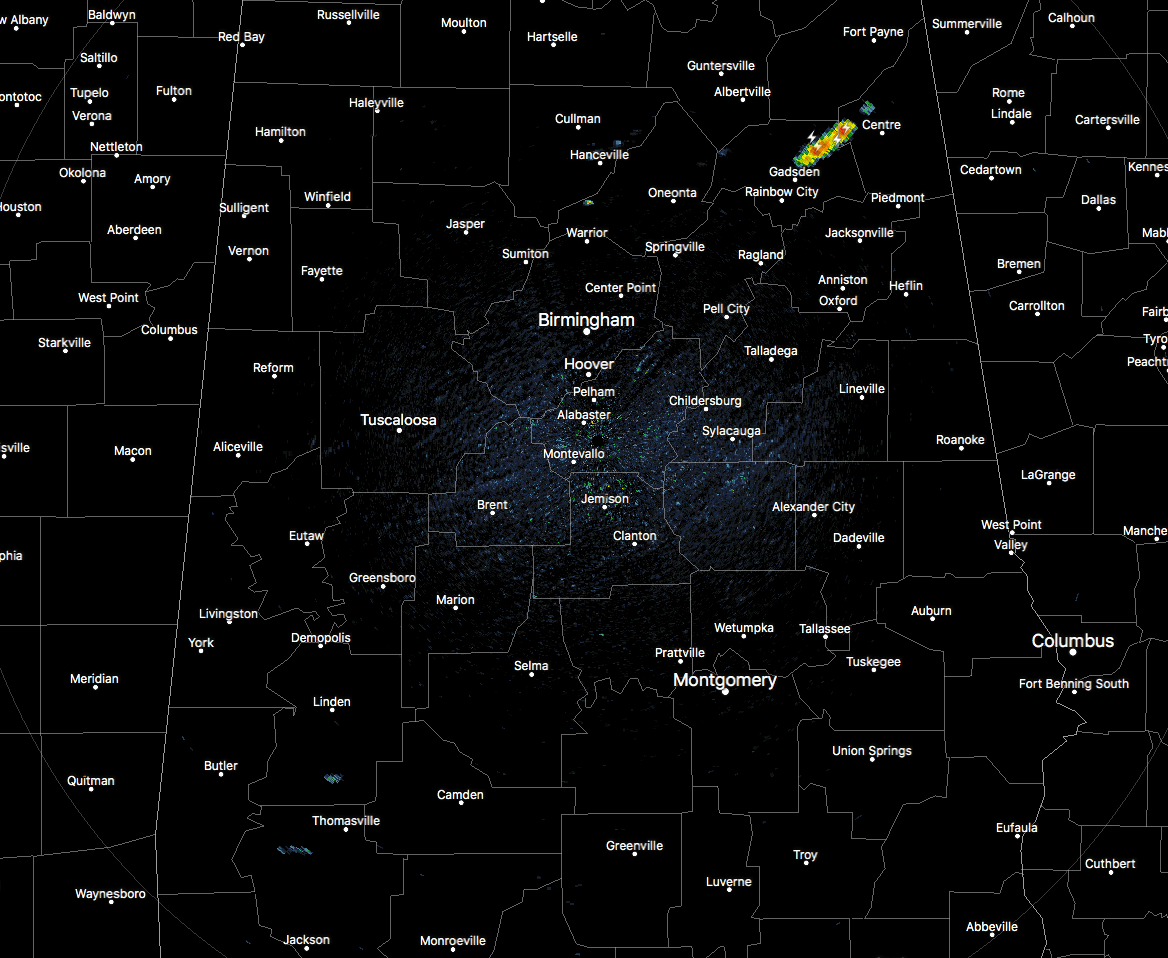
While much of the state is dry and hot as we near the noon hour in Central Alabama, we do have an area of showers and storms that have popped up in northern Etowah and extreme western Cherokee counties. These are moving to the southwest and has already started to produce a good bit of lightning. As I type, another isolated shower has popped up just north of Hanceville in Cullman County. This trend will continue through the remainder of the day until we lose the heating of the day.
Speaking of heating… temperatures across the area are currently ranging in the mid-80s to the lower 90s, with heat index values in the 93-100 degree range. Birmingham was sitting at 88 degrees, while there are a few locations at 90 degrees. Auburn is the current cool spot at 84 degrees.
WHAT TO EXPECT FOR THE REST OF YOUR FRIDAY
It will continue to be hot and humid outside with a good bit of sun before convective development occurs and scattered to numerous shower and storms pop up throughout the afternoon and into the early evening hours. Showers and storms will be isolated to scattered south of a line from Tuscaloosa to Sylacauga to Roanoke, but north of that we can expected to see higher coverage in storms. Afternoon highs will top out in the upper 80s to the lower 90s. By the evening, we’ll still have a good bit of shower and storm activity, but that should begin to start diminishing after we lose the sunlight and the heating of the day. A few may linger into the overnight hours. Lows will be in the upper 60s to the lower 70s.
AN UPDATE ON THE TROPICS
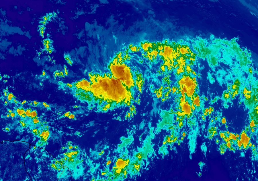
Beryl is now expected to remain a hurricane as it makes it way through the Lesser Antilles by the end of the weekend or into Monday, but the good news is that it is a very compact storm. Current maximum sustained winds are at 80 MPH. It may weaken back to a tropical storm by Monday afternoon or Tuesday, but forecast confidence is low at this point due to the compact size of the storm.
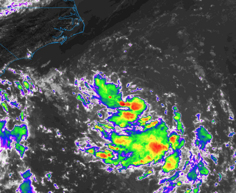
Currently, Invest 96-L is located a few hundred miles southeast of the North Carolina coast. At this point, environmental conditions are becoming more favorable for strengthening and a tropical depression is likely to form before the end of the weekend. This could get close to the US Atlantic Coast next week, but more than likely will stay out to sea as it moves northeastward next week.
BEACH FORECAST CENTER
Get the latest weather and rip current forecasts for the beaches from Fort Morgan to Panama City on our Beach Forecast Center page. There, you can select the forecast of the region that you are interested in.
ON THIS DAY IN WEATHER HISTORY
1893 – A violent tornado killed 71 persons on its forty-mile track across northwestern Iowa. Forty-nine persons were killed around Pomeroy, where eighty percent of the buildings were destroyed, with most leveled to the ground. Photos showed most of the town without a wall or tree left standing.
1985 – Lightning struck a large transformer in Salt Lake County sending a 200 foot fireball into the air and blacking out almost the entire state for up to five hours.
WE’RE HAVING A RECORD-BREAKING YEAR… ADVERTISE WITH US TODAY!
Don’t miss out! We have enjoyed over 11.7 MILLION page views on AlabamaWx.com since the start of 2018. We can customize a creative, flexible and affordable package that will suit your organization’s needs. Contact Bill Murray at (205) 687-0782.
E-FORECAST
Get the AlabamaWx Weather Blog’s Seven-Day Forecast delivered directly to your inbox by email twice daily. It is the most detailed weather forecast available in Central Alabama. Subscribe here… It’s free!
WEATHERBRAINS
Don’t forget you can listen to our weekly 90 minute netcast anytime on the web at WeatherBrains.com or on iTunes. This is the show all about weather featuring many familiar voices, including the meteorologists at ABC 33/40.
Category: Alabama's Weather, ALL POSTS
About the Author (Author Profile)
Scott Martin is an operational meteorologist, professional graphic artist, musician, husband, and father. Not only is Scott a member of the National Weather Association, but he is also the Central Alabama Chapter of the NWA president. Scott is also the co-founder of Racecast Weather, which provides forecasts for many racing series across the USA. He also supplies forecasts for the BassMaster Elite Series events including the BassMaster Classic.Subscribe
If you enjoyed this article, subscribe to receive more just like it.


