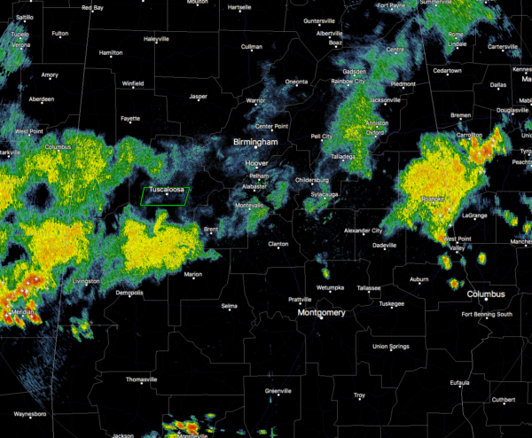
At 7:55 PM: Storms Starting To Settle Down For The Evening
The good news is that the heaviest thunderstorms that caused the flooding earlier in Tuscaloosa has now weakened to a moderate shower and has moved well south of the city. At this point of the evening, the only strong storm in Central Alabama is located over southeastern Randolph and northern Chambers counties in the eastern parts of the area. Pea size hail and winds in excess of 40 MPH will be possible. Go ahead and get into a good safe place if you are in the path of this cell as it moves northwest at 10 MPH.
Back to the Tuscaloosa storm… The Flash Flood Warning will expire at 8:00 PM as the heaviest rain has moved well south of the city. We had several reports of flooding, especially around and on the campus of the University of Alabama. Water reached up to the hoods of vehicles along University Blvd. near Bryant-Denny Stadium. One local trained storm spotter reported 4.50 inches of rain in Cottondale.
Rain is really starting to diminish at this point, as most of the activity is light to moderate. The storm over Chambers and Randolph is really on a weakening trend and the heavy thunderstorms are really starting to lighten up. At this current rate, much of the activity will have dissipated within the next 2-3 hours.
Category: Alabama's Weather, ALL POSTS


