

Here is a Look at the Alabama Weather Situation as of 7:20 p.m.
An outflow boundary pushing eastward out of Mississippi has enhanced thunderstorms across Central Alabama late this afternoon and this evening.
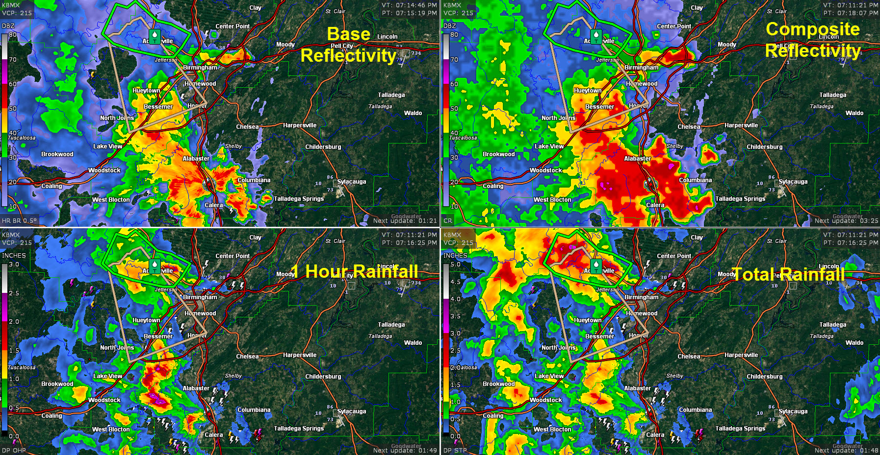
Right now, storms are quite intense with spectacular rainfall rates in areas west of I-65 and south of Birmingham from Bessemer to Calera.
The NWS in Calera has reported 1.01 inches of rain in just 9 minutes!!
The storms are basically stationary but are building east into the Columbiana area in Shelby County.
In the Birmingham area, they are building eastward through Irondale toward Leeds.
Flooding is the main threat with this intense rainfall, although lightning is very intense as well and there could be gusty winds.
A flash flood warning is in effect for western Jefferson County. Flooding has caused water to encroach on a house in Graysville. Rainfall has lightened considerably in that area but flooding will continue for a while.
Intense rainfall in the US-80/I-85 Corridor has prompted flash flood warnings for Montgomery, Lowndesboro, Hayneville, and Snowdoun.
Do not attempt to walk or drive through standing water. Remember, turn around, don’t drown!
Category: Alabama's Weather, ALL POSTS
About the Author (Author Profile)
Bill Murray is the President of The Weather Factory. He is the site's official weather historian and a weekend forecaster. He also anchors the site's severe weather coverage. Bill Murray is the proud holder of National Weather Association Digital Seal #0001 @wxhistorianSubscribe
If you enjoyed this article, subscribe to receive more just like it.


