

A Quick Check On Our Weather At Midday
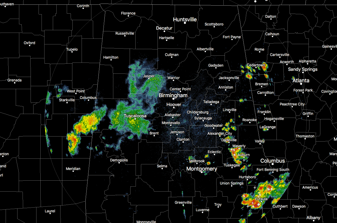
The good news is that the stronger storms that we saw earlier this morning have dissipated and we are just left with some light to moderate showers over the western portions of Central Alabama. Nearly all of the flood advisories that were in effect have expired except for the one for Pickens County, which will soon expire at 1:00 PM.
We are now watching showers and storms starting to blossom over the east and southeastern parts of Central Alabama, as we are starting to see heavy rainfall and dangerous cloud-to-ground lightning affecting areas close to Auburn, Waverly, Dadeville, Jackson’s Gap, and Alexander City. Nothing strong at this point, but this activity is nearly stationary and we may see some localized ponding or flash flooding if these continue to stay in the same place.
With the cloud cover over most of the area in the west and central parts of the area, along with some locations having rain cooled air, temperatures are in the upper 70s to the upper 80s for the most part. Gadsden, Anniston, Sylacauga, and Montgomery are all tied at 90 degrees as they continue to have plenty of sunshine. Birmingham is currently at 82 degrees.
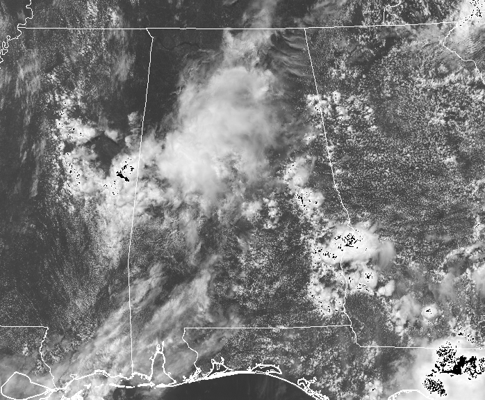
With the effects of the stalled frontal boundary now out of Central Alabama, we will go back to the general forecast that we can give for mid-summer in Central Alabama. We’ll have some sun and some clouds with your daily chance of scattered afternoon showers and thunderstorms. Afternoon highs will mainly be in the lower 80s to the lower 90s. Some of the afternoon storms could briefly become strong with gusty winds and very heavy rainfall at times. The latest run of the NAM has all of the activity dying off before midnight, but you can expect to see some fog developing in areas that received some heavy rainfall during the day. Otherwise, skies will be partly cloudy with lows in the lower to mid-70s.
LOOK BEFORE YOU LOCK
Never leave children, disabled or elderly adults, or pets in parked vehicles. Studies have shown that the temperature inside a parked vehicle can rapidly rise to a dangerous level for children, pets and even adults. Leaving the windows slightly open does not significantly decrease the heating rate. The effects can be more severe on children because their bodies have not developed the ability to efficiently regulate internal temperature. Heat related deaths are preventable, so look before you lock.
BEACH FORECAST CENTER
Get the latest weather and rip current forecasts for the beaches from Fort Morgan to Panama City on our Beach Forecast Center page. There, you can select the forecast of the region that you are interested in.
ON THIS DAY IN WEATHER HISTORY
1977 – Thunderstorms produced torrential rains over parts of southwestern Pennsylvania. Some places receive more than twelve inches in a seven hour period. The heavy rains cause flash flooding along streams resulting in widespread severe damage. The cloudburst floods Johnstown with up to ten feet of water resulting in 76 deaths, countless injuries, and 424 million dollars damage.
2006 – The first of two severe thunderstorms hits the St. Louis area, causing the largest power outage in the city’s history with over 570,000 people losing electricity.
WE’RE HAVING A RECORD-BREAKING YEAR… ADVERTISE WITH US TODAY!
Don’t miss out! We have enjoyed over 12 MILLION page views on AlabamaWx.com since the start of 2018. We can customize a creative, flexible and affordable package that will suit your organization’s needs. Contact Bill Murray at (205) 687-0782.
E-FORECAST
Get the AlabamaWx Weather Blog’s Seven-Day Forecast delivered directly to your inbox by email twice daily. It is the most detailed weather forecast available in Central Alabama. Subscribe here… It’s free!
WEATHERBRAINS
Don’t forget you can listen to our weekly 90 minute netcast anytime on the web at WeatherBrains.com or on iTunes. This is the show all about weather featuring many familiar voices, including the meteorologists at ABC 33/40.
Category: Alabama's Weather, ALL POSTS
About the Author (Author Profile)
Scott Martin is an operational meteorologist, professional graphic artist, musician, husband, and father. Not only is Scott a member of the National Weather Association, but he is also the Central Alabama Chapter of the NWA president. Scott is also the co-founder of Racecast Weather, which provides forecasts for many racing series across the USA. He also supplies forecasts for the BassMaster Elite Series events including the BassMaster Classic.Subscribe
If you enjoyed this article, subscribe to receive more just like it.


