


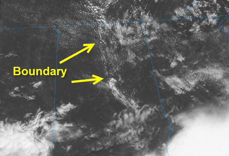
The storms over East Alabama laid down a boundary roughly along I-65 this morning. That boundary should act as a focus for showers and storms to develop. But it is being pushed eastward in a westerly low-level flow.
Somewhat drier and also sinking air behind the boundary will probably eliminate rain and storm chances for the most part.
Ahead of the eastward moving boundary, a few showers and storms will develop. They will affect the most eastern counties of the state.
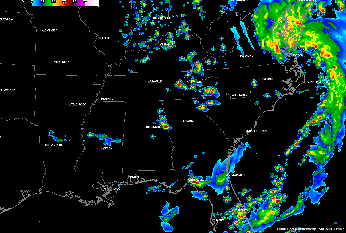
Here is the HRRR simulated radar at 4 p.m.
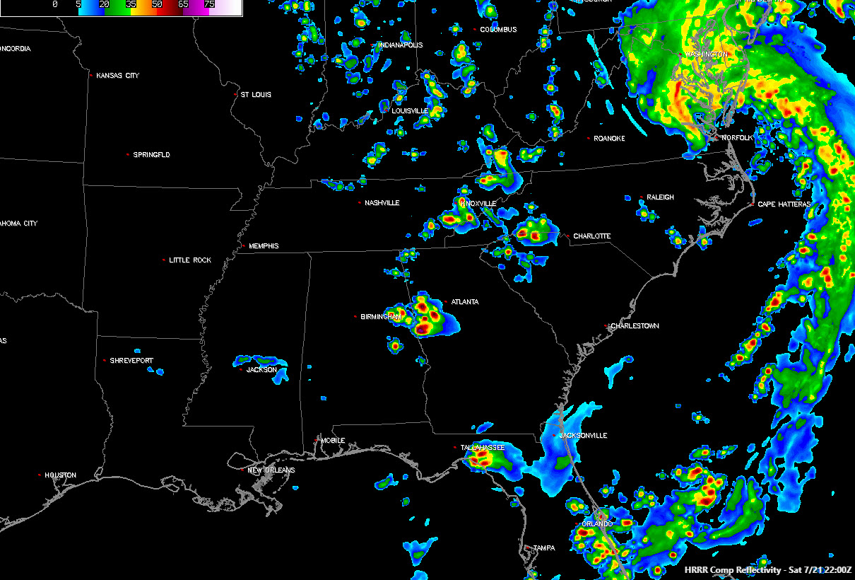
At 5 p.m.
At 6 p.m.

There is a slight risk of severe weather over eastern Alabama this afternoon for those storms. Damaging winds will be the main threat, along with a threat of large hail and a small threat of a tornado.


