

Storms Approaching Northwest Alabama
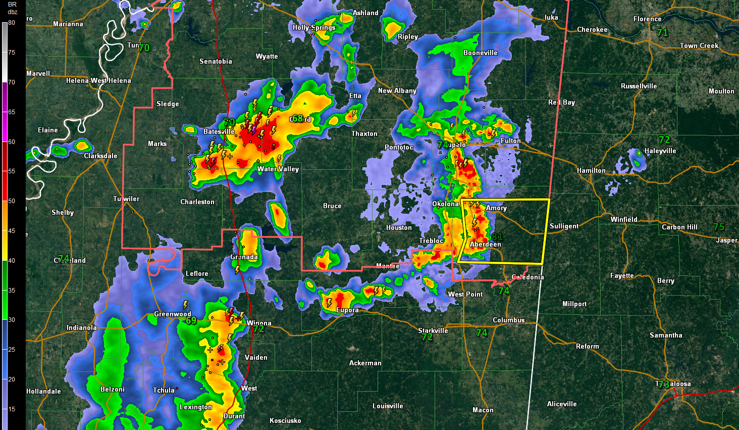
Strong thunderstorms are pushing across Mississippi at this hour. The first storms are now less than an hour from parts of Franklin, Marion and Lamar Counties. These storms have prompted a severe thunderstorm warning for parts of Chickasaw and Monroe Counties in northeastern Mississipi, including Okolona, Trebloc, Aberdeen, and Amory.
These storms will reach Sulligent, Detroit, and Bexar around 9 p.m. and Hamilton and Winfield between 9:15 and 9:30. A significant weather advisory has just been issued for parts of Marion and Lamar Counties.
Other strong storms are near Batesville along I-55 in northern Mississippi.
Even more are lined up along I-55 in Central Mississippi, from Greenwood to just north of Jackson.
The storms are just ahead of an unusually strong surface trough for mid to late August. They will feed on moderately strong instability through eastern Mississippi. They will encounter lower instability in Alabama, which is a cause for thinking that the storms will weaken once they are in our state.
But they will have the potential for producing damaging winds into West Alabama, especially over Marion and Lamar Counties, so be ready for that possibility.
The convection-allowing models like the HRRR do support the rapid weakening idea once they are in the state. This means many areas will get by without even any rain tonight, especially in places like Tuscaloosa, Birmingham, and Gadsden.
Redevelopment may occur over eastern Alabama tomorrow afternoon.
Category: Alabama's Weather, ALL POSTS
About the Author (Author Profile)
Bill Murray is the President of The Weather Factory. He is the site's official weather historian and a weekend forecaster. He also anchors the site's severe weather coverage. Bill Murray is the proud holder of National Weather Association Digital Seal #0001 @wxhistorianSubscribe
If you enjoyed this article, subscribe to receive more just like it.


