

What’s Going On With The Rest Of The Tropical Disturbances Out There

AFTER SOME WEAKENING, ISAAC REMAINS AS A STRONG TROPICAL STORM
As of 10:00 am, Tropical Storm Isaac continues on a westerly track at 16 MPH with maximum sustained winds at 70 MPH. The minimum central pressure is up to 996 MB (29.42 inches).
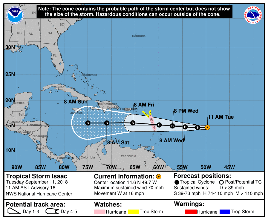
A Hurricane Watch has been issued for Guadeloupe, Martinique, and Dominica. A Tropical Storm Watch has been issued for Antigua and Montserrat.
Issac is expected to be at or near hurricane strength when it approaches the Lesser Antilles on Thursday. Tropical storm conditions can be expected during the pre-dawn hours on Thursday, with hurricane conditions possible in the Hurricane Watch locations later Thursday morning. Storm surge of 2-4 feet is possible just around and north of where the center moves through the area. Rough surf and life-threatening rip currents are expected by Wednesday afternoon for portions of the Lesser Antilles.
Rainfall totals will be around 3-5 inches throughout the event with isolated amounts up to 10 inches possible across the southern parts of the Leeward Islands late this week, and 1-2 inches possible for parts of the Windward Islands.
At this point, it is more likely that Isaac will continue on a path to the west and move across the Yucatan Peninsula and the southern Gulf of Mexico before making a final landfall on the Mexican coast. We do have several members of the ensembles that curve Isaac up into the central Gulf of Mexico by the end of next week. We’ll keep our eye on Isaac just in case that right-hand turn to the northwest occurs.
HELENE IS CURVING AWAY FROM LAND
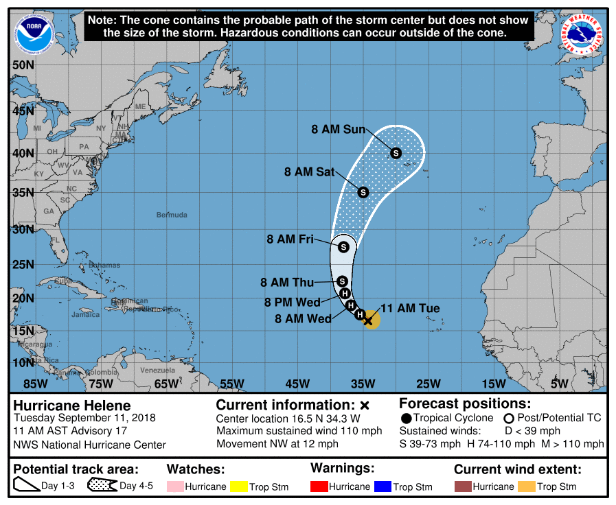
Category 2 Hurricane Helene is still packing winds of 110 MPH as of 10:00 am, with a minimum central pressure of 966 MB (28.53 inches). Movement at this point is to the northwest at 12 MPH, but is expected to continue to turn to the right and will be heading north by Thursday morning, and northeast by Saturday morning. While mainly being a nuisance to fish, it could come close to the Azores on Sunday.
TWO MORE HOTSPOTS OUT THERE
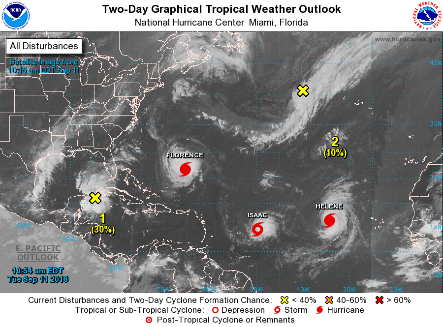
A surface trough associated with an upper-level low is located over the northwestern parts of the Caribbean Sea and the southeastern parts of the Gulf of Mexico. While signs of organization is starting to show, there is no surface circulation being shown at this point. A tropical depression could form as early as Thursday or Friday and is expected to move over the western Gulf of Mexico. People along the Mexican, Texas, and Louisiana coasts need to keep their eyes open on this disturbance. NHC gives it a 60% chance of developing into a depression/storm within the next 5 days.
Finally (whew… out of breath from typing so much), an area of low pressure is expected to form along a trough of low pressure located over the northeastern Atlantic Ocean that has the potential of tropical/subtropical organization this week. At this point, it is expected to meander around and is given a 50% chance of forming into a depression/storm within the next 5 days.
Category: Alabama's Weather, ALL POSTS
About the Author (Author Profile)
Scott Martin is an operational meteorologist, professional graphic artist, musician, husband, and father. Not only is Scott a member of the National Weather Association, but he is also the Central Alabama Chapter of the NWA president. Scott is also the co-founder of Racecast Weather, which provides forecasts for many racing series across the USA. He also supplies forecasts for the BassMaster Elite Series events including the BassMaster Classic.Subscribe
If you enjoyed this article, subscribe to receive more just like it.


