

Quick Afternoon Update On Florence
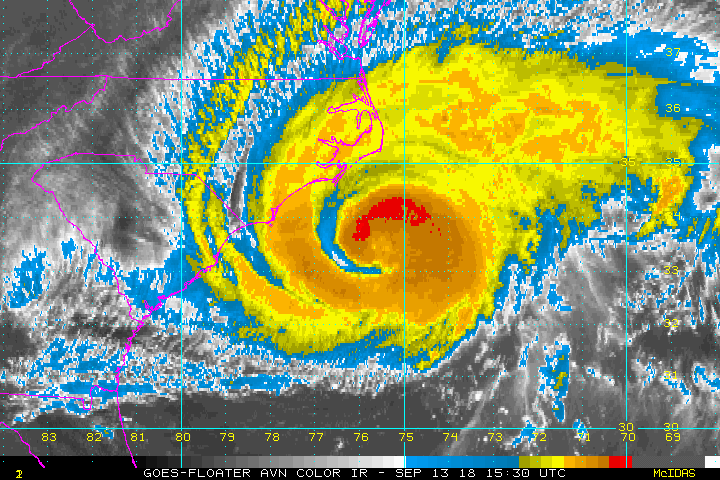
Data from 2:00 pm CT Update: Winds and rough surf are continuing to increase along the outer banks and the coastal parts of southeastern North Carolina, along with the threat of tornadoes on the northern side of the storm.
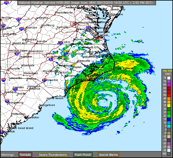
• Radar data from coastal radars show that Florence is now moving toward the west-northwest at approximately 10 MPH.
• The center of Florence is located about 105 miles east-southeast of Wilmington and about 160 miles east of Myrtle Beach.
• Maximum sustained winds are still at 105 MPH and minimum central pressure is 955 MB (28.20 inches).
• A NOAA reporting station at Cape Lookout, North Carolina, recently reported a sustained wind of 60 mph and a gust to 79 MPH.
• Private observing station recently reported a sustained wind of 56 mph (90 km/h) and a gust to 69 MPH at Fort Macon.
• Private observing station recently reported a sustained wind of 55 MPH and a gust to 66 MPH in Pamlico Sound.
• Private observing station recently reported a sustained wind of 50 MPH and a gust to 62 MPH in Ocracoke.
Very important Key Messages from the National Hurricane Center:
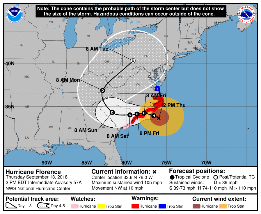
1. A life-threatening storm surge is now highly likely along portions of the coastlines of South Carolina and North Carolina, and a Storm Surge Warning is in effect for a portion of this area. The greatest storm surge inundation is expected between Cape Fear and Cape Hatteras, including the Neuse and Pamlico Rivers and western Pamlico Sound.
2. Life-threatening, catastrophic flash flooding and prolonged significant river flooding are likely over portions of the Carolinas and the southern and central Appalachians through early next week, as Florence is expected to slow down as it approaches the coast and moves inland.
3. Damaging hurricane-force winds are likely along portions of the coasts of South Carolina and North Carolina as soon as this evening, and a Hurricane Warning is in effect. Strong winds could also spread inland into portions of the Carolinas.
4. Large swells affecting Bermuda, portions of the U.S. East Coast, and the northwestern and central Bahamas will continue this week, resulting in life-threatening surf and rip currents.
Category: Alabama's Weather, ALL POSTS
About the Author (Author Profile)
Scott Martin is an operational meteorologist, professional graphic artist, musician, husband, and father. Not only is Scott a member of the National Weather Association, but he is also the Central Alabama Chapter of the NWA president. Scott is also the co-founder of Racecast Weather, which provides forecasts for many racing series across the USA. He also supplies forecasts for the BassMaster Elite Series events including the BassMaster Classic.Subscribe
If you enjoyed this article, subscribe to receive more just like it.


