

Update on Florence At Mid-Morning
The eye of Hurricane Florence is still wobbling slowly southwestward near the coast of southeastern North Carolina. Here is the latest as of 9:00 am CT:
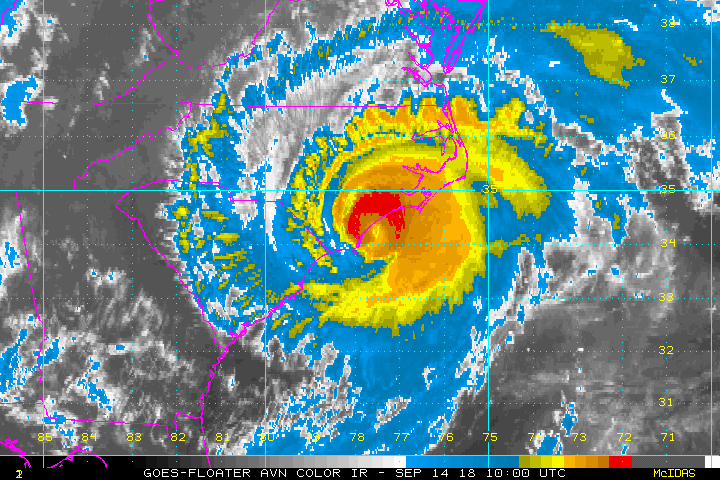
Radar data and surface observations indicate that the center of the eye of Hurricane Florence has been wobbling southwestward near the coast of southeastern North Carolina.

The center of the eye of Hurricane Florence is located roughly 20 miles southwest of Wilmington, North Carolina, and roughly 55 miles east of Myrtle Beach, South Carolina.
Maximum sustained winds are at 85 MPH, making Florence a category 1 hurricane.
Minimum central pressure is 958 MB (28.29 inches).
Movement is to the southwest at 6 MPH.
A buoy southeast of Wilmington, North Carolina, recently reported a wind gust of 76 MPH.
A station at Federal Point, North Carolina, recently reported a pressure of 961.0 MB (28.38 inches).
Florence is forecast to either maintain her current strength or slightly weaken until making landfall later today before wind speeds gradually decrease.
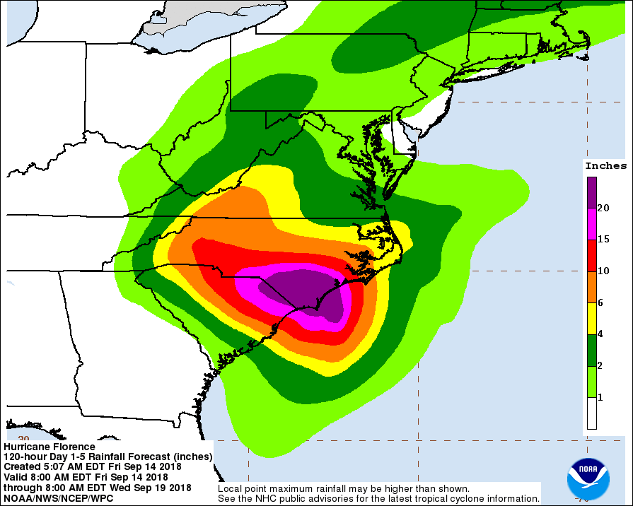
It cannot be emphasized enough that the most serious hazard associated with slow-moving Florence is extremely heavy rainfall, which will cause disastrous flooding that will be spreading inland through the weekend.

The highest risk of flooding remains in the eastern parts of the Carolinas, but a slight risk extends as far north as the northern parts of Virginia.
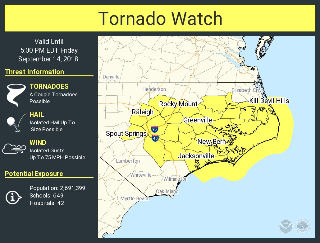
A Tornado Watch is in effect for much of eastern North Carolina until 5:00 pm ET today, most likely will be extended further in time and in area.
Key Messages From The NHC
A life-threatening storm surge is already occurring along portions of the North Carolina coast and will continue through today and tonight. This surge is also likely along portions of the South Carolina coast. The greatest storm surge inundation is expected between Cape Fear and Cape Hatteras, including the Neuse and Pamlico Rivers and western Pamlico Sound.
Life-threatening, catastrophic flash flooding and prolonged significant river flooding are likely over portions of the Carolinas and the southern and central Appalachians through early next week, as Florence is expected to slow down while it moves inland.
Damaging hurricane-force winds are occurring along portions of the North Carolina coast and are expected to spread to portions of the South Carolina coast later today. Strong winds could also spread inland into portions of the Carolinas over the next couple of days.
Large swells affecting Bermuda, portions of the U.S. East Coast, and the northwestern and central Bahamas will continue this week, resulting in life-threatening surf and rip currents.
Category: Alabama's Weather, ALL POSTS
About the Author (Author Profile)
Scott Martin is an operational meteorologist, professional graphic artist, musician, husband, and father. Not only is Scott a member of the National Weather Association, but he is also the Central Alabama Chapter of the NWA president. Scott is also the co-founder of Racecast Weather, which provides forecasts for many racing series across the USA. He also supplies forecasts for the BassMaster Elite Series events including the BassMaster Classic.Subscribe
If you enjoyed this article, subscribe to receive more just like it.


