

An Alabama Weather Update at 12:45 p.m.: A Few Showers Beginning to Form
Let’s take a look at the Alabama Weather Situation just after noon.
A strong ridge of high pressure extends the eastern Pacific across Mexico and the Gulf of Mexico into the western Atlantic. This is keeping a long, snaky frontal system at bay from eastern Texas through northern Mississippi, eastern Tennessee, and southeastern Virginia before stretching out into the Atlantic.
Rain showers are numerous along the long frontal system. The only lightning I could find was across eastern Tennessee and southeastern Texas.
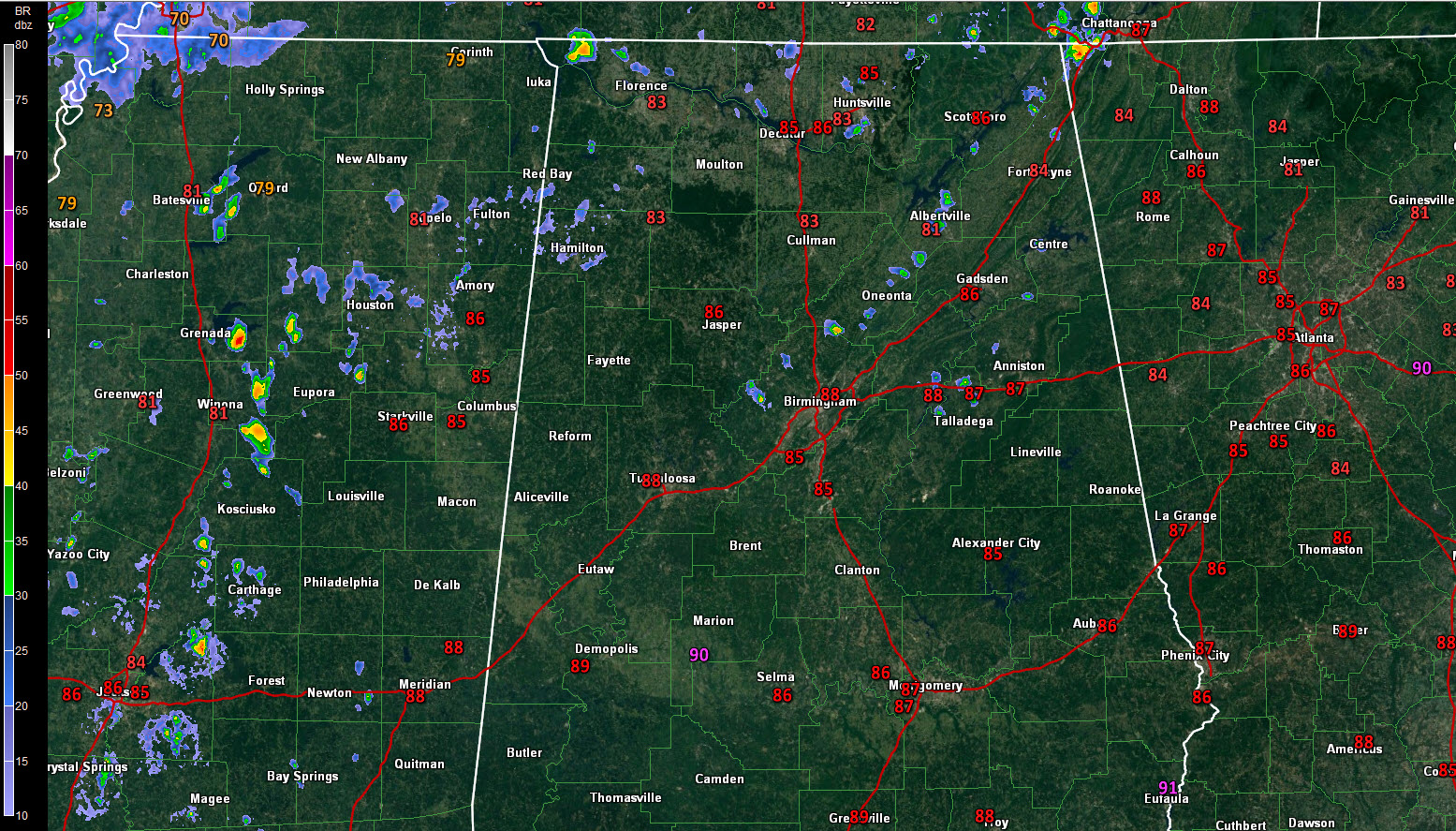
Currently, on radar, showers are occurring over Northwest and North Alabama, including parts of Marion, Franklin and Lawrence Counties eastward across the Tennessee Valley. Other showers are developing from northern Jefferson County northeastward through Blount, Marshall, Jackson and DeKalb Counties. These showers are lifting northward and could eventually develop some lightning. The heaviest showers were east of Warrior in northern Jefferson County, near Oneonta in Blount County and around Albertville in Marshall County.
By tomorrow, our low-level flow will turn more southerly, allowing deeper moisture to overspread the state. Rain showers and storms will form across the state starting during the morning hours. They will be fairly widespread, but rainfall amounts will be generally light. Highs will be limited to the middle 80s mostly. Some upper 80s will be observed in places like Demopolis, Montgomery, and Troy.
Rinse and repeat for Tuesday.
By Wednesday, the cold front will try to make a run at the state. This means additional showers and storms.
The front will lose and by Friday it will wash out. High pressure will begin to take control of Alabama’s weather, leading to fewer showers and warmer temperatures.
The tropics continue to be active. Subtropical Storm Leslie formed in the mid-Atlantic this morning, between Bermuda and the Azores. It will meander for a few days in the Central Atlantic before being absorbed by a larger low-pressure system.
Tropical Storm Kirk continues over the eastern Atlantic. It is expected to steam westward all week, perhaps threatening the Lesser Antilles by late Thursday into Friday. Indications are that it will weaken over the eastern Caribbean.
Invest 98-L may bring rain and gusty winds to the Carolinas Tuesday through Wednesday.
Finally, Tropical Depression Eleven dissipated this morning, east of the islands.
Category: Alabama's Weather, ALL POSTS
About the Author (Author Profile)
Bill Murray is the President of The Weather Factory. He is the site's official weather historian and a weekend forecaster. He also anchors the site's severe weather coverage. Bill Murray is the proud holder of National Weather Association Digital Seal #0001 @wxhistorianSubscribe
If you enjoyed this article, subscribe to receive more just like it.


