

Heavy Rains Continue To Push Across The Area At Midday

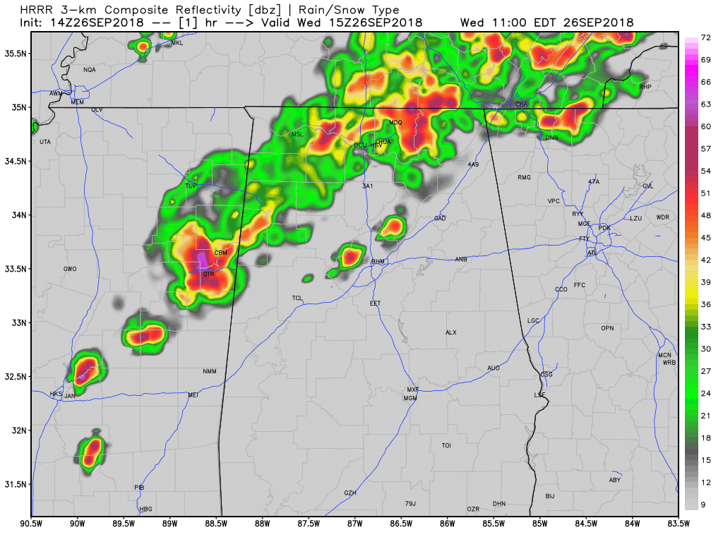
RADAR CHECK AT 11:33 AM: A band of heavy rain and embedded thunderstorms continue to push eastward across Central Alabama as we are making the run up to the midday hour on this first Wednesday of fall. The heaviest rainfall is lined up from Collinsville to Pell City to Hoover to Greensboro and Demopolis, and stretching behind that for about 30 or so miles. Behind the heavier showers and storms, light to moderate rainfall continues to fall over the northwestern quarter of the state.
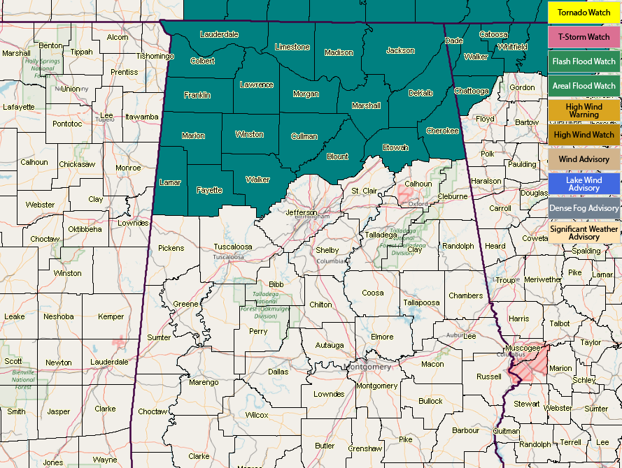
A Flash Flood Watch continues for all of the North Alabama counties and the northern counties of Central Alabama until 7:00 am CT Thursday morning.
A Flash Flood Warning continues in effect for parts of Jefferson County until 1:45 pm this afternoon. Areas in this warning include: Birmingham, Hoover, Vestavia Hills, Bessemer, Homewood, Mountain Brook, Trussville, Hueytown, Gardendale, Irondale, Leeds, Moody, Fairfield, Fultondale, Center Point, Pleasant Grove, Clay, Pinson, Tarrant And Midfield.
Rainfall has been the heaviest during the last hour over the southwestern parts of Jefferson County, where radar is showing estimates of up to and over 2 inches from Bessemer and southwest to the county line.
The only official location report of flooding from Jefferson County is at Brighton as the fire department has been dispatched to evacuate residents from their homes near the Bessemer Super Highway.
Training of cells over the same locations will continue to keel the flash flooding risk in Jefferson County elevated until the band itself moves off farther to the east.
Looks like we’ll have to continue to put up with heavier rainfall at least through 7:00 pm tonight before showers start to diminish in coverage somewhat, but the chance of scattered to numerous showers and a few storms will continue through the late night and overnight hours. The only good news is that highs are only going to top out in the upper 70s to the upper 80s, but the rain will keep us from enjoying that.
We’ll continue to have updates through the day.
Category: Alabama's Weather, ALL POSTS
About the Author (Author Profile)
Scott Martin is an operational meteorologist, professional graphic artist, musician, husband, and father. Not only is Scott a member of the National Weather Association, but he is also the Central Alabama Chapter of the NWA president. Scott is also the co-founder of Racecast Weather, which provides forecasts for many racing series across the USA. He also supplies forecasts for the BassMaster Elite Series events including the BassMaster Classic.Subscribe
If you enjoyed this article, subscribe to receive more just like it.


