

Mainly Dry & Nice Today, Showers & Storms Possible Tomorrow
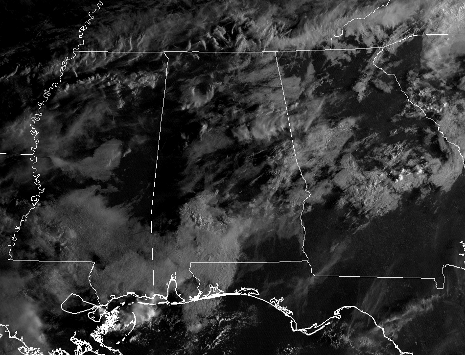
As of 7:30 AM, we have some fog starting to lift along with some cloud cover out there across the state, and radar is free of any rain activity across Central Alabama. Temperatures are sitting in the 60s to the lower 70s across the area.
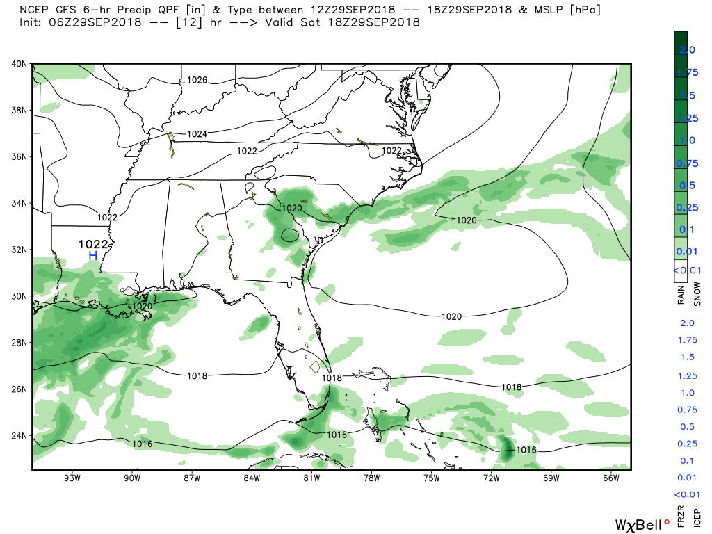
TODAY’S WEATHER: The cold front finally pushed through the state and is currently over the Florida panhandle and down over the northern Gulf of Mexico, thanks in part to high pressure setting up close by. There is a very small chance of isolated to scattered showers and storms in the southern parts of the state while skies will be partly to mostly cloudy where it’s not raining. Both the high-res NAM and the HRRR are agreeing with that. Highs will be topping out in the lower to mid-80s. Any shower activity should dissipate after sunset but we may have some area of patchy dense fog during the overnight hours. Lows will be in the 60s for the most part, with colder locations possibly dipping into the 50s.
SUNDAY: Ridging begins to build over the southeast and moisture levels will begin to climb as it will be pulled in from the southeast. This will bring back a chance of isolated to scattered showers for the northern half of the area, while scattered to numerous showers and storms will be likely for the southern half, mainly through the heating of the day. Skies will be mostly cloudy where it’s not raining, and highs will be in the mid to upper 80s for the most part.
NEXT WEEK: Ridging will start to become more centered over the southeast and this will bring a reduction to our shower and storm chances as we move into the week ahead. Monday will still have a slight chance of isolated showers for much of the area, with a higher risk of scattered showers and storms in the western-third of Central Alabama. Highs will be in the lower to mid-80s. Tuesday, the ridging moves a little more to the west, putting us in a continental northwesterly flow. This will start to pull in drier air into the area, and while showers and storms are not likely, there is a very small chance of a few isolated showers. Highs will be in the mid to upper 80s. The ridge will continue to hold throughout the remainder of the week, keeping us dry but allowing those high temperatures to creep back up again. We’ll be back up in the mid to upper 80s throughout the area with one or two spots hitting 90 degrees down in the extreme southern parts of Central Alabama.
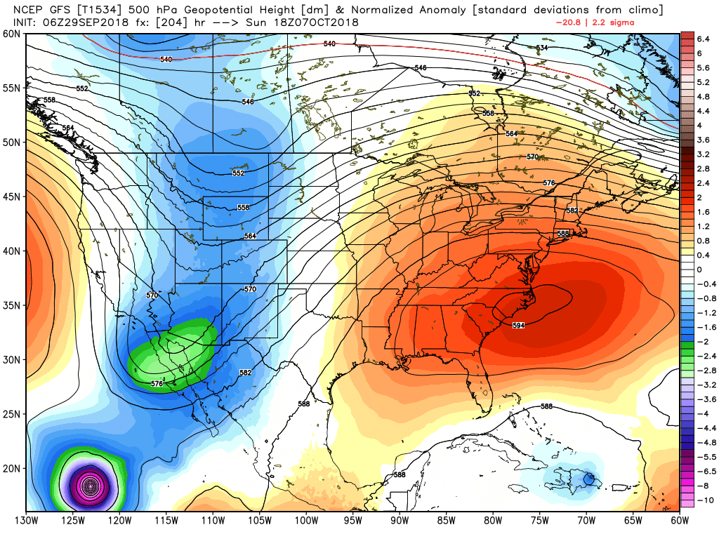
VOODOO LAND: Looking at next weekend as we take a small step into Voodoo Land, we see a deep trough starting to dig into the southwestern United States that actually starts to push the ridging back eastward. This may bring back some scattered shower activity back into the forecast. Highs look to stay up in the mid to upper 80s.
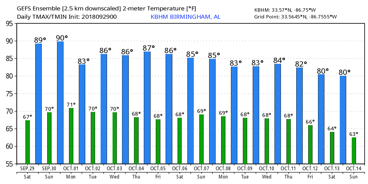
And taking a look at the model trend on temperatures, we do see a cooling trend with highs dropping into the lower 80s by the end of the run on October 14th, with lows getting into the lower 60s.
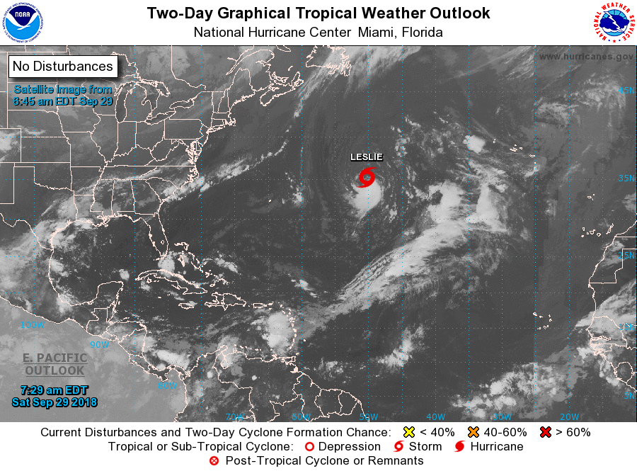
THE TROPICS: Taking a look at the tropics, all is quiet across the Gulf of Mexico and the Caribbean Sea. We only have one system out there in the Atlantic, as Subtropical Storm Leslie will be slowly moving to the southwest over the next few days before turning to the north by an approaching trough. She is expected to strengthen and transition into a tropical storm within the next 48 hours and possibly strengthen into a hurricane within the next 4 to 5 days. No threat to land.
BEACH FORECAST CENTER: Get the latest weather and rip current forecasts for the beaches from Fort Morgan to Panama City on our Beach Forecast Center page. There, you can select the forecast of the region that you are interested in.
CONNECT ON SOCIAL MEDIA: You can find the AlabamaWx Weather Blog on the major social media networks:
Facebook
Twitter
WE’RE HAVING A RECORD-BREAKING YEAR… ADVERTISE WITH US TODAY!: Don’t miss out! We have enjoyed over 15 million page views on AlabamaWx.com since the start of 2018. We can customize a creative, flexible and affordable package that will suit your organization’s needs. Contact Bill Murray at (205) 687-0782.
E-FORECAST: Get the Alabama Wx Weather Blog’s Seven-Day Forecast delivered directly to your inbox by email twice daily. It is the most detailed weather forecast available in Central Alabama. Subscribe here… It’s free!
WEATHERBRAINS: Don’t forget you can listen to our weekly 90 minute netcast anytime on the web at WeatherBrains.com or on iTunes, Stitcher, or Spotify. This is the show all about weather featuring many familiar voices, including the meteorologists at ABC 33/40.
Category: Alabama's Weather, ALL POSTS, Weather Xtreme Videos
About the Author (Author Profile)
Scott Martin is an operational meteorologist, professional graphic artist, musician, husband, and father. Not only is Scott a member of the National Weather Association, but he is also the Central Alabama Chapter of the NWA president. Scott is also the co-founder of Racecast Weather, which provides forecasts for many racing series across the USA. He also supplies forecasts for the BassMaster Elite Series events including the BassMaster Classic.Subscribe
If you enjoyed this article, subscribe to receive more just like it.


