

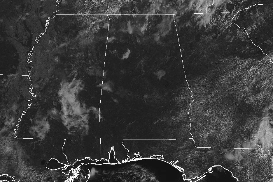
A Bunch Of Sun & Not A Lot Of Clouds At Midday
WEATHER CHECK AT 11:00 AM
While temperatures are expected to be well above normal today, and for the rest of the week, I’ll take the current temperatures at this point. Now come this time tomorrow and Thursday, I’ll trade them for an early November day in a second. Skies are mostly sunny with only a very few clouds filtering out some of the sun from reaching the surface and temperatures are in the upper 70s to the mid-80s. Birmingham was at 82 degrees, while the warm spot was Uniontown at 85 degrees. A few locations throughout the area are tied as the cool spots at 79 degrees.
WEATHER FOR THE REST OF YOUR DAY
While nearly all of Central Alabama is expected to remain dry and getting back up into the “hot” category, there is a very small chance of isolated showers or storms in the northwestern parts of the area (mainly the northern half of Lamar County, all of Marion County, and the northwestern half of Winston County). Now the chance of rain is not an absolute zero for the rest of Central Alabama, but it is right at 10% or less for any one spot. Highs will be up in the mid to the upper 80s, but I wouldn’t be surprised if a few locations top out at or just above 90 degrees as the ridge takes hold over the area. Any clouds that form throughout the daytime will decrease in the evening hours, leaving us with clear skies by the 10:00 pm news. Lows will bottom out in the mid to the upper 60s.
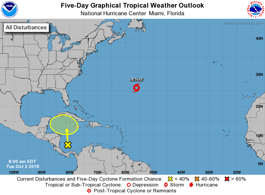
THE TROPICS
Tropical Storm Leslie continues to meander around over the Central Atlantic Ocean and will be no threat to land as she’ll begin to move to the north then eventually out to the east. She may briefly strengthen to a hurricane but will quickly weaken back to a tropical storm by the end of the week.
The only other area of concern is an area of disorganized showers and storms over the southern Caribbean Sea. This disturbance has the potential for gradual development through this week and the weekend as it drifts northward. At this point, the NHC only gives it a 20% chance of forming into a depression/storm within the next 5 days. This is still considered a pretty active period of the hurricane season, historically, so we’ll have to watch this disturbance to see what happens.
BEACH FORECAST CENTER
Get the latest weather and rip current forecasts for the beaches from Fort Morgan to Panama City on our Beach Forecast Center page. There, you can select the forecast of the region that you are interested in.
CONNECT ON SOCIAL MEDIA
You can find the AlabamaWx Weather Blog on the major social media networks:
Facebook
Twitter
WE’RE HAVING A RECORD-BREAKING YEAR… ADVERTISE WITH US TODAY!
Don’t miss out! We have enjoyed over 15.2 million page views on AlabamaWx.com since the start of 2018. We can customize a creative, flexible and affordable package that will suit your organization’s needs. Contact Bill Murray at (205) 687-0782.
E-FORECAST
Get the Alabama Wx Weather Blog’s Seven-Day Forecast delivered directly to your inbox by email twice daily. It is the most detailed weather forecast available in Central Alabama. Subscribe here… It’s free!
WEATHERBRAINS
Don’t forget you can listen to our weekly 90 minute netcast anytime on the web at WeatherBrains.com or on iTunes, Stitcher, or Spotify. This is the show all about weather featuring many familiar voices, including the meteorologists at ABC 33/40.
ON THIS DAY IN WEATHER HISTORY
1989 – Flooding due to thunderstorm rains in the southeastern U.S. on the last day of September and the first day of October caused the Etowah River to rise seven feet above flood stage at Canton GA. Thunderstorms produced up to ten inches of rain in northeastern Georgia, with six inches reported at Athens GA in 24 hours. One man was killed, and another man was injured, when sucked by floodwaters into drainage lines.
Category: Alabama's Weather, ALL POSTS
About the Author (Author Profile)
Scott Martin is an operational meteorologist, professional graphic artist, musician, husband, and father. Not only is Scott a member of the National Weather Association, but he is also the Central Alabama Chapter of the NWA president. Scott is also the co-founder of Racecast Weather, which provides forecasts for many racing series across the USA. He also supplies forecasts for the BassMaster Elite Series events including the BassMaster Classic.Subscribe
If you enjoyed this article, subscribe to receive more just like it.


