

Wow! What A Great Weather Weekend In Store For Central Alabama
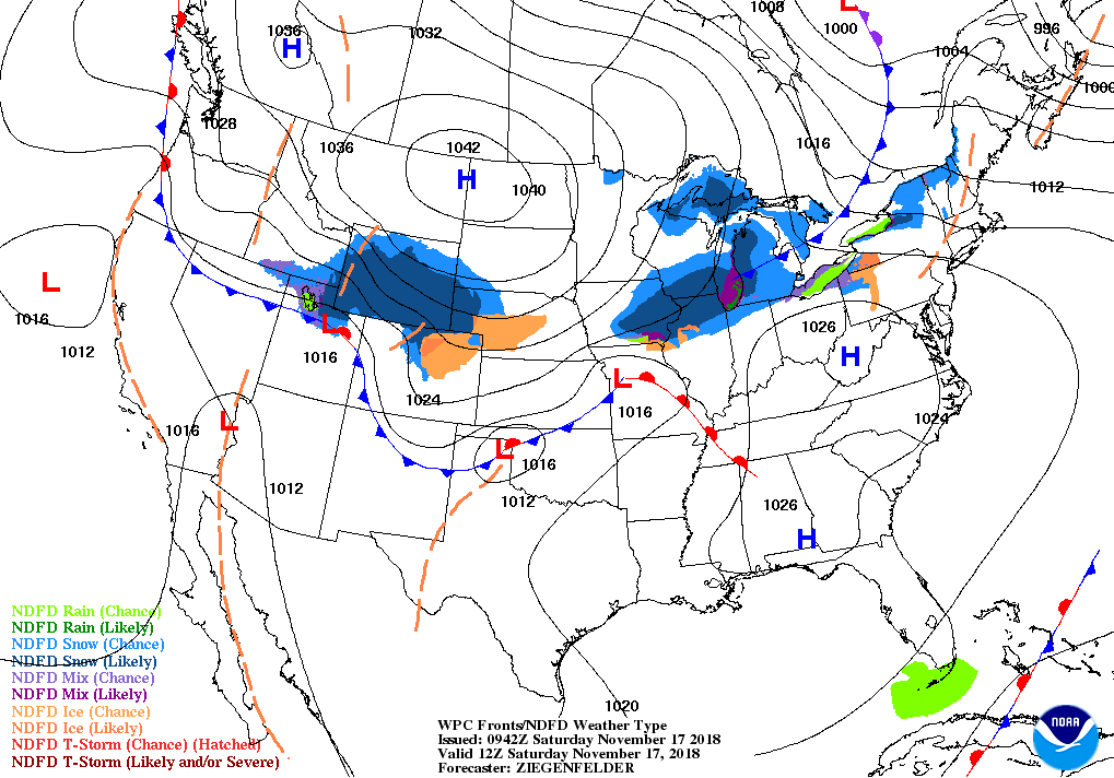
TODAY: We have a zonal flow set up across much of the eastern half of the country as a strong ridge is building over the northwestern corner of the country and into Canada. We’ll have plenty of sunshine throughout the day with clear skies this evening. Winds will be light and afternoon highs top out in the mid-60s across the area. Out in Tuscaloosa for the Alabama/Citadel game, temperatures will start in the upper 50s at kickoff (11:00 am CST) and climb into the mid-60s by the 4th quarter. Down on the plains in Auburn, kickoff temperatures (3:00 PM CST) will be in the mid-60s and dropping into the upper 40s by the final whistle.
SUNDAY: We’ll continue to be in a zonal flow at 500mb on Sunday and we’ll have sunny skies throughout the day, but some clouds will start to move in late. No rain involved with those clouds as our air is just too dry to support any rainfall at this point. Afternoon highs will be in the mid to the upper 60s.
MONDAY THROUGH WEDNESDAY: The beginning of the week will be mainly dry through “Hump Day” as a high will start off on Monday to our south over the Alabama Gulf Coast. We may have to deal with a spotty shower very late on Monday as some moisture will be working around the north side of that high, but those chances dissipate completely by the morning rush hour on Tuesday. Skies will be partly sunny with highs in the upper 50s to the upper 60s.
That high will move out but another one will be building out to our west over the eastern parts of Oklahoma and Kansas on Tuesday. Skies will clear out early and we’ll have plenty of sunshine by late morning with highs in the mid-50s to the lower 60s.
On Wednesday, the high will have made it just to our northwest over western Tennessee. We’ll have sunny skies with highs in the mid-50s to the lower 60s.
THANKSGIVING DAY: Outstanding weather for the day of thanks, featuring plenty of sunshine with a passing cloud or two. Afternoon highs topping out in the upper 50s to the lower 60s across Central Alabama.
FRIDAY: A disturbance is starting to form out to our west that will be bringing with it some higher moisture values. That means that we could see a few scattered showers during the day on Friday across Central Alabama. Umbrellas may be needed at times while you’re out hitting the shopping centers grabbing up those holiday deals. Highs will top out in the upper 50s to the mid-60s across the area.
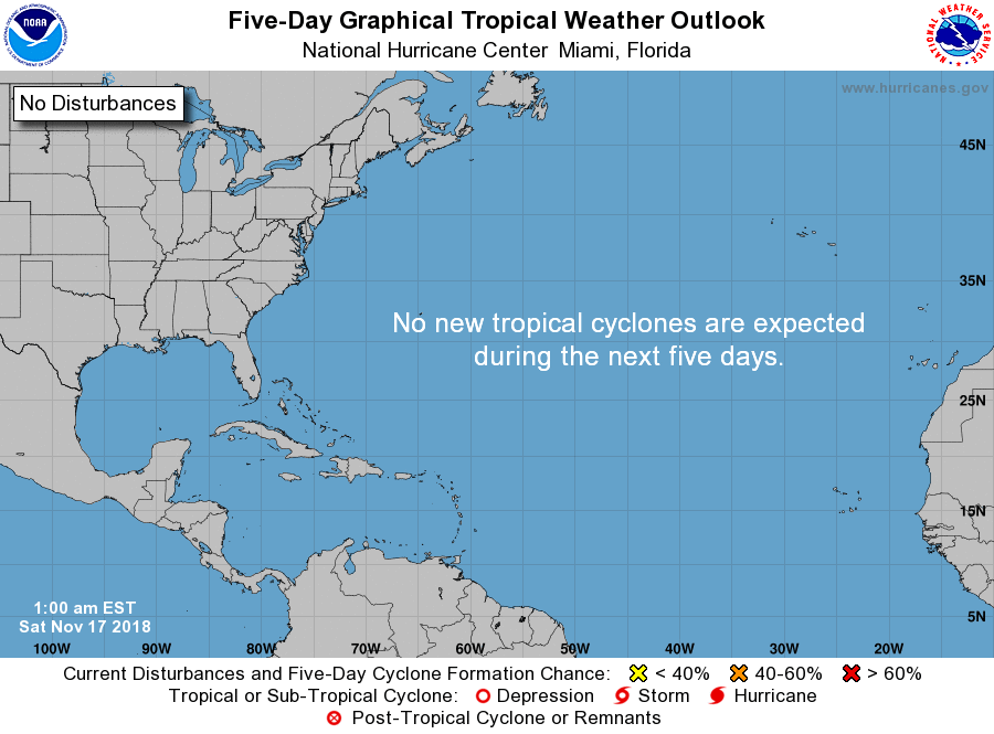
THE TROPICS: No areas of interest across the Atlantic Ocean, Gulf of Mexico, or the Caribbean Sea, and no new tropical cyclone development is expected throughout the next 5 days. Only 13 more days of the Atlantic Hurricane Season left for 2018.
BEACH FORECAST CENTER: Get the latest weather and rip current forecasts for the beaches from Fort Morgan to Panama City on our Beach Forecast Center page. There, you can select the forecast of the region that you are interested in.
WE’RE HAVING A RECORD-BREAKING YEAR… ADVERTISE WITH US TODAY!: Don’t miss out! We have enjoyed over 18.1 million page views on AlabamaWx.com so far in 2018. We can customize a creative, flexible and affordable package that will suit your organization’s needs. Contact Bill Murray at (205) 687-0782.
E-FORECAST: Get the Alabama Wx Weather Blog’s Seven-Day Forecast delivered directly to your inbox by email twice daily. It is the most detailed weather forecast available in Central Alabama. Subscribe here… It’s free!
CONNECT ON SOCIAL MEDIA: You can find the AlabamaWx Weather Blog on the major social media networks:
Facebook
Twitter
WEATHERBRAINS: Don’t forget you can listen to our weekly 90 minute netcast anytime on the web at WeatherBrains.com or on iTunes, Stitcher, or Spotify. This is the show all about weather featuring many familiar voices, including the meteorologists at ABC 33/40.
VOODOO LAND: The good news is that those shower chances will be lifting out of the area on Saturday morning, well before kickoff of the Alabama/Auburn game at Bryant-Denny Stadium. It is still too early to know for certain as this is still out in Voodoo Land, and this model output will change throughout the week. Shower chances look to creep back in for Sunday for the late morning through the evening hours.
Category: Alabama's Weather, ALL POSTS, Weather Xtreme Videos
About the Author (Author Profile)
Scott Martin is an operational meteorologist, professional graphic artist, musician, husband, and father. Not only is Scott a member of the National Weather Association, but he is also the Central Alabama Chapter of the NWA president. Scott is also the co-founder of Racecast Weather, which provides forecasts for many racing series across the USA. He also supplies forecasts for the BassMaster Elite Series events including the BassMaster Classic.Subscribe
If you enjoyed this article, subscribe to receive more just like it.


