

Some Flurries Mixed In With Showers In North Alabama, Still Above Freezing & No Travel Issues
While light showers with a few flakes are being reported across the extreme northern parts of Central Alabama and up into North Alabama, we may have some locations in the north that could end up with a light dusting. Later this afternoon, we could see even more flakes starting to mix into the precipitation that will be falling over the northern parts of the area. This precipitation will slowly move to the south and east. The good news is that readings at the surface are in the upper 30s to the mid-40s across the area, so there is no threat of accumulations on road surfaces at this point.
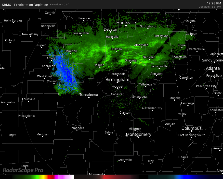
Radar at 12:30 pm shows mostly light rain falling over the northern parts of the state with the possibility of some snow flurries and light snow falling over the extreme western and northwestern parts of Central Alabama… mainly over Lamar and Pickens counties.
Some locations in North Alabama have some snow sticking to trees and other outdoor decks and furniture, but all surface temperatures are above freezing and no accumulations are occurring on roadways.
Snow flurries mixed in with light drizzle or light showers can be seen as far south as the Birmingham metropolitan area later this evening, but we have very little moisture in the atmosphere to work with. Along with that, temperatures will still be above freezing at the surface, so no accumulations are expected tonight for the much of the northern half of Central Alabama.
The best chance of any accumulations will mainly be in North Alabama and in the extreme northern parts of Blount and Etowah counties. If that does occur, totals will be 1/10th of an inch or less, with most of that sticking to tops of cars, decks, and any outdoor furniture. None expected on roadways.
The precipitation is expected to come to an end late tonight at or just after midnight. Skies will begin to clear out and that will allow temperatures to drop below freezing, with lows expected to reach the mid-20s to the lower 30s across the area. We may end up with a few slick spots during the pre-dawn hours to around 9:00 am Tuesday, north of the I-20 corridor.
We’ll keep you updated throughout the day if any changes to the forecast are needed. By the way, afternoon highs are forecast to be in the lower to mid-40s today, with lows reaching the mid-20s to the lower 30s across the area during the overnight hours. Weather will be much brighter with highs reaching the mid-40s to the lower 50s on Tuesday afternoon with sunny skies.
Category: Alabama's Weather, ALL POSTS
About the Author (Author Profile)
Scott Martin is an operational meteorologist, professional graphic artist, musician, husband, and father. Not only is Scott a member of the National Weather Association, but he is also the Central Alabama Chapter of the NWA president. Scott is also the co-founder of Racecast Weather, which provides forecasts for many racing series across the USA. He also supplies forecasts for the BassMaster Elite Series events including the BassMaster Classic.Subscribe
If you enjoyed this article, subscribe to receive more just like it.


