

Potential For Strong To Severe Storms Continue For Later Today
Looks like the last day of 2018 will be a stormy one, and we may have a few weather fireworks during the afternoon and evening hours before we get to fire off some actual fireworks for the ringing in of the new year at midnight.
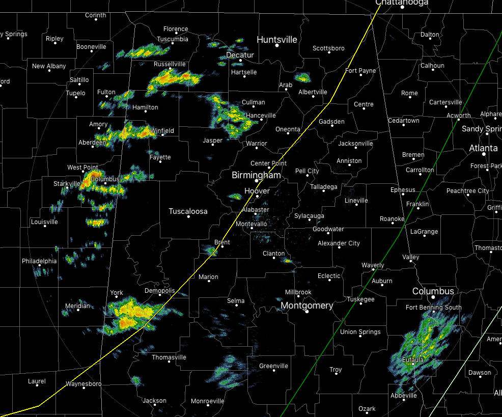
Radar at 9:05 am shows some scattered shower activity over the northwestern and western parts of North/Central Alabama at this point, with a few light showers beginning to exit the state in the southeastern corner of the area. All of the activity is moving to the northeast. The good news is that there is no lightning showing up with these showers, but that will change as we reach the late morning and early afternoon hours.
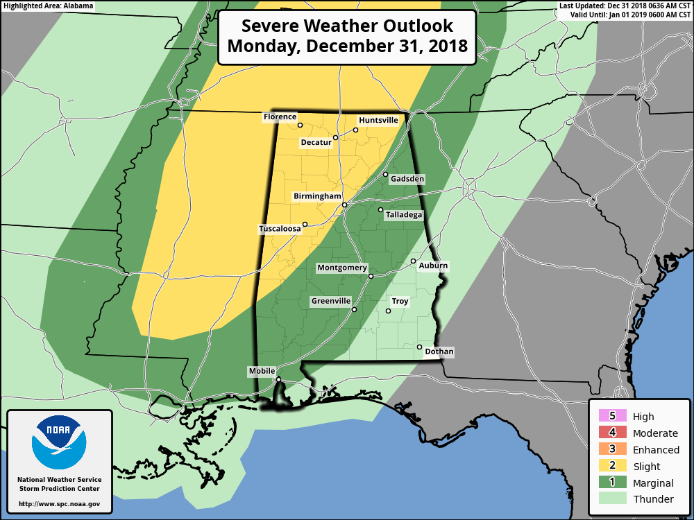
The Storm Prediction Center has nearly all of the northwestern half of the state defined in a Slight Risk for severe storms throughout the day today and through the overnight hours tonight. The Slight Risk includes locations west of a line from Myrtlewood (Marengo Co.) to West Blocton (Bibb Co.) to Mountainboro (Etowah Co.) to Henagar (Dekalb Co.). A Marginal Risk extends out from the Slight Risk to as far east as Red Level (Coffee Co.) to Notasulga (Macon Co.) to Rock Mills (Randolph Co.)
The main threat with today’s storms will be from isolated damaging thunderstorm wind gusts up to 60, but there is a small threat of an isolated tornado or two. Along with those threats, winds this afternoon could gust up to 30 MPH outside of storms. With the saturated ground, these wind gusts could bring down some trees.
NWS Birmingham will be sending up an extra weather balloon at noon today for the threat of severe weather across the area.
Timing for the stronger to severe storms will be from the late morning hours through the early evening hours, with a peak in the action during the afternoon and early evening hours. The Slight Risk areas should see the stronger storms from 1:00 pm to 7:00 pm, while the Marginal Risk area should see those from 6:00 pm through 9:00 pm. By the time we reach 9:00 pm, the threat for stronger to severe storms should be over.
Unfortunately, we have the potential of some flash flooding as we could see some thunderstorms dump heavy amounts of rainfall in a very short amount of time, in some cases, around 1.00 inches in less than one hour.
We’ll keep you posted throughout the day and warnings will automatically be posted to the blog as soon as they are issued from NWS Huntsville and NWS Birmingham. Go ahead and have your severe weather safety plan ready to go just in case your location goes under a warning. Have your phones charged and fresh batteries in your flashlights.
Category: Alabama's Weather, ALL POSTS
About the Author (Author Profile)
Scott Martin is an operational meteorologist, professional graphic artist, musician, husband, and father. Not only is Scott a member of the National Weather Association, but he is also the Central Alabama Chapter of the NWA president. Scott is also the co-founder of Racecast Weather, which provides forecasts for many racing series across the USA. He also supplies forecasts for the BassMaster Elite Series events including the BassMaster Classic.Subscribe
If you enjoyed this article, subscribe to receive more just like it.


