

Line Of Showers Pushing Across Parts Of The Area; No Lightning At This Point
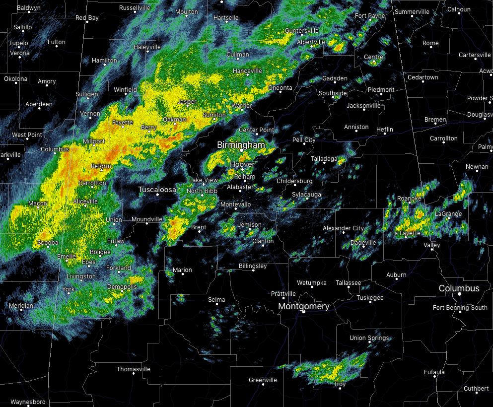
As of 10:30 am this morning, we have a few areas of moderate to heavy rainfall falling over Central Alabama. There is a cluster of showers moving across the southern portions of Jefferson County that is starting to move into Birmingham as I type. This is just a good moderate to heavy shower at this point, no lightning involved at all.
Behind that, there is a line of moderate to heavier rainfall stretching from Hanceville down to the southwest through Parrish and Jasper, Berry, and approaching Gordo, Reform, and Carrollton. While the cells within the line are moving to the northeast, the line itself is moving eastward. Once again, just rain with no lightning present at this time.
There are a few more pockets of showers out there… one is over parts of Tallapoosa and Chambers counties moving northeastward and will be out of the state in a little bit. The other pocket of showers is over the northern parts of Pike County and will be moving into Bullock County shortly.
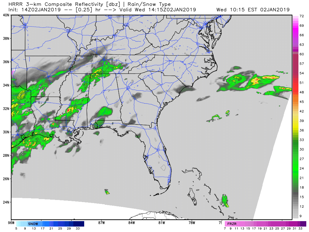
Today will be a cooler day with showers likely throughout the day. The above animation is the latest from the HRRR showing rain will be more likely mainly north of the I-20 corridor, but showers are likely across all of Central Alabama today. We’ll get a push from the west that will get the rain to move across all of the area later tonight after midnight.
Category: Alabama's Weather, ALL POSTS
About the Author (Author Profile)
Scott Martin is an operational meteorologist, professional graphic artist, musician, husband, and father. Not only is Scott a member of the National Weather Association, but he is also the Central Alabama Chapter of the NWA president. Scott is also the co-founder of Racecast Weather, which provides forecasts for many racing series across the USA. He also supplies forecasts for the BassMaster Elite Series events including the BassMaster Classic.Subscribe
If you enjoyed this article, subscribe to receive more just like it.


